Tag Archives: bridge

Man at work

Odlum’s Bridge, Kilbeggan Branch of the Grand Canal, 19 February 2011

This slideshow requires JavaScript.

I should point out that I am unable to change the speed of transitions on the slide show, which considerably underrepresents the speed of the slashing. Even clicking the forward arrow as fast as possible doesn’t do it justice.


Clonmel

Here is a short piece about the Suir in Clonmel and the opportunities for appreciating its natural and built heritage.

The Erne to Lough Oughter

How they got the dredgers past the distillery in 1857. No pics, alas, but it’s worth using the links to the OSI maps.

Waterways restoration? No thanks

An article in the Irish Times about railway restoration has prompted me to set out my views on waterways restoration. Essentially, I don’t believe public funds should be spent on projects that won’t provide a decent return, but I do favour small-scale conservation, opening up walking and cycling routes along waterways and marketing them to industrial heritage enthusiasts (and others).


Old boats

I’ve set up a new page on which I intend to collect pics showing older Irish inland (and estuarial) working boats. I’ve started it off with a copy of the posting (below) about Portobello and a photo of a yawl at Clonmel; this is a page that will have material added as I come across it.

New section

I have started a new section on People. So far, the top-level page links only to the first entry, which is for Major Rowland Raven-Hart OBE, whose Canoeing in Ireland, published in around 1938, is a short guide to canoeing on several of Ireland’s longer rivers, including the Shannon, the Erne, the Suir, the Barrow and the Munster Blackwater.

I have added such information about Major Raven-Hart as I have been able to find.


Nineteenth-century Irish canal boats

Illustrations of early Irish inland waterways vessels are relatively scarce. The drawing below shows the sterns of two of them.

Portobello Harbour 1882

This is from The Graphic of May 13, 1882, and shows the lighting of tar-barrels in Portobello Harbour, on the Grand Canal in Dublin, to celebrate the release from prison of Charles Stewart Parnell and two colleagues.

The layout of the harbour in around 1900 can be seen on the OSI Historic 25″ map. Where were the vessels tied? What are the buildings in the background? What can be said about the vessels? Presumably wooden horse-drawn barges, but they look rather narrow to me. Comments welcome.

The harbour itself is, alas, no more.


Ephemera 10: the pontoons at Ballina

Do my eyes deceive me?

The still-unopened mooring pontoons below the bridge at Ballina (bottom of Lough Derg) seem to have sprouted an extension.

Here is what they looked like in 2009.

The upstream end of the Ballina pontoons in February 2009

Here they are in the floods of November 2009.

The upstream end of the Ballina pontoons in the floods of November 2009

And here they are in January 2011, seen from downriver.

The upstream end of the Ballina pontoons in January 2011

Well I never.


Ephemera 9: the flash lock at Killaloe

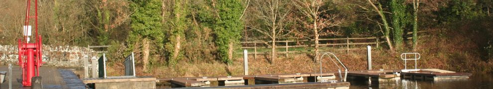
As part of its new mooring scheme at Killaloe, Waterways Ireland has commissioned contractors (L&M Keating Ltd) to carry out various works including the installation of a lock at the upper end of the canal, beside the Phoenix boathouse and just downstream from the Pierhead. The lock is to control access to the canal; presumably the stop planks in the existing lock chamber will be removed, allowing boats to pass down under the bridge.

The lock under construction

As I understand it, this lock is to have a single pair of gates. Boats wishing to pass through will tie up temporarily and use a squawk-box (or similar technological marvel) to communicate with the bridge-keeper at Portumna, who will cause the gates to be opened and then, presumably, closed after the boat has passed through. This system will prevent the use of the canal by cads and bounders using jetskis, speedboats and other excrescences.

Stanked off and pumped out

However, the water through Killaloe Bridge has a gradient or slope, especially in flood and when Ardnacrusha power station is running. The canal above the lock will be at the higher level; the canal below the lock will be fed from the bottom end, where it rejoins the river. So is there not likely to be a difference in height at the lock? Is this the equivalent of a flash lock?

I’m sure there is an engineering answer to this; I would welcome enlightenment.


Ephemera 7

The view from Dromod 30 December 2010.

Dromod

The Swiss Army Knife is no longer sprawling across the canal above Noggus Bridge on the Grand: it’s parked in the middle of the canal, closer to the bridge.