I have a page about the Shannon eel fishery here.
In April 2012 Frank Feighan TD asked many Dáil questions about the Shannon eel fishery; the answers provide a useful update to (and expansion of) the information on my page.
I have a page about the Shannon eel fishery here.
In April 2012 Frank Feighan TD asked many Dáil questions about the Shannon eel fishery; the answers provide a useful update to (and expansion of) the information on my page.
Posted in Ashore, Built heritage, Economic activities, Engineering and construction, Extant waterways, Industrial heritage, Ireland, Irish waterways general, Natural heritage, Operations, People, Politics, Shannon, shannon estuary, Sources, The fishing trade, waterways, Waterways management
Tagged bridge, canal, Clare, department of arts heritage and the gaeltacht, eels, ESB, estuary, Frank Feighan, Ireland, Killaloe, Lough Derg, Lough Neagh, Operations, Pat Rabbitte, Shannon, waterways, weir, workboat
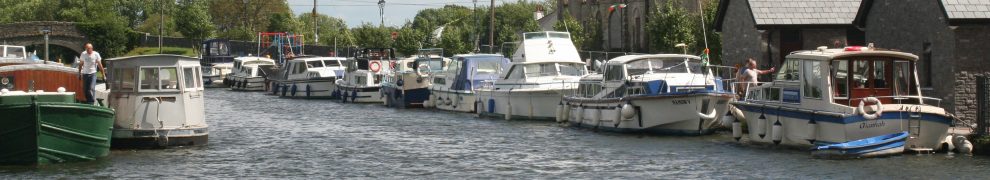
The old Limerick Navigation included a section of canal at Killaloe, with three locks. The uppermost, now disused, is still visible at Killaloe; the middle lock (Moys) is accessible by small boat; the third (Cussaun) is under water in the Flooded Area created by Parteen Villa Weir. The wall that divided the canal from the river downstream of Killaloe bridge forms an island whereon are the former eel-packing station run by the ESB, the former goods store (inhabited by Waterways Ireland) and the former marble mill (now an ESB engineering works). The island hosts the Killaloe market on Sunday mornings.
The curious can (obstructions permitting) walk a little further downstream to where the wall was breached, allowing boats to access the canal below the bridge without having to go as far as Moys Lock.

An obstruction

A section of the canal below the bridge in Killaloe ~1900 (OSI)
![]()
The west side of the canal, below the slip, was lined with trees.

May 2008

May 2008

May 2008

November 2008

November 2008

November 2008, with homemade boat shelter

The trees behind the marble mill: seen from the far side of the river in December 2009

August 2010

A fallen tree blocks the canal in December 2010

April 2011

April 2011

November 2011

November 2011

November 2011
MARINE NOTICE No. 86 of 2011
Shannon Navigation
Lough Derg
Killaloe CanalCanal Maintenance – Tree Cutting
Waterways Ireland wishes to advise all masters and owners of vessels that tree cutting will take place along the Killaloe Canal banks from the vicinity of the cathedral downstream to the lower entrance from the river
Shannon, from Monday 19th Sep until about mid Oct.Access to this section of the canal will be closed during this period. […]
Marine Notice 24/2012 of 16 March 2012 said
Works are still ongoing along the Killaloe Canal banks from the vicinity of the Cathedral downstream to the lower entrance from the river Shannon.
Access to this section of the canal will be closed until further notice.
That notice has not (as of 10 June 2012) been withdrawn so it must be assumed that the works continue.
The works photographed on 10 June 2012.


Posted in Ashore, Charles Wye Williams, Economic activities, Engineering and construction, Extant waterways, Industrial heritage, Ireland, Natural heritage, Operations, Scenery, Shannon, waterways, Waterways management
Tagged bridge, canal, Clare, ESB, Ireland, Killaloe, Limerick, lock, lost, Lough Derg, marble mill, Operations, quay, Shannon, trees, Waterways Ireland
I mentioned the other day that extensive searches of tinterweb had failed to find any data on the heights of overhead power lines above the Shannon and that I had been forced to resort to the telephone.
I am pleased to report that the ESB expert duly rang me back today, and further pleased to report that he had himself measured the height of every cable over the Shannon. Oh joy, oh happiness, I thought. But not for long.
The ESB, it seems, does not reveal the actual height of power lines above the water. This, if I understood the reasoning correctly, is because the water level varies and a boat-owner might not understand that, hit a line with a mast and then sue the ESB [where “ESB” means “electricity transmission or distribution operation”]. I have been told that a boat-owner in coastal water did just that (presumably between the mainland and an island) and that the lawyers have advised ESB to take no further risk; I would welcome information about the incident.
So, if you want to find the height of a power line, you’ll need to polish up your trigonometry (and then relate the height to Ordinary Summer Level). But the ESB does supply the information to one organisation that makes charts: the United Kingdom Hydrographic Office. That’s OK for coastal charts, but the UKHO (to the best of my knowledge) has not surveyed the inland Shannon since 1839, and I don’t think its inland charts have been updated since then. It is possible, of course, that the UKHO supplies the data to other (electronic or paper) chart-makers; I have emailed them to ask.
The quest continues again. More info when I get it.
Posted in Ashore, Built heritage, Economic activities, Engineering and construction, Extant waterways, Industrial heritage, Ireland, Irish inland waterways vessels, Operations, Politics, Shannon, shannon estuary, Sources, waterways, Waterways management
Tagged boats, clearance, ESB, height, Ireland, Lough Derg, Operations, OSL, overhead power line, Shannon, transmission, vessels, water level, waterways
So you’re out in your sailing-boat, heading for Portumna, and you see that there’s an electricity cable crossing the waterway ahead of you, just downstream of the bridge. You think you’ll fit under it but it would be nice to know the clearance ….
Electricity is ESB, isn’t it? Well, perhaps not: it could be ESB Networks, which seems to mean distribution, or EirGrid, which means transmission. It could also be one of the other companies that sells volts, but I don’t think they run big wires.
Half an hour of searching the websites of the three bodies failed to produce anything about the heights of pylons or cables or overhead powerlines. Safety advice said not to go near them, but that’s what you are trying to do: it would help to know how near is near. Another half an hour of general googling; still no result.
So, as it’s a smallish line on wooden poles, rather than a large one on very tall steel pylons, you guess that it might be distribution rather than transmission, and thus ESB Networks rather than EirGrid.
I rang; someone will ring back within 48 working hours. The quest continues ….
What is the magic combination of search terms that will find the heights above water of all power lines over Irish waterways?
Posted in Ashore, Economic activities, Engineering and construction, Extant waterways, Ireland, Operations, Shannon, Sources, waterways
Tagged boats, distribution, ESB, Ireland, Lough Derg, mast, Operations, power line, Shannon, transmission, waterways, yacht
The waterway power stations are back in the news again.
Posted in Ashore, Built heritage, Economic activities, Engineering and construction, Extant waterways, Ireland, Non-waterway, Operations, Shannon, Suir, waterways
Tagged Endesa, ESB, estuary, Great Island, power station, Shannon, Suir, Tarbert, waterways
Conservation of Silver Eels on the River Shannon
Expressions of interest are invited from all interested parties to assess eligibility for a competitive tender process to award Silver Eel Operations contract on the River Shannon at ESB Eel Weir Killaloe, Co Clare.
To be eligible for consideration interested parties must have:
To register your interest, please contact:
ESB Fisheries Conservation,
Ardnacrusha Generating Station,
Limerick, Co.Clare
before 16.00hrs on Friday 13th April 2012.
Phone: 061 350598/350538; Fax 061 344560
Email: tom.obrien1@esb.ie
================================
More on the eel fishery here.
Posted in Ashore, Built heritage, Economic activities, Engineering and construction, Extant waterways, Industrial heritage, Ireland, Natural heritage, Operations, People, Shannon, Sources, The fishing trade, waterways, Waterways management
Tagged anguilla anguilla, boats, canal, Clare, eel, ESB, fishery, Ireland, Killaloe, Shannon, Silver Eel, waterways
The lake level seems to be down about a foot. Two rumours purport to account for this: either (a) the powers-that-be want us to get used to a new, lower level, so that we won’t notice when Dublin starts extracting water, or (b) the ESB is generating as much electricity as it can before it starts getting charged for water. Such charges would be covered by the same European Commission reasoned opinion as that mentioned here that might see Waterways Ireland being charged to fill the Grand, Royal and SEW.
Or, of course, it could just be that there hasn’t been much rain. According to Met Éireann’s seasonal summary for winter 2012 [two-page PDF]:
Majority of rainfall totals were below normal for winter across the southern half of the country and in some parts of the east. Rainfall totals were below average in the majority of these parts during December and January, while all stations reported dry conditions in February. Most stations the east and south reported a below average number of wetdays (days with 1 mm or more) and the driest winter since 2006 (6 years).
Ardnacrusha usually runs fewer turbines in summer.
Posted in Ashore, Built heritage, Economic activities, Engineering and construction, Extant waterways, Industrial heritage, Ireland, Irish waterways general, Non-waterway, Operations, Politics, waterways, Waterways management, Weather
Tagged Dublin, ESB, Grand Canal, Ireland, Lough Derg, Royal Canal, Shannon-Erne Waterway, waterways, Waterways Ireland

