Tarbert Island
The Irish Times reports that:
AN BORD Pleanála has approved the application by Endesa Ireland, part of the Spanish energy company, to build a combined-cycle gas turbine power plant on the former ESB station at Tarbert, Co Kerry.
I presume that, when it says that “A submarine cable is to supply Moneypoint.” it means that a submarine pipe will do so: I imagine that the power station at Moneypoint is more likely to want gas than electricity from its rival across the estuary.
Tarbert is now the southern station for the ferries that cross the Shannon Estuary, but it has had a long history as an estuary port. Even before the first of the piers was built, Tarbert Roads provided a sheltered anchorage, and the estuary steamers adopted ingenious methods to get passengers and cargo from shore to steamer and vice versa.
Tarbert was also an important administrative centre and Tarbert Island (as was), which now houses piers and power station, had a Coast Guard station, a lighthouse, a signal mast and the largest of the six forts that guarded the Shannon Estuary. The ESB power station is built on the Ordnance Ground, right on top of the seven-gun battery, as you can see if you play with the Overlay feature on the Historic 6″ Ordnance Survey map.
Moneypoint had a large quarry; it may have been from there that Charles Wye Williams got the “marble” that he polished in the marble mill at Killaloe.
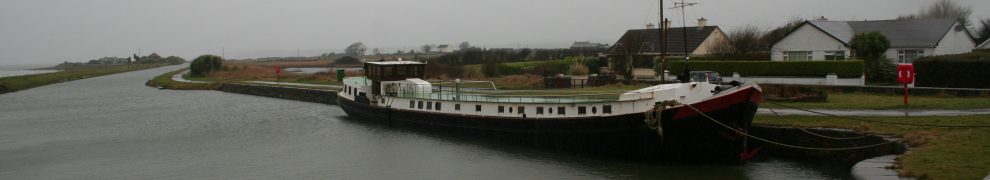
Saleen Pier at Ballylongford is covered here.
Posted in Ashore, Charles Wye Williams, Economic activities, Extant waterways, Forgotten navigations, Industrial heritage, Irish waterways general, Non-waterway, Operations, Scenery, shannon estuary, Steamers
Tagged Ballylongford, battery, boats, Clare, Coast Guard, ESB, ferry, flow, fort, Ireland, jetties, Kerry, Killaloe, Killimer, Kilrush, Limerick, marble mill, Moneypoint, Operations, ordnance ground, pier, quarry, quay, Saleen, Shannon, shannon estuary, Tarbert, vessels, waterways