Category Archives: Built heritage

Grand Canal Harbour maltings: a protected structure

I see on this website that the curved building at Grand Canal Harbour in Dublin, is a protected structure.

Here is the roof in 2007:

The roof in 2007

Here is the roof in October 2011:

The roof in October 2011

I have asked the developers for their comments.


The Broadstone

On a quick visit to Dublin, I managed to get a carless photo of the Broadstone MGWR station building.

The Broadstone building


Glorious Galway

Book by Meitheal Mara being launched on 20 October 2011:

Galway possesses an immensely rich heritage of boats, beyond compare on the island of Ireland and significant in the wider European context. This book covers not only the well-known craft, the Curachs and Galway Hookers but also the lesser-known ones: the wooden angling boats of Lough Corrib; the ubiquitous Curach Adhmaid; the fishing boats – Lobster Boats, Trawlers and Half-Deckers; the Barges and Hire-cruisers of the Shannon; the Flats, Yawls and Curachs of the oyster fishery; the clinker punts and cots of the Shannon callows, and many more.

Link to PDF.

The book can be bought from the Meitheal Mara website.

This site has no commercial interest in the matter but I am happy to draw attention to books on aspects of Ireland’s waterways history and heritage.


Two more sisters

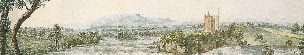
Members of the Heritage Boat Association have, in recent weeks, visited Piltown (Co Kilkenny) and Portlaw (Co Waterford) by barge, the first time in many years that large vessels have been up those rivers.

Many of the published accounts of Portlaw, including the Heritage Council’s Heritage Conservation Plan, pay inadequate attention to the navigation of the Clodiagh; it may have been even richer than we thought.

The HBA has a press release about some significant finds at Portlaw.

The owners of the barge Hawthorn joined other boats for the trips and wrote about them here:

Here is the relevant section of the OSI map for Portlaw (choose one of the Historic options). Here is where the Pil joins the Suir (zoomed out).

Here is my own article (in need of updating) about Portlaw and the Clodiagh.

Incidentally, I contend that the OSI maps are wrong in describing the gates on the canal as flood gates: they would open to, rather than close against, an incoming flood, and would prevent the discharge of an outgoing flood.


Cycling the Royal Canal

Here is a very short report from someone who did some of it (Dublin to Abbeyshrule).

Love me tender

Waterways Ireland tender documents are a source of interesting and occasionally useful information. At present WI is looking for tenders for

  • a hospitality guide
  • turf (sod peat) for bank repairs on the Royal Canal
  • automation of certain weirs. Expressing an interest in this one will allow you to get some original (Shannon Commissioners) drawings of parts of the  old weirs.


Waterways Forward

Read about the EU’s Waterways Forward project here and download PDFs showing what the Irish participants Waterways Ireland and South Tipperary County Council got out of the project. WI’s project was on the implementation of the Water Framework Directive on the Royal and Grand Canals; South Tipperary County Council’s was about generating a shared vision for the Suir through the River Café project.

Some folk may recognise the canal boat on the WI document. That fella gets in everywhere.


Buggering up the Barrow

Have you ever wondered, as you grounded on a sand bar or fought a current upstream, quite why the River Barrow is so challenging?

Here is a confession (with photos) from the man wot done it — in 1931 ….

Uncle Gaybo …

bigs it up for the Barrow, specifically a walk from Graiguenamanagh to St Mullins.

Forts, weirs, piers, power stations …

… just some of the things you can see from the Killimer to Tarbert ferry.

Actually, I lied about the weirs, but they were there once. As were the salmon.