Tag Archives: Portarlington

Canal carrying 1846: Dublin to Waterford

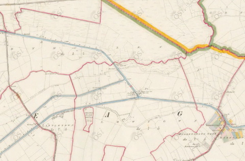
Lowtown is at the western end of the summit level of the Grand Canal; it thus has some claim to be the highest point on the canal. It is close to the village of Robertstown in County Kildare.

Lowtown is also the site of the junction between the main (Dublin to Shannon) line of the Grand Canal and its most important branch, the Barrow Line.

Lowtown (OSI ~1840)

Lowtown (OSI ~1840)

The main line from Dublin comes in from near the bottom right and exits near the top left. The two cuts leaving near the bottom left are the Old and New Barrow Lines, which join together just off the map. The Barrow Line runs to Athy, in south County Kildare, from which the Barrow [river] Navigation runs to the tidal lock at St Mullins, downstream of Graiguenamanagh.

The River Nore joins the Barrow a litle further downstream; the Nore is navigable on the tide upstream to Inistiogue. The combined rivers flow south through the port of New Ross and eventually join the estuary of the River Suir. Turning right at that point takes you up the Suir to Waterford, Carrick-on-Suir and Clonmel. Thus the Barrow Line, from Lowtown, forms an inland waterway link between Dublin and some towns along the Barrow, Nore and Suir.

Isaac Slater’s Directory[i] of 1846 lists those carrying goods on inland waterways. There is a long list for Dublin; entries for other towns list those providing local services. There are some conflicts between the lists (see below).

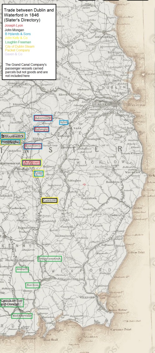
The map below shows those carrying on the Barrow Line of the Grand Canal and on the rivers Barrow, Nore and Suir. Each carrier is assigned a colour, which is used to frame the name of each place served by that carrier. Some towns (Mountmellick, Carrick-on-Suir, Clonmel) are off the map, further to the west. Note that the map is from the 25″ Ordnance Survey map of around 1900 rather than the 6″ of around 1840: I used it because it was clearer, but it shows features (eg railway lines) that were not present in 1846.

Click on the map to get a slightly larger version.

Dublin to Waterford: inland waterway traders 1846 (OSI)

Dublin to Waterford: inland waterway carriers 1846 (OSI)

Notes

All but one of the carriers are shown as having Dublin premises at Grand Canal Harbour, James Street. The exception is Gaven & Co, which is mentioned only in the Mountmellick entry.

I have not included the Grand Canal Company’s passenger-carrying boats, which carried parcels but not goods.

The City of Dublin Steam Packet Company entry for Dublin does not include Portarlington and Mountmellick amongst the towns served but the entry for Mountmellick says that the company’s boats leave for Dublin every Tuesday and Friday (its agent being John White) while that for Portarlington says they leave weekly. Boats from Mountmellick had to pass through Portarlington as well as Monastereven and other towns en route to Dublin.

Similarly, the entry for Mountmellick says that the Hylands boats leave there every other day while that for Portarlington says that they pass through weekly.

There is a page missing from the electronic copy of the directory that I consulted so the entry for Monastereven is incomplete.

The entry for Carlow says

To DUBLIN, and also to [New] ROSS, Boats depart, at uncertain periods, from the Wharfs of Lawrence and James Kelly, the Quay.

It does not say whether Lawrence and James Kelly owned any boats. They may have had boats but used them only for their own goods.

The entry for Mountmellick says “Bryan Hyland” rather than “B Hylands”.

The entry for Mountmellick includes the only mention I have found of Gaven & Co’s boats (James Waldron, agent).

The entry for Rathangan says

There are Boats for the conveyance of Goods, but no fixed period of departure.

Thomas Berry & Co, the most important carrier on the Grand Canal, did not venture south of Lowtown.

More

As far as I know, little has been written about the carrying companies, especially those of the nineteenth century. I would be glad to hear from anyone who can correct, supplement or comment on this information.


[i] I Slater’s National Commercial Directory of Ireland: including, in addition to the trades’ lists, alphabetical directories of Dublin, Belfast, Cork and Limerick. To which are added, classified directories of the important English towns of Manchester, Liverpool, Birmingham, Sheffield, Leeds and Bristol; and, in Scotland, those of Glasgow and Paisley. Embellished with a large new map of Ireland, faithfully depicting the lines of railways in operation or in progress, engraved on steel. I Slater, Manchester, 1846

My OSI logo and permit number for website

Watering Dublin

Someone asked me recently about the progress of the scheme to supply Dublin with water from the Shannon. I had to confess that I haven’t been keeping up with the matter, because I don’t think it’s very important, but happily KildareStreet.com has provided an update. On Tuesday 16 July 2013 one of the Sinn Féin chappies, Brian Stanley of Laois-Offaly, asked a priority question:

54. To ask the Minister for Environment, Community and Local Government the progress being made on the Dublin, Garryhinch, Shannon water supply project; and the timeframe for planning, construction and completion phases of this project.

I suspect that most folk think of the scheme as one involving Dublin and the Shannon, so that the inclusion of Garryhinch may have been puzzling. It seems that Garryhinch is on the road from Portarlington to Mountmellick, just after that nasty bend where folk go to commit golf.

And Mr Stanley is interested not because he wants Garryhinch, Portarlington Golf Club, or indeed Portarlington and Mountmellick to be flooded but because he wants his constituents to be employed digging a hole in the ground there (a bit like the Clones Sheugh, really) and working in a water-based ecopark that will include a reservoir where the Shannon’s water will be stored.

Anyway, Fergus O’Dowd [FG, Louth], who is a Minister of State for something, replied:

The Dublin water supply scheme long-term water source is listed as a scheme at planning stage in my Department’s water services investment programme 2010 to 2013. Dublin City Council is the lead authority for this scheme, on behalf of all of the water services authorities in the greater Dublin area.

Studies carried out for the city council and a strategic environmental assessment have identified a preferred option which involves abstraction of raw water from Lough Derg and pumping the abstracted water through a new pipeline to a proposed storage reservoir at Garryhinch cut-away bog in County Offaly, forming part of a proposed midlands water-based eco-park. After treatment, water would then be conveyed to the west of Dublin where the new supply would be integrated with the existing storage and trunk distribution system.

In December 2012, the Department approved a brief for the engagement of consultants for the planning and statutory approval phase of the scheme. Dublin City Council has carried out a procurement process and I understand it will shortly be in a position to appoint a consultant to advance the further planning of this scheme.

The programme for project implementation has been developed based on the planning and statutory approval phase taking approximately two years. The detailed design and procurement phase should take a further two years, while the construction and commissioning phase should be completed in three years.

Following their appointment by Dublin City Council, the consultants will undertake the environmental impact statement and other statutory requirements in preparation for a submission to An Bord Pleanála which will adjudicate on the matter.

He forgot to mention “best practice”, so he’s lost some brownie points. Mr Stanley wanted it all to happen much faster, to be completed before 2021, but the discussion provided no more useful information. Bord na Móna has some more information about the eco-park here. All good stuff, much as I suggested for Lough Oughter, but I’d lose the eco title: eco stuff is so last millennium.

Grand water

Here is a page about the feeders that supplied water to the Grand Canal. There will soon be a page about the Royal Canal feeders; these will lead to an examination of the current and proposed supply of water to the Royal.

Portarlington and Mountmellick

I have added some photos and maps to the page about the Mountmellick Line of the Grand Canal. Thanks to Martin O’Shea for two of the photos.

Russells of Portarlington, timber merchants

I am indebted to Eleanor Russell for permission to reproduce four photos of the canal operations of Messrs Russells of Portarlington, timber merchants and sawmills operators. They used the Royal and Grand Canals (and the Barrow Line and Mountmellick Branch) to carry timber cut on large estates to their sawmills. One of the estates on which they cut timber was Rockville, and Eleanor Russell has also given me permission to use a photo of Rockville House, taken in 1913, on my page about the Rockville Navigations.

Buggering up the Barrow

Have you ever wondered, as you grounded on a sand bar or fought a current upstream, quite why the River Barrow is so challenging?

Here is a confession (with photos) from the man wot done it — in 1931 ….

The upper Barrow

Charlie Horan (of Go with the Flow, the canoe expedition specialists) left a comment on my post about Abbeyleix (below) saying

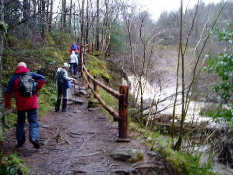
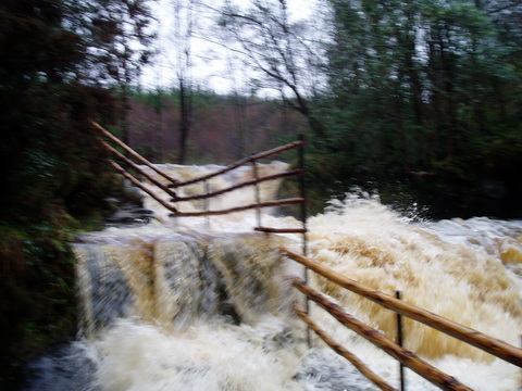
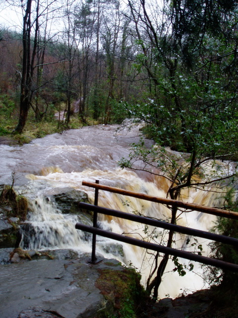
I have some very very interesting pictures of the Barrow near source in flood taken just two weeks ago ….

And here they are. They are indeed interesting!

White water (courtesy Eamonn and Charlie Horan)

Eek (courtesy Eamonn and Charlie Horan)

The burling Barrow brown (as Gerald Manley Hopkins called it) (courtesy Eamonn and Charlie Horan)

Even the indefatigable F E Prothero might have been put off …. He canoed down from Mountmellick to Athy in 1897, taking about eight and a half hours. Major Rowland Raven-Hart said that the Barrow had been canoed from a little above Portarlington (which is downstream of Mountmellick); there is a PDF of his book here.