Category Archives: Forgotten navigations

The Suir towing-path

His late Most Excellent Majesty Henry the Eighth, by the Grace of God, King of England and France, Defender of the Faith, Lord of Ireland and of the Church of England and also of Ireland in Earth Supreme Head, has many claims to fame, but the greatest is undoubtedly his Act for the Weares upon the Barrow, and other Waters in the County of Killkenny of 1537, which begins thus:

Prayen the commons of this present Parliament assembled, That where at all times necessarie boates, scowts, wherries, clarans, cottes, and other vessels, loden and bestowed with goods, merchandizes, and other stuffe, have beene used to passe and repasse thorough and in the King’s most excellent Majesty’s rivers and waters of the Barrow, the Noyre, the Suyr, and the Rie, within this land, which Rie is in the county of Kilkenny, to and from the King’s citie of Waterford, and the townes of Kilkenny, Rosse, and Clomel [sic], to and from diverse borrowe and corporate townes, and other places, being sitiated in the counties of Kyldare, Catherlagh, Wexford, Kilkenny, Waterford, and Tipperary, through which great commoditie and profit hath growen and might grow to the said citie, townes, noroughes, and other places, and to all and every the King’s true subjects adjoyning to the same waters and rivers: […]

We resume a couple of pages later:

[…] and that the said owners, their servants, marryners, boatmen, and other rulers and conveyers, and all other persons coming in ayd and help of them and every of them, at all such times as the said mariners, boatemen, and other rulers and conveyers shall thinke the same necessarie and needfull, shall have and occupie at every of their wills and pleasures, the space and breadth of seven foote or more, as need require, of plain ground, upon every part of the land, of every side of every the said rivers and waters, next adjoyning to the said rivers and waters, and that to bee where they must needs draw the said boats and other vessels afore named, with strength of horses or men, by land […].

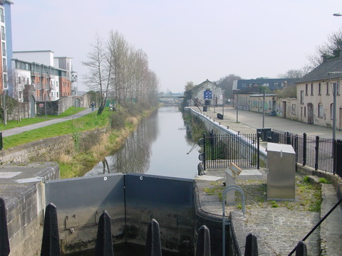
So His late Most Excellent Majesty provided that those drawing boats, using manpower or horsepower, could use a space seven foot wide on either side of the river. From the 1750s onwards, work was done on building a towing-path along the Suir between Carrick and Clonmel; work seems to have been finished before 1789 and the towing-path continued in use until the early years of the twentieth century.

Kincor Castle below Sir Thomas's Bridge at Ferryhouse

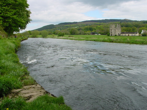
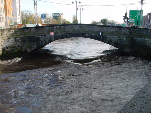
Kincor Castle below Sir Thomas’s Bridge at Ferryhouse

Much, but not all, of the towing-path is accessible, and maintainted by South Tipperary County Council; as well as providing a walking route, it allows anglers, boaters and other leisure users to get to the river. However, some sections are impassable, so that it is not possible to walk the whole length of this extremely scenic route between Clonmel and Carrick.

South Tipperary County Council is now considering declaring public roads on the towing-path and thus taking it in charge.

South Tipperary County Council's newspaper ad about declaring public roads on the Suir towing-path

South Tipperary County Council’s newspaper ad about declaring public roads on the Suir towing-path

The Council’s documents are here. I think that this is a good idea and I have written to the Council (and to local newspapers) to declare my support.


The fear of Baal’s Bridge

In May 1895 the fear induced by the prospect of a passage under Baal’s Bridge, on the Abbey River in Limerick, as revealed in the commercial court in London before Mr Justice Mathew and reported by the Freeman’s Journal of 20 May 1895.

Arthur George Mumford of Colchester, Essex, was described as an agent, but was actually a marine engineer and manufacturer of steam engines. He owned a 25-ton steam yacht called Gipsy, which he decided to sell through Messrs Cox & King, the well-known yachting agents (their 1913 catalogue is here).

The buyer was Ambrose Hall, the man responsible for the statue of Patrick Sarsfield. A former mayor of Limerick, he was an alderman and a “house and land commission agent”; his address was given as Mignon House, Limerick, which I have not so far found.

Hall bought the boat for £500; it was to be delivered to him at Limerick. The original plan was to sail it around the coast of Ireland and up the Shannon estuary, but bad weather in late 1894 caused Cox & King to suggest taking it to Dublin and then down the Grand Canal and the Shannon to Limerick. Hall agreed; the boat left Dublin in January 1895. It reached Killaloe on 19 January and Limerick “a day or two afterwards”, where it was moored in the canal harbour.

25 Grand Canal Harbour Limerick March 2007 01_resize

Canal harbour, Limerick in March 2007

Hall refused to accept the boat in the canal, saying that it should have been delivered to Limerick dock, a short distance downstream. Mumford and Cox & King sued him and the National Bank.

Hall and Baal

Ordnance Survey ~1900

Hall, an alderman and a former mayor, who had lived at North Strand, presumably knew the river and its difficulties.

Baal's Bridge 20091128 1_resize

Baal’s Bridge looking upstream towards the canal harbour in the floods of 2009

Navigation arch at Mathew Bridge 20091122_resize

The navigation arch at Mathew Bridge looking downstream in the floods of 2009

It was contended by the defendant that to get the vessel from the canal into the estuary of the Shannon there was a considerable risk involved. The passage was only a few hundred yards, but it was stated it could only be effected at certain states of the tide when it would be possible to get through Ballsbridge.

The judge sensibly suggested that it should be possible to insure the boat for the journey; the plaintiffs agreed to deliver it; Hall agreed to accept delivery and to pay £15 for the cost of the caretaker who had been looking after the boat since 23 January; the case was settled.

Clearly Ambrose Hall didn’t know Pat Lysaght.

My OSI logo and permit number for website

The 120′ Irish steam-powered narrow boat

Read about it here.

Canal boat sunk on the Liffey

In a comment here I wondered what a canal boat was doing as far up the Liffey as Grattan Bridge in 1873. Here is a report from the Freeman’s Journal of 10 March 1875 that may provide a possible explanation.

THE LATE WRECK IN THE RIVER LIFFEY:— The porter-laden canal boat which was swamped on Monday by being borne by the flood in the river against the southern abutments, at the western side of Grattan-bridge, still remains in the place where she sank. Though she came with great force against the structure, she did not inflict the slightest injury upon it. Measures will be at once taken for floating the sunken vessel, which does not in any way interfere with the river traffic, as the centre arches are quite clear. All the porter which was on board the canal boat when she went down has been secured.

Remember that Guinness built its wharf on the Liffey in 1873 but did not start building its own fleet of barges for the Liffey until 1877. It did, however, have “a few small tugs” that were used to draw laden boats.

Guinness had easy access to the Grand Canal Harbour at James’s Street, so it seems unlikely to me that Grand Canal boats would risk the Liffey passage to supply pubs along the Grand, the Barrow and the lower Shannon. It therefore seems more likely that the boats were either Royal Canal boats or were being used to supply ships in the port.

Dublin

Dublin City Public Libraries have some nice photos available online. The section on the Port of Dublin includes 1926 aerial photos of the Guinness wharf and of Spencer Dock (not busy) and Grand Canal Dock (including the section beyond the railway line, now filled in). There is also a photo of a steam barge at the Guinness wharf. In the Commercial Dublin section, I saw two businesses beside the Grand Canal, Ever Ready Batteries at Portobello and Gordon’s Fuels at Harold’s Cross.

One for the Phizzers

Quite a few visitors to this site come to read about the Broadstone. Here is a piece about the pontoon bridge used at the Broadstone between (AFAIK) 1847 and 1877. It was designed by Robert Mallet and it is interesting to see how an inventive engineer solved the peculiar problems of the Broadstone site.

The Fergus estuary

I have a page about the Fergus estuary here with links from that page to others about places on the estuary (including Paradise).

Mediaeval fishweir at the Boarland Rock in the Fergus Estuary © Dr Aidan O’Sullivan, UCD 2008

Mediaeval fishweir at the Boarland Rock in the Fergus Estuary © Dr Aidan O’Sullivan, UCD 2008

The UCD School of Archaeology has, for many years, been investigating the Fergus estuary and has found remarkable evidence of settlement and activities on the estuary stretching back to the Iron Age (about 100 BCE) and the Bronze Age (almost 800 BCE). Read about the project here and see more photos of mediaeval fishweirs and earlier artefacts here.

The photo above is used in accordance with the terms set out here.

Northsouthery 121212

The North/South Ministerial Council reports here [PDF] on the most recent inland waterways meeting, which was held on 121212. Not much happened (or at least not much that is being revealed to the citizens and subjects). Sponsor departments are to think about having a board; there is still no money for the Clones Sheugh but an interagency groups is to find some [hint: look under the end of a rainbow] and it was John Martin’s last appearance as he will be retiring in March and the search for a new CEO has a process (which is important).

The interesting bit is that WI is to transfer some property at Harvey’s Quay, Limerick, to Limerick City Council, which is making a boardwalk. And something similar is happening in Tullamore. You’re nobody nowadays unless you have a boardwalk; their usefulness in Irish weather is not proven.

Finally, I noted a certain modesty in WI’s aims for 2013, no doubt in keeping with the tenor of the times:

Ministers discussed the main priorities for Waterways Ireland in 2013 and noted progress on the 2013 Business Plan and Budget. The priorities for 2013 include:

• ensure the navigations are open and all existing facilities operational during the main boating season from April to October
• to actively promote the waterways to extend and expand recreational use of the waterways in all its forms.


Around the world with Irish waterways

Yesterday was one of those days: I managed to track down sources for several pieces of information I’ve been hunting for some time, but in the process I came across a few interesting links, from Gordon of Khartoum to the War between the States.

The starting point was William Watson, manager of the Inland Department and later Chairman of the City of Dublin Steam Packet Company. He worked with Robert Mallet on the design of an innovative boat for use on Irish inland waterways. Robert Mallet married a Cordelia Watson in 1831. (I thought that might be a daughter of William of the CoDSPCo but it’s pretty clear from the excellent Mallett Family History site that that was not so.)

One of Mallet’s inventions was a large mortar designed for use in the Crimean War. And one of Mallet’s sons, John William Mallet, went to the USA and became professor of chemistry at the University of Alabama. He joined the Confederate forces, rising to the rank of lieutenant-colonel in the artillery and superintendent of the Confederate ordnance laboratories.

Meanwhile Watson’s son Charles Moore went east rather than west. Colonel Sir Charles Moore Watson KCMG, CB, MA, of the Royal Engineers, Watson Pasha, was a general in the Egyptian Army and Governor-General of the Red Sea Littoral. Watson’s base was at Suakin on the Red Sea. The Dubliner was succeeded in that post by a Kerryman, Horatio Herbert Kitchener, from Ballylongford near Saleen on the Shannon Estuary, on which the City of Dublin Steam Packet Company operated.

Watson was “Gordon’s principal friend in Egypt”:

It is certain that Watson was, above all others, the one man in Cairo whom Gordon cared about most, and that he was the last to see Gordon off when he started [for Khartoum].

Gordon died at Khartoum; the relief expedition, led by another Irishman, Sir Garnet Wolseley, arrived two days too late.

A younger brother of Sir Garnet, Frederick Wolseley, went to Australia. His Sheep Shearing Machine Company made a brief expedition into the manufacture of motor-cars, under one Herbert Austin, who later founded his own company. Austin and Wolseley both ended up in British Leyland Motor Corporation, which made diesel engines, some of which were marinised and used in boats on the Irish inland waterways … which brings us back to where we started.

Please, sir, I want some more

I have written from time to time about the Heritage Council and the budget cuts it has suffered. Here’s a comment from December 2010; here I said that the Council’s vigorous lobbying campaign had succeeded in ensuring its own survival; last month it became clear that, although the Council had survived, its main grants scheme had not.

The dauntless Michael Starrett returns to battle in today’s Irish Times [incidentally, if the Irish Times tries to charge me for linking to their site, I’ll set McGarr Solicitors on them]. He argues that natural and cultural heritage are the core of the tourism product and that they are being damaged by the withdrawal of (inter alia) the Council’s programme of (mostly small) grants to (mostly small) community projects.

This line of argument accords with that used by the Council in its successful campaign to ensure its own survival. It was made explicit in the report Economic Value of Ireland’s Historic Environment [PDF] produced by Ecorys and Fitzpatrick Associates for the Heritage Council and launched in May 2012. However, there are some difficulties with its use in the present context.

The first is that some folk might feel that heritage (natural or built) should be appreciated for itself, not for its economic value. That’s fine as long as people do it on their own time; I lose sympathy when that argument is used to extract money from taxpayers while hiding the economic cost and distracting attention from the beneficiaries of that spending.

The second difficulty is that the Economic Value of Ireland’s Historic Environment concentrates on larger sites and attractions:

Reflecting these various criteria, Ireland’s historic environment has been defined for the purposes of this study as comprising the following sets of built heritage assets – those which are statutorily protected, together with components of the broader built heritage:

– World Heritage Sites
– Recorded Monuments, as defined by the Department of Arts, Heritage and the Gaeltacht
– Protected Structures included in planning authorities’ development plans
– Architectural Conservation Areas included in planning authorities’ development plans
– Designed landscapes surveyed by the Inventory of Architectural Heritage, and
– Other structures erected pre-1919, of which a note says “This is an increasingly accepted definitional component for the broader built heritage, although it is  acknowledged that some Protected Structures may have been built post 1919. Up to 1919 most houses in Ireland and Great Britain were built by skilled craftsmen using traditional indigenous building materials. Although the majority of older buildings are not listed/ statutorily protected, the majority provide flexible domestic and office accommodation. Major investment in money, energy and materials is embodied in these structures.”

The economic impact of the sector is the sum of three things:

  • Direct repair and maintenance output in relation to pre-1919
    building stock
  • Direct tourism expenditure by tourists principally attracted to
    Ireland by the Historic Environment (HE)
  • Direct employment, expenditure and income by the public sector (eg the Office of Public Works), subtracting overlap with the repair and maintenance category and the tourism expenditure category.

Eight of the ten case-studies considered in the report are about large sites, some of them commercial operations and others state-owned. The two exceptions are the Irish Landmark Trust and the Heritage Council’s grant scheme for traditional farm buildings.

Now, as far as I can make out, a lot of the recipients of Heritage Council grants (generally, not just those for farm buildings) would have fallen into the “Other structures erected pre-1919” category. I have not been able to discover, from the report, how much of the Historic Environment’s contribution to Gross Value Added is attributable to that category, or to any other category that might include the Council’s recipients of small grants.

In effect, the report seems to me to made some very broad-brush claims about the annual value of the Historic Environment, and those claims are being used to cast a halo effect over the entire sector. But it is not, it seems to me, proven that spending on any particular sub-sector is a good investment. (If I am wrong on that, I would welcome comments.)

Furthermore, I suspect that most of the contribution of the small projects supported by Heritage Council grants would come from the spending on repair and maintenance (where the total contribution is arrived at after some pretty heroic assumptions) rather than from that by tourists. Approaching it from the bottom up, I suspect that very few tourists are attracted to Ireland by the fact that the Heritage Council has grant-aided the clearing of an individual graveyard or the removal of rhododendron from a woodland.

So the argument that is being presented today, that (to quote the headline) “Tourism will suffer without real support for heritage” where “heritage” means “small local projects”, is not convincing. And it is rendered even less convincing by the fact that Heritage Council grants schemes explicitly gave low priority to tourism projects. But that is not to say that the small schemes are without value: there could and, I would argue, should be an effort to use them as part of the tourism marketing effort.

But there is a real difficulty here. How do you market small-scale tourism attractions? How does a small enterprise, or a small community, sell its heritage? How do the overseers of the national tourism product get tourists out of the well-known areas and off the beaten track, to places where they can meet real people and see real stuff? Maybe that’s what The Ghastly Gathering is about [I’m sorry: I can’t bring myself to read it].

Towards the end of his article, Michael Starrett talks in terms of landscapes, and I think he is right to use a term that is broader than a single site or location for a project. To have an impact, to be marketable, small projects need to be linked. Some of those links could be geographical, within a single area or landscape; some could be temporal, some familial, yet others commercial or otherwise thematic (for instance, the fascinating history of the Irish egg trade). I think that the small projects can help to attract tourists, but they need to be organised.