Tag Archives: canal

More on WI and the canals

It says here:

A number of questions have been repeatedly posed since the initial communications about the Canal Bye-law Enforcement. These are listed below in the following categories. Click on the category to access the questions and answers.

Five downloadable PDFs on


WI EML

EML? Extended Mooring Locations. Lots more info from WI here including a map and list of locations to be EMLed in 2012/13 and PDF maps for each of the locations currently being done.

A big shout out for whoever in WI has taken charge of using the website to keep folk informed: there has been a noticeable, and welcome, increase in the amount of information being made available.

Thon Strabane sheugh

[I’m practising Ulster Scots in a spirit of parity of esteem and such.]

I wrote the other day about a Sinn Féin campaign to have the Strabane Canal foisted upon the unfortunate Waterways Ireland (as though it didn’t have enough trouble already, what with smooth newts and mooring permits).

I once went looking for the Strabane Canal but I couldn’t find it (and wasn’t allowed to spend enough time searching). I don’t know that area at all, so I thought it would be useful to send a drone [well, actually, I used Google Maps in Photos view] to capture an aerial view of the Foyle. I was particularly interested in the likely demand for the Strabane Canal and I thought the number of pleasure craft on the Foyle might be a useful indicator.

This might be the Google view of the downstream lock on the canal.

So I flew the Googledrone down one bank from Strabane to the sea, crossed the mouth of the estuary and came back on the far side. And as far as I can see, there are very few pleasure boats on the Foyle. Londonderry Port and Harbour Commissioners have a small marina in Stroke City, Lough Foyle Yacht Club races dinghies and Foyle Punts from Culmore Point and there is a port at Greencastle, but that seems to be about it. I saw no serried ranks of motor cruisers, narrowboats or barges parked anywhere. It is of course possible that I missed them in my flyover, but where are the boats to come from to sue the Strabane Canal?

Save the newts: abandon the Clones sheugh!

Why has the proposed sheugh not yet been approved in Northern ireland? Because the Northern Ireland Environment Agency has been asking hard questions. WI has very kindly put the answers on its website.

The newts are going to be evicted, the stables may have to go but the Orange Hall won’t be affected. Hours of interesting reading.


Eeyore’s Gloomy Place

Here is an article, perhaps by Philip Dixon Hardy himself, from his Dublin Penny Journal of 1835. It is about the Bog of Allen, and the turfcutters living thereon, seen from the Grand Canal in 1835.

He visited a turfcutter’s hovel in the bog while stopped at a double lock about twenty miles from Dublin. What lock could that have been?

Note that Kildare is not among the counties mentioned in the article.

WI extended mooring permits

A Waterways Ireland press release has winged its way to my desk. If you want a permit (or licence?) you must provide a copy of your insurance and pay a damage deposit.

The full thing:

Waterways Ireland announced in June 2012 a change in the permit system allowing for year-long mooring permits on the Grand & Royal Canal and Barrow Navigation. The full list of Extended Mooring Locations has been published and is available on www.waterwaysireland.org, in the Canal Bye-Law Enforcement section.

The first four [for certain values of four. bjg] locations where the permits for extended mooring are being opened for application are Shannon Harbour on the Grand Canal, Rathangan and Vicarstown on the Barrow Line and Barrow Navigation, Clondra (East of Richmond Harbour), Confey and the 15th lock on the Royal Canal.

The application process for the Extended Mooring Permit for these locations will open on the 19th November and will remain open for 2 weeks. Boat owners with boats in the four locations with Combined Mooring and Passage Permits will be advised by letter. The Application Form and Guidance Notes for all applicants will be placed on www.waterwaysireland.org. The applicant is required to complete an application form, supply a copy of their insurance, certify that the boat complies with the byelaws and pay the €152 fee and a damage deposit of €250.

Permits will be allocated on a first come first served basis, so to receive a preferred location early applications are advised. Applications will only be accepted from owners already holding a valid annual Combined Mooring and Passage Permit. Boat owners without a Combined Mooring & Passage Permit who wish to apply for an Extended Mooring Permit can do so by ticking the box on the Extended Mooring Application Form and supplying the additional fee.

Applicants will be notified within 28 days of the success of their application.  Successful applicants will be required to sign the Extended Mooring Permit license and will then have a period in which to move to their new mooring. Enforcement of the 5 day rule will begin in this area following the issue of a Marine Notice.

Applications for the next set of Extended Mooring Locations will continue on a rolling basis thereafter with Waterways Ireland intention to open sufficient locations to cover demand on all of the canals by the end of March 2013.

Boats that cruise and move (staying at a mooring for up to 5 days) will not require an Extended Mooring Permit or be in breach of the Bye-laws.

Waterways Ireland will continue to contact permit holders regularly to ensure they are kept up to date with the roll-out of the new permit. All queries about the enforcement of the current bye-laws or the Extended Mooring Permit should be directed to Shane Anderson, Assistant Inspector of Navigation: Tel no +353 (0)87 286 5726, Email shane.anderson@waterwaysireland.org.

These changes are necessary steps to improve the management of the canals and waterway amenities for both the navigational and recreational user, so that investment in the new infrastructure and facilities which Waterways Ireland has undertaken is maximised for every user.

Despite asking them several times, I still don’t understand what WI means by “permit” and “licence”. And now we have a “Permit licence”.

A Winn for the Grand

In today’s Sunday Business Post Jasper Winn, the paper’s Hardy Outdoor Correspondent, describes a five-day walk along the Grand Canal, from Harold’s Cross to Shannon Harbour. He did it in winter, camping out on the bank overnight despite its being so cold that the canal froze over, and finishing some of his days’ walks in the dark.

The SBP operates a paywall so you may not be able to see the page, but this is the link in case you want to try.

Northern Ireland seeks cutting-edge technology … of the 18th century

IndustrialHeritageIreland reports on two recent outbreaks of cargo cultism in Norn Iron. Folk in Tyrone want the whole of the Ulster Canal to be restored to its, er, former glory, which presumably means without any water west of Monaghan, while a Sinn Féin MLA wants to lumber Waterways Ireland with responsibility for the useless Strabane Canal on which £1.3 million has already been wasted.

What is it with Sinn Féin and canals? I realise that Irish republicanism is by definition a backward-looking creed, with little contact with reality, but why not look to (say) early nineteenth century technology, like the steam railway, rather than that of the eighteenth century?

Part of the problem, I suspect, is that Sinn Féin folk, especially those who are subjects of Her current Majesty, adopt a British conception of inland waterways. In Britain, canals dominate and boats must travel slowly, no faster than the horse-drawn vessels of the eighteenth and nineteenth centuries. But Irish waterways are dominated by lakes, whereon modern folk like to zoom around in fast boats: jetskis, speedboats and skiboats, fast cruisers. Such boats are entirely unsuitable for canals: they damage the banks and the pace bores their owners.

As it happens, we have lots of lakes where owners can zoom. [I’d prefer if they didn’t, but that’s the way it is.] And with reductions in the amount of boating activity, we don’t need any additional waterways. Sinn Féin, though, doesn’t seem to have grasped this. Stuck in the eighteenth century, it wants canals. I suppose we should be grateful it isn’t proposing to have the taxpayer stump up for coal-mines as well.

For the record

The Limerick Leader article about a proposed Limerick river bus has some statements that do not accord with my understanding.

The venture will see the river bus depart Guinness Pier – across from Athlunkard Boat Club at O’Dwyer Bridge – every two hours, bound for the power station […].

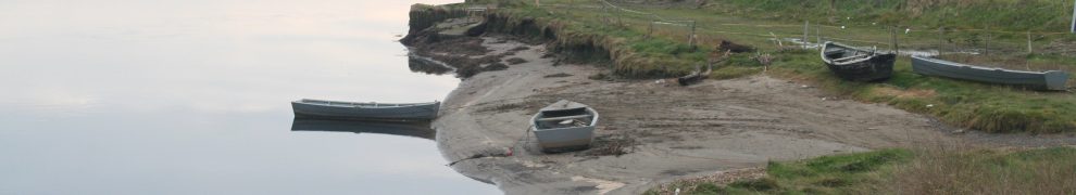
As far as I know, the pier in question was the Ranks jetty and was not used by Messrs Guinness. The Eclipse Flower, and other vessels owned by Ranks and their predecessors, sailed up the Shannon from there rather than attempt the stretch from Baal’s Bridge to Custom House Quay.

The boat will follow the route taken by barges of old – both passenger and commercial – some of which historically transported Guinness to the city up until the mid-1960s.

“It is a tried and tested route,” said Mr Flynn, stressing the viability and safety of the route, which passes Long Pavement – the edges of which have been repaired and grassed over – and finishes at the hydro-electric plant.

“Every passenger and commercial barge that came to Limerick for 50 years used that stretch of water. It is very safe. It was navigated by all the barges,” he said.

The route to Limerick through Ardnacrusha came into use only after the construction of the power station in the 1920s and was used for a little over thirty years. To the best of my knowledge, there were no passenger services in those years: passenger carrying stopped in the first half of the nineteenth century, when traffic was still using the old Limerick Navigation. There have been some trip-boats in recent years, but they did not (and do not) use “barges of old”. Some old barges, now converted and with more powerful engines, have safely navigated that stretch, but they do it when conditions are right.

During the final phases of Ardnacrusha’s construction, both old and new navigations were closed; the Grand Canal Company (GCC), the main commercial carrying company, ran to Killaloe and had its cargoes carried onward by rail to Limerick. When the new route through Ardnacrusha was opened, the GCC thought it was so dangerous that it refused to use it for about a year. It resumed operations only when a boom was put across the river above Baal’s Bridge and posts were provided upstream of O’Dwyer Bridge to which barges could tie while waiting for suitable states of the tide.

I accept that the proposed river bus will not be going downstream as far as Baal’s Bridge, but it will still be navigating on a stretch of water where Waterways Ireland advises that boats should not navigate when more than one turbine is running at Ardnacrusha. The ESB can run up to four turbines, each of which is said to add a knot to the current, and it can switch them on immediately, with no warning to any boat using the river.

Other pages on this site make it clear that I share the promoters’ enthusiasm for Ardnacrusha and the canal and river thence to Limerick. I do not say that the difficulties of that stretch cannot be overcome, but I do not think that they should be dismissed.


That Limerick “river bus” …

… from the (presumably artificially created) photograph in the Limerick Leader seems to be the Cailín Turána, formerly part of the Aran Islands Fast Ferries fleet at Doolin and seen here out of the water at Cork Dockyard in 2004. The vessel has not been on the Dept of Transport’s List of Certified Passenger Ships since 2007 (and may have come off the list before that: I have not kept copies of the lists earlier than 2007). It could of course have been used in Ireland for purposes other than carrying fare-paying passengers, or outside Ireland for any purpose, after 2004.

And it may be that the vessel shown in the photo is not that which is to be used in Limerick.