WI at work in Killaloe Novemebr 2012.

Old crane being painted

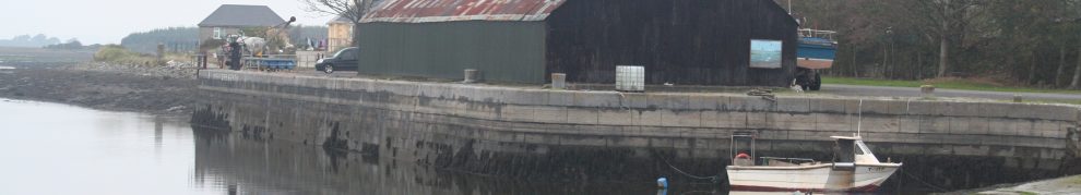
The Marindus weedspraying pontoon. This Marindus may be Marindus Engineering Ltd of Kilmore Quay, Co Wexford
WI at work in Killaloe Novemebr 2012.
Old crane being painted
The Marindus weedspraying pontoon. This Marindus may be Marindus Engineering Ltd of Kilmore Quay, Co Wexford
Posted in Ashore, Built heritage, Charles Wye Williams, Economic activities, Engineering and construction, Extant waterways, Forgotten navigations, Industrial heritage, Ireland, Irish inland waterways vessels, Irish waterways general, Operations, Restoration and rebuilding, Shannon, waterways, Waterways management, Weather
Tagged boats, bridge, canal, Clare, crane, ESB, flow, Ireland, Killaloe, lock, Lough Derg, Marindus, Operations, paint, Shannon, vessels, waterways, Waterways Ireland, weed, workboat
Waterways Ireland has parked a canteen trailer and some pontoons at Errina Bridge.

The compound, with Official Notices signed Rabbit

Pontoons

The canteen trailer

Another view of the canteen trailer

Evidence of tree cutting above Errina Lock, but that may not have anything to do with Waterways Ireland

The guardians of the lock
Posted in Ashore, Built heritage, Charles Wye Williams, Drainage, Economic activities, Engineering and construction, Forgotten navigations, Industrial heritage, Ireland, Irish inland waterways vessels, Natural heritage, Operations, Restoration and rebuilding, Shannon, The cattle trade, The turf trade, waterways, Waterways management
Tagged boats, bridge, canal, Clare, Errina, floods, Ireland, Killaloe, Limerick, lock, lost, Lough Derg, O'Briensbridge, Operations, Plassey-Errina Canal, pony, Shannon, Tipperary, water level, waterways, Waterways Ireland, workboat
The upper chamber at Ardnacrusha lock
Posted in Built heritage, Economic activities, Engineering and construction, Extant waterways, Industrial heritage, Ireland, Operations, Shannon, waterways
Tagged Ardnacrusha, canal, chamber, Clare, ESB, headrace, Ireland, lock, tailrace, waterways
I wrote here about the Park Canal and why it should not be restored. I did not include, because I had not then seen it, a link to this report in the Limerick Post. It shows why the gates on the second lock were not replaced. The core problem is that the banks in the upper section of the canal slope too steeply to be stable.

The slope of the banks above the railway bridge (from a boat)
Happily, this deficiency in the original construction has saved us from another foolish restoration.
Posted in Ashore, Built heritage, Charles Wye Williams, Drainage, Economic activities, Engineering and construction, Extant waterways, Forgotten navigations, Industrial heritage, Ireland, Operations, People, Politics, Rail, Restoration and rebuilding, Scenery, Shannon, Sources, The cattle trade, waterways, Waterways management
Tagged boats, bridge, canal, Clare, Guinness, Ireland, Limerick, Limerick City Council, lock, Operations, Park Canal, Shannon, slope, turf, vessels, water level, waterways, Waterways Ireland
Here is an article, perhaps by Philip Dixon Hardy himself, from his Dublin Penny Journal of 1835. It is about the Bog of Allen, and the turfcutters living thereon, seen from the Grand Canal in 1835.
He visited a turfcutter’s hovel in the bog while stopped at a double lock about twenty miles from Dublin. What lock could that have been?
Note that Kildare is not among the counties mentioned in the article.
Posted in Ashore, Drainage, Economic activities, Engineering and construction, Extant waterways, Industrial heritage, Ireland, Irish inland waterways vessels, Irish waterways general, Natural heritage, Non-waterway, Operations, People, Scenery, Sources, The turf trade, Tourism, waterways
Tagged boats, bog, Bog of Allen, canal, Dublin, Dublin Penny Journal, Galway. Roscommon, gorse, Grand Canal, hovel, Ireland, King's County, landlord, landshark, lock, Longford, Meath, Operations, Philip Dixon Hardy, Queen's County, reclamation, Royal Canal, Shannon, Tipperary, Tullamore, turf, vessels, Westmeath, Wicklow
In today’s Sunday Business Post Jasper Winn, the paper’s Hardy Outdoor Correspondent, describes a five-day walk along the Grand Canal, from Harold’s Cross to Shannon Harbour. He did it in winter, camping out on the bank overnight despite its being so cold that the canal froze over, and finishing some of his days’ walks in the dark.
The SBP operates a paywall so you may not be able to see the page, but this is the link in case you want to try.
Posted in Ashore, Built heritage, Engineering and construction, Extant waterways, Industrial heritage, Ireland, Natural heritage, People, Scenery, Shannon, Tourism, Water sports activities, waterways, Weather
Tagged canal, Daingean, Dublin, frost, Grand Canal, ice, Ireland, Jasper Winn, lock, Operations, Sallins, Shannon, Shannon Harbour, Sunday Business Post, walk, waterways, Waterways Ireland
The Limerick Leader article about a proposed Limerick river bus has some statements that do not accord with my understanding.
The venture will see the river bus depart Guinness Pier – across from Athlunkard Boat Club at O’Dwyer Bridge – every two hours, bound for the power station […].
As far as I know, the pier in question was the Ranks jetty and was not used by Messrs Guinness. The Eclipse Flower, and other vessels owned by Ranks and their predecessors, sailed up the Shannon from there rather than attempt the stretch from Baal’s Bridge to Custom House Quay.
The boat will follow the route taken by barges of old – both passenger and commercial – some of which historically transported Guinness to the city up until the mid-1960s.
“It is a tried and tested route,” said Mr Flynn, stressing the viability and safety of the route, which passes Long Pavement – the edges of which have been repaired and grassed over – and finishes at the hydro-electric plant.
“Every passenger and commercial barge that came to Limerick for 50 years used that stretch of water. It is very safe. It was navigated by all the barges,” he said.
The route to Limerick through Ardnacrusha came into use only after the construction of the power station in the 1920s and was used for a little over thirty years. To the best of my knowledge, there were no passenger services in those years: passenger carrying stopped in the first half of the nineteenth century, when traffic was still using the old Limerick Navigation. There have been some trip-boats in recent years, but they did not (and do not) use “barges of old”. Some old barges, now converted and with more powerful engines, have safely navigated that stretch, but they do it when conditions are right.
During the final phases of Ardnacrusha’s construction, both old and new navigations were closed; the Grand Canal Company (GCC), the main commercial carrying company, ran to Killaloe and had its cargoes carried onward by rail to Limerick. When the new route through Ardnacrusha was opened, the GCC thought it was so dangerous that it refused to use it for about a year. It resumed operations only when a boom was put across the river above Baal’s Bridge and posts were provided upstream of O’Dwyer Bridge to which barges could tie while waiting for suitable states of the tide.
I accept that the proposed river bus will not be going downstream as far as Baal’s Bridge, but it will still be navigating on a stretch of water where Waterways Ireland advises that boats should not navigate when more than one turbine is running at Ardnacrusha. The ESB can run up to four turbines, each of which is said to add a knot to the current, and it can switch them on immediately, with no warning to any boat using the river.
Other pages on this site make it clear that I share the promoters’ enthusiasm for Ardnacrusha and the canal and river thence to Limerick. I do not say that the difficulties of that stretch cannot be overcome, but I do not think that they should be dismissed.
Posted in Ashore, Built heritage, Economic activities, Engineering and construction, Extant waterways, Industrial heritage, Ireland, Irish inland waterways vessels, Non-waterway, Operations, People, Rail, Restoration and rebuilding, Scenery, Shannon, Sources, Tourism, waterways, Waterways management
Tagged Ardnacrusha, Baal's Bridge, boats, bridge, canal, Clare, Eclipse Flower, ESB, floods, flow, Grand Canal Company, Guinness, Ireland, jetties, Killaloe, Limerick, Limerick Leader, lock, Lough Derg, O'Dwyer Bridge, Operations, Park Bridge, Ranks, river bus, Shannon, vessels, water level, waterways, Waterways Ireland
… from the (presumably artificially created) photograph in the Limerick Leader seems to be the Cailín Turána, formerly part of the Aran Islands Fast Ferries fleet at Doolin and seen here out of the water at Cork Dockyard in 2004. The vessel has not been on the Dept of Transport’s List of Certified Passenger Ships since 2007 (and may have come off the list before that: I have not kept copies of the lists earlier than 2007). It could of course have been used in Ireland for purposes other than carrying fare-paying passengers, or outside Ireland for any purpose, after 2004.
And it may be that the vessel shown in the photo is not that which is to be used in Limerick.
Posted in Economic activities, Engineering and construction, Extant waterways, Industrial heritage, Ireland, Irish inland waterways vessels, Non-waterway, Operations, People, Restoration and rebuilding, Shannon, Sources, Tourism, waterways, Waterways management
Tagged Ardnacrusha, Athlunkard, boats, canal, Clare, ESB, estuary, flow, Ireland, Limerick, lock, Operations, Ranks, Shannon, vessels, water level, waterways, Waterways Ireland, workboat

