
The Barrow at Monasterevan (or -in)
Wouldn’t it be better if the Council ordered weak currents instead?
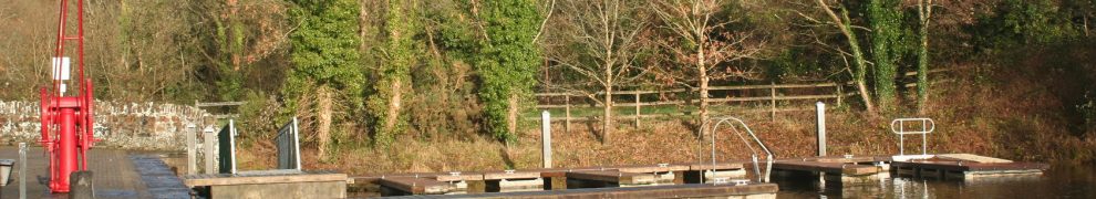
The Barrow at Monasterevan (or -in)
Wouldn’t it be better if the Council ordered weak currents instead?
Posted in Ashore, Extant waterways, Operations, Tourism, Water sports activities, Waterways management
Tagged bank, Barrow, county council, current, flow, Kildare, lifering, Monasterevan, Monasterevin, river, water level
I have written a page suggesting that, on good economic principles, the Irish government should use the Royal Canal as a giant rubbish dump.
This step would solve the impending shortage of landfill sites, avoid the need for an incinerator at Poolbeg and allow Keynesian bottles to be used to provide employment and stimulate the economy.
I have also suggested an alternative use for the Royal, but I’m afraid the alternative is almost laughably implausible: it is that folk should be encouraged to go boating on the Royal. I even suggest — I know it’s ridiculous — that some folk might like to complete the “Irish ring” or triangle: along the Grand to Dublin, to the Shannon along the Royal and then completing the circuit by travelling south along the Shannon.
If the numbers travelling were to justify the upkeep of the canals, large numbers of hirers would be needed, as would large numbers of hire boats. But not all of the existing hire firms are keen on the idea and none of them (as far as I know) is advertising the route. Waterways Ireland promoted it at a recent Birmingham boat show, but without the sort of detailed information that a would-be hirer would need.
It may be that Waterways Ireland is holding back until an adequate water supply for the Royal has been secured and until the obstacles at the Dublin end have all been removed. Perhaps it intends to persuade hire firms (new or existing) to provide packages; perhaps it will have a super new marketing campaign once everything is ready, and perhaps it’s just playing for time at the moment.
The problem with that approach is that it risks losing goodwill from potential hirers who, having heard of the reopening of the Royal, are now finding it difficult to arrange a trip.
One of the major sources of difficulty, as I see it, is the absence of information about what a trip might entail. Only the IWAI Dublin Branch seems to have made any effort to help folk who want to travel the route; neither the RCAG nor the Waterways Ireland site is of much use to anyone.
Accordingly, I have written a second page with some suggestions about how a hirer might tackle the trip. I still think it’s ridiculously difficult to plan, especially for a would-be hirer form overseas, and my information is not complete. I hope that folk will suggest improvements and help to tie down the details. And if anyone knows of a hire firm that is offering packages, with all the schedules worked out and the bookings made, do please give the details.
Posted in Economic activities, Engineering and construction, Extant waterways, Industrial heritage, Operations, Restoration and rebuilding, Tourism, Waterways management
Tagged boats, bridge, canal, flow, Grand Canal, Green and Silver, hire firm, Ireland, Ireland canals Grand Royal, Irish ring, lock, Newcomen, Operations, Rolt, Royal Canal, Shannon, triangle, vessels, water level, waterways, Waterways Ireland
Ming Flanagan was the first to be elected a TD in the Roscommon South Leitrim constituency in the 2011 general election.

Ming launching himself on the Rockville Navigations
His sterling qualities were shown when, in September 2010, he kayaked down the Rockville Navigations, with a companion, to check this tourism and recreational resource (which I had brought to his attention in his capacity as Mayor of County Roscommon).
Another person on the side of righteousness is Paudie Coffey of Portlaw, mentioned favourably here; he was first home in Waterford, where he stood for Fine Gael.
Posted in Built heritage, Economic activities, Extant waterways, Forgotten navigations, Industrial heritage, Irish inland waterways vessels, Irish waterways general, Operations, Scenery, Suir, Water sports activities
Tagged 2011, boats, bridge, canal, Carrick-on-Suir, Clodiagh, Coffey, Dáil, Department of Community Equality and Gaeltacht Affairs, election, Ireland, Ireland waterways rockville, lock, lost, Malcolmson, Ming, Operations, Portlaw, quay, Rockville, Roscommon, Shannon, Suir, TD, turf, vessels, water level, Waterford, waterways, weir
Do my eyes deceive me?
The still-unopened mooring pontoons below the bridge at Ballina (bottom of Lough Derg) seem to have sprouted an extension.
Here is what they looked like in 2009.

The upstream end of the Ballina pontoons in February 2009
Here they are in the floods of November 2009.

The upstream end of the Ballina pontoons in the floods of November 2009
And here they are in January 2011, seen from downriver.

The upstream end of the Ballina pontoons in January 2011
Well I never.
Posted in Ashore, Economic activities, Extant waterways, Irish waterways general, Operations, Weather
Tagged Ballina, boats, bridge, Clare, floods, flow, Ireland, jetties, Killaloe, Lough Derg, Operations, pontoon, Shannon, Tipperary, water level, waterways, Waterways Ireland
As part of its new mooring scheme at Killaloe, Waterways Ireland has commissioned contractors (L&M Keating Ltd) to carry out various works including the installation of a lock at the upper end of the canal, beside the Phoenix boathouse and just downstream from the Pierhead. The lock is to control access to the canal; presumably the stop planks in the existing lock chamber will be removed, allowing boats to pass down under the bridge.

The lock under construction
As I understand it, this lock is to have a single pair of gates. Boats wishing to pass through will tie up temporarily and use a squawk-box (or similar technological marvel) to communicate with the bridge-keeper at Portumna, who will cause the gates to be opened and then, presumably, closed after the boat has passed through. This system will prevent the use of the canal by cads and bounders using jetskis, speedboats and other excrescences.

Stanked off and pumped out
However, the water through Killaloe Bridge has a gradient or slope, especially in flood and when Ardnacrusha power station is running. The canal above the lock will be at the higher level; the canal below the lock will be fed from the bottom end, where it rejoins the river. So is there not likely to be a difference in height at the lock? Is this the equivalent of a flash lock?
I’m sure there is an engineering answer to this; I would welcome enlightenment.
Posted in Ashore, Economic activities, Extant waterways, Operations, Weather
Tagged boats, bridge, canal, Clare, ESB, flash lock, floods, flow, Ireland, Killaloe, L&M Keating Ltd, Limerick Navigation, lock, Lough Derg, Operations, Phoenix, Shannon, stank, vessels, water level, Waterways Ireland

