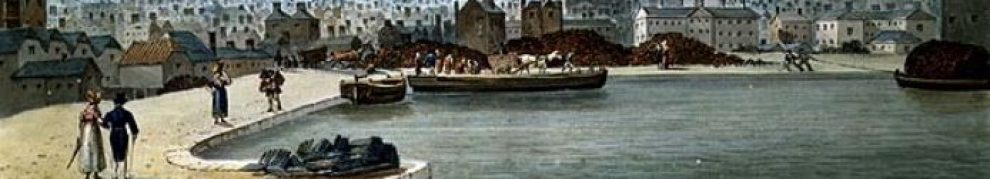
… but I’d like to know more about Mr Christmas’s canals.
Off the Suir, near Mount Congreve.
… but I’d like to know more about Mr Christmas’s canals.
Off the Suir, near Mount Congreve.
Posted in Built heritage, Canals, Drainage, Economic activities, Engineering and construction, Extant waterways, Forgotten navigations, Industrial heritage, Ireland, Operations, People, Sources, Suir, waterways
Tagged canal, Christmas, Dooneen, Ireland, Mount Congreve, Operations, Suir, waterways, Whitfield
… even today.
Posted in Built heritage, Canals, Economic activities, Engineering and construction, Extant waterways, Foreign parts, Forgotten navigations, Industrial heritage, Ireland, Operations, Restoration and rebuilding, Shannon, Sources, Tourism, Ulster Canal, waterways, Waterways management
Tagged belfast, boats, canal, Clones, Clones sheugh, Coleraine, department of arts heritage and the gaeltacht, Erne, Ireland, Limerick, Lough Neagh, Operations, Saunderson's Sheugh, Shannon, Ulster Canal, waterways
FINAL SALE
Of the Extensive Stock of Woollen and other Shop Goods, including Blankets, Flannels, and Stuffs, Cotton Cords, Hosiery, Muslins, Trimmings, &c, &c, all more or less injured by fresh water, caused by the sinking of Boat No 49, at Moyvalley, on the Evening of Monday the 9th instant, by the Night Passage Boat.
TO BE SOLD BY AUCTION, Store No 6, Royal Canal Harbour, Constitution Hill, on THIs DAY (Friday), 20th Nov, 1846 (weather permitting), for account of whom it may concern, the residue of the large Stock of partially damaged Shop Goods, in Lots suitable to purchasers.
Sale to commence at half-past Eleven O’Clock.
The Sale will finally close To-Morrow. There are a quantity of Pack Sheets and Boxes to be disposed of.
JOHN LITTLEDALE, Auctioneer,
9, Upper Ormond-quay.
The Freeman’s Journal and Daily Commercial Advertiser
20 November 1846
Limerick City & County Council [why don’t they shorten it to Limerick Council?] is examining options for an improved road from Limerick to Foynes, which is the main port on the Shannon Estuary. The options are set out on this website and you can download a PDF map that makes it easier to see the details.
The Red Route would cross the Deel Navigation just below Askeaton: the existing route does the same so there might not be any extra interference with the navigation. But the Red Route would also cross the Maigue and the Blue Route would do so just below the new quay at Adare. No doubt the Adarians would welcome a bypass but I imagine that some will be watching to ensure that navigation on the Maigue is not impeded.
Meanwhile we learn that some folk and some other folk want the railway line from Foynes to be reinstated. I have no idea why they think that’s a good idea: it’s not as if there were vast piles of incoming freight piled up at Foynes, unable to be shifted by road. Rip up the tracks and make a greenway, that’s what I say.
Posted in Ashore, Built heritage, Economic activities, Engineering and construction, Extant waterways, Forgotten navigations, Industrial heritage, Ireland, Operations, People, Rail, Restoration and rebuilding, shannon estuary, waterways, Waterways management
Tagged Adare, Askeaton, Deel, estuary, Foynes, Ireland, Limerick, Maigue, Operations, Port Company, railway, SFPC, Shannon, waterways
I noted recently that, according to the Department of Arts Heritage and the Gaeltacht, Waterways Ireland’s budget for the Clones Sheugh assumed a cost of land [including legal costs] of just over €52,500 per acre, when “the majority of [the land] is poor quality agricultural land”. I have asked Waterways Ireland for more information about this.
But today [as I am sure all regular readers will be aware] the Irish Farmers Journal Agricultural Land Price report 2014 has been published. It says that the average price of Co Monaghan land (based on 25 completed transactions) was only €9384 per acre, with a range from €1049 (for a 43-acre lot of which 12 acres were bog) to €40000 for land with development potential near Carrickmacross. A 25-acre “holding of prime agricultural land overlooking the lake at Emyvale” went for €14800 per acre and the county’s weighted average was €8103 per acre.
In Fermanagh, in Northern Ireland, the average price was £7493 (€10126) per acre, but “Lots of poor, rocky and heather land sold for around £1700/acre”.
Posted in Ashore, Canals, Drainage, Economic activities, Engineering and construction, Foreign parts, Forgotten navigations, Industrial heritage, Ireland, People, Politics, Restoration and rebuilding, Sources, Ulster Canal, waterways, Waterways management
Tagged agricultural land, barge, canal, Clones, Clones sheugh, department of arts heritage and the gaeltacht, Erne, Fermanagh, land prices, Monaghan, Saunderson's Sheugh, Ulster Canal, Waterways Ireland
To complement my page on the Eglinton Canal in Galway, here is one about the Claddagh Basin.
Posted in Built heritage, Canals, Economic activities, Engineering and construction, Extant waterways, Forgotten navigations, Industrial heritage, Ireland, Irish inland waterways vessels, Operations, People, Politics, Sources, Water sports activities, waterways, Waterways management
Tagged Board of Public Works, Board of Works, boats, bridge, canal, Claddagh, Corrib, Corrib Navigation Trustees, Galway, Ireland, lock, quay, Roberts, vessels, Wilde
The trackway [towing-path] on the River Barrow changes from the east {left) bank to the west at Leighlinbridge and back again at Graiguecullen/Carlow.
It seems to me that there may have been some difficulties in getting horse-drawn boats from one side of the river to the other and I have found no evidence on how it was done, so here is some speculation instead.
Posted in Built heritage, Canals, Economic activities, Engineering and construction, Extant waterways, Industrial heritage, Ireland, Irish inland waterways vessels, Operations, Sources, Suir, The grain trade, waterways, Waterways management, Weather
Tagged barge, Barrow, Barrow Navigation Company, boats, bridge, canal, Carlow, Carrick-on-Suir, Clonmel, floods, flow, Graiguenamanagh, Grand Canal, Grand Canal Company, Inistiogue, Ireland, Leighlinbridge, lock, Loughlin Freeman, New Ross, Operations, Shannon, Suir, tracking, trackline, trackway, Waterford, waterways, weir
Monday 23 March James Scully “The Grand Canal in Offaly 1794 – 1804.” – Offaly History Centre – 8pm 2014-15 is the bicentenary of the connection from the Liffey with the Shannon. The talk will be based on contemporary sources, primary and secondary but mostly on the Grand Canal Minute Books.
I’ve just been flying by rail: looking over some of the present and former railways that cross[ed], impinge[d] upon or were otherwise related to waterways. They are all on Industrial Heritage Ireland’s new Historic Map of Irish railways.
In the midlands, for example, it shows the line from Clara to Banagher, home of Ireland’s shortest canal: folk visiting Shannon Harbour will know about that. And anyone driving to Shannon Harbour from (say) Limerick will have crossed the Stolen Railway from Birr (then Parsonstown) to Portumna: it’s there too, as are the lines on both sides of the Shannon Estuary, and those near the Suir and Barrow and many many more.
Work has begun on providing links to a database with information about the individual stations: Donegal, which had an extraordinary number of them, was the first area to be done.
Hours of enjoyment; thanks to Ewan Duffy for putting in so much work.
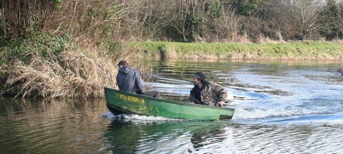
Rounding Soldier’s Island
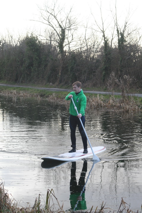
SUPper at the dry dock
… and a two-man racing kayak that I didn’t photograph. All in the space of about half an hour at Sallins.

