Drawings now uploaded. Much more activity in these than in the Lough Ree equivalents, with steamers towing barges, turf boats, the surveyors’ cutter and other excitements.
Drawings now uploaded. Much more activity in these than in the Lough Ree equivalents, with steamers towing barges, turf boats, the surveyors’ cutter and other excitements.
Posted in Ashore, Built heritage, Charles Wye Williams, Economic activities, Engineering and construction, Extant waterways, Industrial heritage, Ireland, Irish inland waterways vessels, Irish waterways general, Natural heritage, Operations, People, Politics, Scenery, Sources, Steamers, The cattle trade, The turf trade, Tourism, waterways, Waterways management
Tagged Admiralty, Beechey, boats, Charles Wye Williams, chart, Clare, cutter, drawing, Grand Canal, Holy Island, hydrographic, Ireland, Killaloe, Lady Lansdowne, Limerick, Lough Derg, Nutgrove, Operations, quay, Shannon, survey, turf, vessels, waterways, Williamstown, Wolfe, workboat
The development of the Plot 8 site at the Grand Canal Docks, Ringsend, was to be the most valuable of three sites to be sold by Waterways Ireland, with Craggy Island hoping to use the proceeds to fund the Ulster Canal. The DDDA’s interest in Plot 8 has now passed to NAMA.
I provided background information from the Oireachtas Committee of Public Accounts here; the DDDA announcement is here but NAMA, alas, has no information at the moment.
DDDA had withdrawn permission for IWAI Dublin Branch to work on the graving docks at the site.
Posted in Ashore, Built heritage, Economic activities, Engineering and construction, Extant waterways, Industrial heritage, Ireland, Operations, People, Politics, Restoration and rebuilding, Ulster Canal
Tagged canal, Craggy Island, DDDA, Department of Community Equality and Gaeltacht Affairs, Dublin, Erne, Grand Canal, Ireland, lock, Lough Neagh, NAMA, Operations, quay, U2, Ulster Canal, waterways, Waterways Ireland
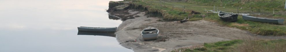
Here is a page showing eight of the drawings made by Commander Wolfe RN and Lieutenant Beechey RN while surveying Lough Ree in 1837.
Posted in Built heritage, Engineering and construction, Extant waterways, Industrial heritage, Ireland, Operations, People, Scenery, waterways, Waterways management
Tagged 1837, Admiralty, Beechey, boats, chart, Ireland, Lough Ree, Operations, Shannon, survey, waterways, Wolfe
The Limerick Leader has a story here.
Waterways Ireland tender documents are a source of interesting and occasionally useful information. At present WI is looking for tenders for
Posted in Ashore, Built heritage, Economic activities, Engineering and construction, Extant waterways, Industrial heritage, Ireland, Irish waterways general, Operations, Restoration and rebuilding, Scenery, Sources, The turf trade, Tourism, waterways, Waterways management
Tagged canal, Ireland, Operations, Royal Canal, Shannon, turf, waterways, Waterways Ireland, weir
The Anglo-Celt reports that Ballyconnell, Co Cavan, is to have a new “inner relief road” (a cure for indigestion?). The road will cross the Junction Canal (Shannon–Erne Waterway), or Woodford Canal as the newspaper calls it, on “an expansive new bridge”:
The bridge has to allow enough clearance for boating traffic on the canal. The new road will come out past the Old Ennis Mill location and just before the Quinn cement plant.
The work is to be finished by August 2012. The Waterways Ireland website has, as yet, no information about any interruption to navigation during construction.
Posted in Ashore, Economic activities, Engineering and construction, Extant waterways, Ireland, Irish waterways general, Non-waterway, Waterways management
Tagged Ballinamore and Ballyconnell Canal, Ballyconnell, boats, bridge, canal, Erne, Ireland, Junction Canal, Operations, Shannon, Shannon-Erne Waterway, Waterways Ireland
… just some of the things you can see from the Killimer to Tarbert ferry.
Actually, I lied about the weirs, but they were there once. As were the salmon.
Posted in Ashore, Built heritage, Charles Wye Williams, Economic activities, Engineering and construction, Extant waterways, Industrial heritage, Ireland, Irish inland waterways vessels, Irish waterways general, Natural heritage, Non-waterway, Operations, Scenery, shannon estuary, Sources, Steamers, The cattle trade, The fishing trade, The turf trade, Tourism, waterways, Waterways management, Weather
Tagged battery, boats, Clare, Endesa, ESB, estuary, ferry, flow, fort, Ireland, jetties, Kerry, Kilkerin, Killaloe, Killimer, Kilrush, lighthouse, Limerick, Napoleon, Operations, power station, quay, redoubt, Shannon, Tarbert, Tarbert Race, Tarbert Roads, vessels, waterways, weir, workboat

