Tag Archives: waterways

Polluting the water

Mr Hogan said he had been negotiating with the European Commission in 2011 and 2012 to minimise the impact of new septic tank regulations.

That’s from this article in the Irish Times.

Why does this chap want to minimise the impact of his own department’s regulations? Is he not at all interested in water quality?

Angela, would you mind invading please?


Shannon 1 design

If you don’t like hanging around airports, Shannon offers you a choice: you can go and look at the estuary instead, which is much more interesting.

Shannon Foynes Port Company workboat Shannon 1 passing Shannon Airport; Ringmoylan Pier in the background

Shannon 1, the successor to Curraghgour II, is a Damen MultiCat.

Shannon Foynes Port Company has updated its website.


Royal Canal: speed of lock operation

From Robert Mallett MRIA, MSCEI “On certain improved Methods of constructing Valves or Sluices, as applied to Canal and Dock Gates, &c, and similar Works of Hydraulic Engineering” in The Architectural Magazine 1837.


A target for WI to aim for?

Sunset on the Lower Shannon

A poem by Sir Aubrey de Vere, father of the more famous Aubrey Thomas de Vere. The family estates were at Curraghchase, now a forest park, on the south side of the Shannon estuary and now best known as the home of Caroline Rigney, producer of some of Ireland’s best bacon. Sir Aubrey’s wife was one Mary Rice, of the Mount Trenchard family, one of whose members had a major role in the development of the Shannon in the 1840s.

Sunset on the Lower Shannon

How beautiful the tints of closing even!
The dark blue hills, the crimson glow of heaven,
The shadows purpling o’er the wat’ry scene,
Now streaked with gold — now tinged with tender green;
And yon bright path that burns along the deep,
Ere the sun sinks behind his western steep,
Soft fades the parting glory through the sky,
Commingling with the cool aerial dye;
While every cloud still kindling in the beam,
In mirrored beauty prints the waveless stream,
Light barques, with dusky sails, scarce seen to glide,
Bend their brown shadows o’er the glowing tide;
And hark! at intervals the sound of oars
Comes, faint from distance, to the silent shores,
Blent with the plaintive cadence of the song
Of boatmen, chanting as they drift along.
But see the radiant orb now sinks apace —
Gradual and slow, he stoops his glorious face;
And now — but half his swelling disk appears —
And now, how quickly gone! he scarcely rears
One burning point above the mountain’s head —
And now, the last expiring beam has fled.

Sir Aubrey de Vere in The Dublin Penny Journal Vol 1 No 17
October 20 1832

The “light barques” probably included some turf boats.

There are more poems by Sir Aubrey here.

Waterways salaries

There is a complete list of officers’ salaries here.


Prothero on the lakes of Galway and Mayo

The oarsman F E Prothero did not reach the west of Ireland, so his account of the lakes of Galway and Mayo is based on guidebooks. Here it is.

DCAL, DAHG and WI

I was interested to see that DCAL has its own research programme [DOC file], but also makes use of other research services including the NI Continuous Household Survey:

To monitor engagement in culture and sport in Northern Ireland

The Continuous Household Survey (CHS) and the Young People Behaviour and Attitudes Survey (YPBAS) will continue to monitor engagement in sport, arts, museums and libraries in Northern Irelandfor adults and children. The CHS will also capture engagement by people in Northern Irelandat fisheries and waterways under DCAL’s control as well as engagement in Irish and Ulster-Scots languages and events. The barriers and benefits to engagement will also be explored.

DCAL and non-navigaBLE Waterways

I don’t know whether “waterways under DCAL’s control” are deemed to include those managed by Waterways Ireland as well as those directly controlled by DCAL:

The Department also has ownership of, and custodial responsibility for, those remaining sections of the Lagan and Coalisland Canals that remain in Government ownership following abandonment of navigation in the 1950s. An ongoing programme is in place for each of these highly popular towpaths to upgrade access for pedestrians, cyclists and disabled access.

I don’t suppose it would make much sense to ask questions about just two derelict waterways while ignoring those that are navigable, but the results are not shown on the CHS web pages: interested folk must ask DCAL direct.

I note that the DCAL Resource Accounts for the year ended 31 March 2011 [PDF] show that DCAL “Estimates provided for expenditure on […] certain inland waterways (including payments to the Rivers Agency), Waterways Ireland, […].” Later, we read:

Inland Waterways

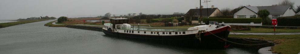
DCAL manages and maintains 11 miles of the Lagan Towpath from Stranmillis to  Sprucefield; 3.5 miles of towpath at Soldierstown, Aghalee; 4.5 miles of towpath on the  Coalisland Canal; 22 water recreation sites; and shooting rights over the foreshore of Lough Erne. Work on the development of a policy on the re-opening of abandoned canals is in the preliminary stages.

Given that DCAL can own and run waterways, I wonder why the supporters of the Newry Canal did not seek to have it taken over by DCAL rather than by Waterways Ireland.

Water recreation

The non-navigable waterways are the second of DCAL’s three main activities. The first is this:

We are committed to developing the recreational potential of inland waterways through our Province-wide Water Recreation Programme.

Applicants, such as Local Authorities, are encouraged to work in partnership with the Department in providing and promoting water recreation facilities such as riverside paths and boat moorings for public use. Wherever practicable, works will incorporate disabled access facilities.

Again, the DCAL Resource Accounts for the year ended 31 March 2011 [PDF] provide more details:

Inland Waterways

[…] The Department continued to administer an annual Water Recreation Programme, amounting to £430k in 2010-11, aimed at developing the recreation and navigational potential of Northern Ireland’s Inland Waterways. Applicant organisations, primarily local authorities, were encouraged to work in partnership with the Department in the provision of water recreation facilities, such as riverside paths and canoe trails, complementing the Department’s continued commitment to upgrading the Lagan and Coalisland Canal towpaths for shared pedestrian and cyclist use. 9 new projects were completed during 2010-11. Funded projects were required to have an identifiable strategic value and where possible, contribute to the Department’s commitment to provide at least 5 kilometres of new or improved access for disabled persons each year.

This too would cover cooperation with the four local authorities who control the Newry Canal.

Oddly enough, inland waterways and fisheries are grouped together on DCAL’s website but they are in two separate divisions: waterways, for some reason, are in Culture whereas inland fisheries come under Sport, Museums and Recreation. DCAL does not, however, put waterways under southnorthery.

DCAL and DAHG

There is a useful contrast here with DAHG, which thinks that waterways exist purely to serve northsouthery: despite what WI thinks it is for

Waterways Ireland has responsibility for the management, maintenance, development and restoration of inland navigable waterways principally for recreational purposes.

… DAHG does not appear to have adopted the view that waterways are for recreation. Perhaps if it gained responsibility for some waterways outside WI’s scope, it would develop a policy on recreational use of waterways. That would mean that, like DCAL

The Department is also the sponsor department in Northern Ireland for Waterways Ireland which is the Cross-Border Body responsible for the management, maintenance, development and restoration of operational waterways throughout the island of Ireland.

… DAHG would be the department responsible for recreation on waterways, one (large) set of which are managed by WI, which in turn is controlled by the two departments.

The difficulty with DAHG’s current arrangements is that there is a division between theory and reality, but DAHG has organised its functions on the basis of theory. In reality, waterways are for recreation (or, if you prefer, leisure), but DAHG insists that they’re for northsouthery. Because that’s now been successfully routinised, waterways receive relatively little attention and are not, as far as I can see, considered as part of state provision for leisure or recreation. There can be no proper policy-making for the sector unless it’s grounded in reality.

More on WI’s non-houseboat policy

A year ago, in March 2011, I wrote about Waterways Ireland’s attempt to reorganise the liveaboard boats on the Grand Canal at Sallins. That attempt ultimately failed, and WI’s provision of houseboat moorings at Shannon Harbour was likewise unsuccessful: usually reliable sources tell me that two spaces have been allocated, but to non-residential boats.

Amongst the concentrations of boats parked on the Grand Canal (most of them disregarding the five-day rule), the proportions of residential boats are [I think: I know of no reliable statistics] higher at Hazelhatch and Sallins, both at the eastern end, rather lower at Lowtown and lowest at Tullamore and Shannon Harbour.

It seems that WI’s focus has shifted away from the residential boats, which it tried to tackle last year, to the non-residential boats: it has recently issued Marine Notices warning that the five-day rule will be enforced at hard-edged [ie the best] moorings on Tullamore’s “spur line” and between the 35th Lock and Griffith Bridge at Shannon Harbour. However, no notices have so far been issued about Lowtown, Sallins or Hazelhatch.

I think WI is right to separate the residential issue from the parking, but it will be interesting to see what is planned for the eastern end of the canal.

Incidentally, all of this smacks of Kremlinology, trying to deduce policy positions from minor clues, and is necessarily speculative. It would be really nice if WI published policy proposals on its website, invited comments and then formally promulgated the final policies.


DCAL disclosures

You will be pleased to learn that, on 28 May 2010, Arthur Scott (Director of the Culture Division) and Rosalie Flanagan (Permanent Secretary) of the Department of Culture, Arts and Leisure each received from Waterways Ireland a waterways mug and a book on the Royal Canal, total value £20 each. Later in the year, however, Rosalie Flanagan declined an invitation, estimated to be worth £8, to the opening of the Royal Canal on 1 October 2010.

Mrs Flanagan and husband are members of the Belfast Boat Club but do not hold any position on the Club’s Committees or Council. Orla Bateson, Head of DCAL’s Research & Statistics Branch, is a committee member of Intercity Paddlers, a Belfast canoe club.


A waterway for everyone in the audience

My attention has been drawn to this Dáil written question by Joan Burton TD (Dublin West, Labour) and the answer by Éamon Ó Cuív TD (Minister, Department of Community, Rural and Gaeltacht Affairs; Galway West, Fianna Fail).

The layout on the kildarestreet site is not perfect, so I reproduce some of the list here:

The following are the details requested by the Deputy in respect of non-navigable stretches of canals that are within the control of Waterways Ireland and are being or could be restored:

Grand Canal

  • Kilbeggan Branch (8.2 miles long) in Co. Offaly and Co. Westmeath
  • Part of Naas & Corbally Branch (Corbally Extension) (4.4 miles long) in Co. Kildare
  • Barrow Line Part of Mountmellick Branch (0.25 miles long) in Co. Kildare (remaining 11 miles filled in).

Royal Canal

  • Part of Royal Canal (11 miles long) in Co. Longford, currently under restoration
  • Longford Branch (3 miles long) in Co. Longford.

The Royal Canal main line is currently under restoration and the remaining work necessary to return it to full navigation between Dublin and the Shannon is due for completion in 2010.

Ulster Canal

  • 46 miles long in Co. Cavan, Co. Monaghan, Co. Fermanagh and Co. Armagh.

Approval has been given to Waterways Ireland to restore the stretch between Lough Erne and Clones. Present indications are that this stretch could be re-opened by 2013.

And (perhaps because the economy was so successful) we could have waterways everywhere:

It is intended, subject to availability of resources, to carry out feasibility studies and preliminary designs in relation to the Longford Branch, the Kilbeggan Branch and the Corbally Extension, along with extensions to Annagh Upper near Dowra on the Shannon Navigation and to Lough Oughter on the Erne System with a view to possible re-opening. Consideration will also be given to the carrying out of preliminary analysis and assessment of the Mountmellick Branch, as well as the Boyne Navigation (which is primarily a river navigation) and the extension towards Mohill on the Rinn River, as future possibilities for restoration.

“The Irish economy entered severe recession in 2008,” according to Wikipedia’s useful summary of the financial crisis, but Craggy Island (nach maireann, comme on dit) still hoped to drag Ireland into the Canal Age.