Tag Archives: boats

The Royal under the Railway

A new, short book, on aspects of the history of the Royal Canal, published by the Railway and Canal Historical Society, will be launched at the Clinker Lecture on 18 October 2014. The title is The Royal under the Railway: Ireland’s Royal Canal 1830–1899 and it covers a number of topics, mostly about the canal after it was bought by the Midland Great Western Railway. From the Introduction:

The accounts of the Midland Great Western Railway for the half year ending 31 December 1849, four years after it bought the Royal Canal, showed its gross income from the railway as £23,773 and its income from the canal as £7,677, roughly a quarter of the total. By 1899, though, income from the railway was £264,393 and that from the canal £2,220, less than one per cent of the total. The Royal Canal, never particularly successful, had declined into utter irrelevance.

It may seem perverse, therefore, to offer even a short book on the canal’s history in that period, especially as there exist two full histories, by Peter Clarke and by Ruth Delany (with Ian Bath in the most recent edition). This, though, is not a full history, even of the limited period, roughly 1830–1899, from just before the railway took over until the end of the nineteenth century. This is rather a complement to those histories, providing just enough background information to  enable the book to stand alone while covering some new topics and providing new or extra information on others. The topics include:

  • the 120-foot steam-powered narrowboat
  • the Midland Great Western Railway’s early attempts at running canal boats
  • the ingenious Mr Mallet’s moveable bridge
  • the whore who held the mortgage on the canal
  • the competition between the roads of Roscommon and the Royal Canal
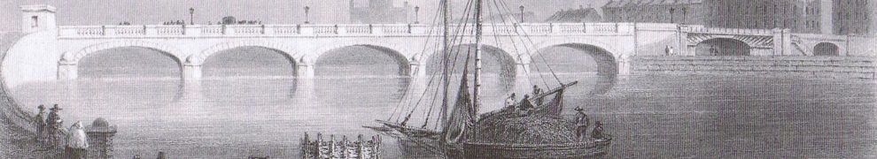
  • the reconstruction of Dublin bridges over the canal
  • the horses who slept on board their boat.

[…] this book is not intended to be the last word on any of those topics. I hope that it might encourage others – those researching local, family, social, industrial, transport, economic or technological history – to record and transmit anything they might learn about the history of the Royal Canal. To take just three topics, we know very little about canal employees, the operations of canal traders or the management of the horse-drawn canal boats. On any one of those, useful information could just as easily be found by a local or family historian as by a canal specialist.


Steam, the Shannon and the Great British Breakfast

That is the title of the Railway and Canal Historical Society‘s 2014 Clinker Memorial Lecture, to be held at the Birmingham and Midland Institute, Margaret Street, Birmingham B3 3BS, at 1415 on Saturday 18 October 2014.

The lecture will concentrate on the period before 1850 with such interesting topics as

  • Shannon steamers
  • the Grand and Royal Canals
  • the first Irish turf (peat) to reach the USA (possibly)
  • port developments in Dublin, Limerick and Kingstonw
  • the Dublin and Kingstown Ship Canal
  • the Midland Great Western Railway
  • what “cattle class” really means
  • bacon and eggs.

Admission is free and booking is not required. However, if you plan to attend, it would be helpful if you could e-mail […] to this effect.

The Clinker Memorial Lecture is named for Charles R Clinker, an eminent railway authoe and one-time historian of the Great Western Railway, who died in 1983.

If you would like the contact email address, leave a Comment below and I’ll get in touch with you direct.


Shannon traffic figures to July 2014

I am grateful to Waterways Ireland for letting me have the Shannon traffic figures for July 2014. All the usual caveats apply:

  • the underlying figures do not record total waterways usage (even for the Shannon) as, for instance, sailing, fishing or waterskiing on lakes or river stretches, which did not involve a passage through a lock or Portumna Bridge, would not be recorded
  • the passage records would not show, for instance, a change in the balance of types of activities from those in larger cruising boats to those in smaller (sailing, fishing, waterskiing) boats
  • figures like these, for a small number of months, will not necessarily be representative of those for the year as a whole. The winter months, January to March, see little traffic in any year; for April, May and June, the weather can have a large influence on the amount of activity especially, I suspect, in private boats.

On the other hand, the figures do include the Shannon’s most significant tourism activity, the cruiser hire business. And they are our only consistent long-term indicator of usage of the inland waterways.

Shannon all boats Jan to Jul 2014

Total (private + hired) traffic for the first seven months of each year

Traffic in 2013 was up a bit on 2012; 2014 is down slightly below the 2012 level. It’s the lowest seven-month figure in the series (ie since 2003), which is a bit of a surprise: I thought that the good weather would encourage more boating.

The changes are small, so their importance must not be exaggerated, but they’re not cause for celebration. Let’s see whether the drop was amongst private or hired boats (or both).

Shannon private boats Jan to Jul 2014

Private-boat traffic for the first seven months of each year

Private traffic is up a bit on 2012 but down on 2013.

Shannon hired boats Jan to Jul 2014

Hire-boat traffic for the first seven months of each year

Hire-boat traffic is down on both previous years, but the pace of decline seems to have slowed.

Shannon private and hired -v- 2003 Jan to Jul 2014

Changes since 2003: private and hired boats

Hire-boat traffic seems to be levelling off at 40% of its 2003 figure: a massive loss of business. I do not know whether anyone is trying to, or could, recover that amount of business. I am not aware of any new Shannon-based tourism business that could compensate for the losses in the cruising (hire-boat) business, but I would be glad to hear from anyone who knows of such projects. Something with high growth potential is required.

Private traffic is wobbling either side of its 2003 figure: the increases during the Celtic Tiger years have been lost.

Shannon private -v- hired boats Jan to Jul 2014

Still roughly 50/50

In the year to July 2014, hire-boat traffic was just above private traffic, but there is very little in it. Private traffic is now comparatively more important to Waterways Ireland [which may be why it is now trying to establish its economic importance] but it does not bring in much money from outside the two jurisdictions, so the case for public spending on waterways becomes much weaker.

And, quite clearly, opening more waterways doesn’t work: as this chart showed last month, the branches off the main lines of the Shannon, Erne and SEW are little used. The Lough Allen Canal, the Suck and the navigation to Limerick are very little used and I see no sign that the reopened Royal Canal has attracted many visitors to Ireland. What is needed is more intensive usage of the main waterways, not further dilution by the opening of more branches [to Clones or anywhere else].

SnnNav JanJun 6

High and low usage

Finally, I thought it might be interesting to see whether the monthly pattern of usage has changed since 2003. To avoid an over-cluttered chart, I included only four years: 2003, 2003 +5, 2003 + 10 and 2014. The chart is for all boats, private and hired.

Shannon all boats by month selected years Jan to Jul 2014

Monthly traffic, selected years

The season seems to have got going earlier in 2003 and even in 2008. Was the weather better in those years?


Sliabh Aughty Furnace Festival

I don’t know how many people are aware that there were once extensive ironworks [which used water transport] along the lower western shore of Lough Derg and in the foothills of Sliabh Aughty. The existence of a townland called Furnace, near Whitegate, might be a clue, I suppose. Ger Madden had an article on “The Iron Works of Sliabh Aughty” in Sliabh Aughty: East Clare Heritage Journal No 7 [1997]; he told me the other day that the works burned an acre of oak every day during the season. That bears out what J H Andrews said in “Notes on the Historical Geography of the Irish Iron Industry” [Irish Geography: bulletin of the Geographical Society of Ireland Vol III No 3 1956]:

[…] the Irish woods were exploited [for charcoal] with an extravagant disregard for the future supply position, although at first the conversion of woodland to permanent pasture could have been justified in many cases as a rational long-term economic decision. […] [Cpppicing was] never adopted in Ireland, even by such enlightened land owners as Sir William Petty, so that even a small forge or furnace could despoil its woods at an alarming rate.

Ger and others in Mountshannon have now organised the Sliabh Aughty Furnace Festival, to be held in Mountshannon on 20 and 21 September 2013. The leaflet says:

In the 17th and 18th century, the western shores of Lough Derg were the setting for an intensive iron industry. Although little known, it has left many traces in the landscape and various archives.

The Sliabh Aughty Furnace Project is hoping to safeguard these monuments for the future, research the history and develop the story as a touristic attraction. […]

The festival caters both for those with a deep interest in the subject and for those who might like a lighter approach. For the first group, there is a series of talks in the Mountshannon Hotel, running from 1030 to 1630 (with an hour for lunch):

1030 Paul Rondelez “Iron production in the Sliabh Aughty mountains”
1100 Mary Sleeman “Heritage and the law”
1200 Gerard Madden “The Emmerton Papers” [an archive with valuable
information about the Clare ironworks]
1230 Professor Audrey Horning “Archaeology and early industry in Ireland and
the Americas” [yes, there is a direct link]
1400 Dr Colin Rynne “Industry on the Shannon”
1430 Dr Christy Cuniffe “An elusive foundry in the Slieve Aughty foothills: the
work of T Clarke”
1530 Sean Spellissy “Expanding on Slieve Aughty”
1600 Ewelina Rondelez “The Sliabh Aughty Furnace Project”

The Aistear Iniscealtra Park [the maze] will have events including blacksmithing, charcoal production, a living history tent, sword-fighting demonstrations, 17th century games, a knitting demonstration, an exhibition on the ironworks, stalls with local produce and a barbecue.

All of that for €10 (adult rate; under-16s €5, toddlers free).

On the Sunday there is a guided tour of the remaining furnaces, leaving the harbour at 10.30am: free if you use your own transport, €20 by bus.

There is a website here with full details including information about accommodation in the area.


Waterways Ireland news

Lots of info pouring from Waterways Ireland at the moment: July Shannon traffic stats, which will take me some time to analyse, serviced moorings in Sallins, digital navigation thingies for the Erne and Lower Bann and an online survey.

Here’s the press release for navigation thingies. I’ll cover the online survey in a separate message.

Waterways Ireland Pilots Digital Navigation Guides to the Inland Waterways

Waterways Ireland has developed an Online Navigation Guide for the Lower Bann for use on computers, tablets and mobile phones. In a major step change in the presentation of navigation guides for Ireland’s Inland Waterways, Waterways Ireland has, in consultation with user groups, developed, tested and now launched, pilot Online Navigation Guides, designed to provide a convenient alternative to printed navigation guides.

The online guide to navigation has been developed internally within Waterways Ireland using ArcGIS online. This interactive web mapping application details navigation features such as Locks, Moorings, Weirs, Navigation Markers and other facilities along the waterway. These data layers are then overlaid using ArcGIS online web maps. GPS surveys or digitising onscreen using Ordnance Survey Maps have been used to capture the location of features. The application enables the public to pan around the map, identify features, print maps, switch between base mapping & satellite view and switch on and off layers. The Lower Bann Guide is complete and available for free on our website and can be viewed on a PC, Tablet or Smartphone.

Waterways Ireland will update the maps on an ongoing basis so that the latest navigational information is always available online. Ongoing feedback is welcomed from users to keep the mapping information accurate.

With both the Lower Bann and the Erne System Navigation Guides presently available online, Waterways Ireland is commencing work with user groups on the Shannon and will subsequently cover the remaining waterways.

The maps are available on www.waterwaysireland.org by choosing the waterway and then selected the map tab. To directly access the Lower Bann & Lough Erne Online Navigation Guides, click [this] .

In the initial pilot period, broadband access or a wifi link will be required to use the online navigation guides for the Lower Bann and Erne Systems. Progress is being made on an offline/cached version which will be made available as soon as possible.
It is also planned that the next phase of the Online Navigation Guides will have additional layers of information for waterway & waterside recreational and tourism activity which the user can turn on and off.

In this transition period Waterways Ireland continues to offer a paper product to Waterway users. A comprehensive navigation guide for the Erne System, Shannon-Erne Waterway and Shannon Navigation is for sale at www.shopwaterwaysireland.org for €15/£12.60 and the Lower Bann Guide is also available.


Mayo’s canal system

No, not the Belmullet Canal, nor the Cong Canal. James McParlan MD, in his Statistical Survey of the County of Mayo, with observations on the means of improvement; drawn up in the year 1801, for the consideration, and under the direction of The Dublin Society [printed by Graisberry and Campbell, Dublin in 1802 and available here courtesy of Messrs Google], after mentioning some lakes and navigable rivers, said:

Those are the only navigations or navigable rivers in this county, except the Marquis of Sligo‘s canal, which winds for several miles through his demesne; it serves for conveying sea and other manures to different parts of the demesne, for conveying among the fields turnips and green feeding, and for several purposes.

I have looked on the OSI 6″ maps [~1840] at the Browne estates listed on the Landed Estates Database, but I have found no sign of the canals. I didn’t know where to look, and the good marquis owned a lot of land, so I may have missed something; furthermore almost forty years elapsed between McParlan’s work and the publication of the OSI maps and the canals may have fallen out of use in that period. If anyone knows where they were, and whether any trace remains, I would be grateful for information.


Did you know …

… that Pollboy Lock, on the River Suck, can be filled in one minute and fifty-eight seconds?

Pollboy

Pollboy

Ballinasloe footbridge

Here is a new page with a brief account of the Ballinasloe Line of the Grand Canal and some photos of a footbridge that seems to have been built across it in the twentieth century.

Loos change as TippCoCo hopes to swipe the loot

Er … sorry about the outbreak of headlineitis: it’s corresponding with journalists that does it.

The Tipperary Star reports (on paper, not on its website) that Tipperary County Council intends to issue “swipe cards for boating facilities along Lough Derg”. Michael Hayes, the engineer for Nenagh Municipal District Council, said that the cards were sold along the Shannon but that the revenue went to Waterways Ireland whereas the council bore all the costs. He is quoted as saying that “We are pursuing it to have them pay some of the costs”: another threat to WI’s budget.

Councillor Phyll Bugler said that it was “not acceptable” that shower and toilet blocks closed early, although she is not reported to have commented on the cost of having staff to clean the blocks late at night.

I suspect that Waterways Ireland’s income from the smart cards is minimal.


Saving canals

Barrow Line 20140721 03_resize

Barrow Line 1

Barrow Line 20140721 06_resize

Barrow Line 2

Barrow Line 20140721 08_resize

Barrow Line 3

Barrow Line 20140721 09_resize

Barrow Line 4

When I get a moment, I must find out how many boats have been down that way in this warm, sunny July, the peak of the holiday season. The warmth will have encouraged the vegetation, but I suspect relatively few boats have been through. And only two boats entered the Royal through Dublin in July, even though two openings were offered.

Apart from giving artistic verisimilitude to an otherwise bald and unconvincing narrative about the value of the canal tourist industry and the abiding love of boaters for the canal, using canals helps to keep the weed down.