Tag Archives: weir

The Shannon in winter

Downriver from Shannon Harbour to Dromineer in December 2014. It began as a bright, cold morning.

Shannon Harbour to Dromineer December 2014 01_resize

Leaving Shannon Harbour after icebreaking between the locks

Shannon Harbour to Dromineer December 2014 02_resize

Flooding to the south-east

Shannon Harbour to Dromineer December 2014 03_resize

But southward, look …

Shannon Harbour to Dromineer December 2014 06_resize

The Brosna

Shannon Harbour to Dromineer December 2014 73_resize

Heading for Banagher Bridge 1

Shannon Harbour to Dromineer December 2014 75_resize

Keeping close to the pontoons

Shannon Harbour to Dromineer December 2014 98_resize

Heading for Banagher Bridge 2

Shannon Harbour to Dromineer December 2014 103_resize

Heading for Banagher Bridge 3

There is a YouTube video of the shooting of the bridge here. It seems to start automatically, including sound; I don’t know how to avoid that.

Shannon Harbour to Dromineer December 2014 107_resize

Looking back at Banagher

Shannon Harbour to Dromineer December 2014 116_resize

Colours

Shannon Harbour to Dromineer December 2014 124_resize

Invernisk

Shannon Harbour to Dromineer December 2014 129_resize

Shannon Grove

Shannon Harbour to Dromineer December 2014 134_resize

Current

Shannon Harbour to Dromineer December 2014 140_resize

Scarpering heron

Shannon Harbour to Dromineer December 2014 146_resize

Colours

Shannon Harbour to Dromineer December 2014 149_resize

Marker and gauge

Shannon Harbour to Dromineer December 2014 151_resize

House

Shannon Harbour to Dromineer December 2014 169_resize

Boats at Meelick

Shannon Harbour to Dromineer December 2014 170_resize

Meelick weir

Shannon Harbour to Dromineer December 2014 174_resize

East bank

Shannon Harbour to Dromineer December 2014 176_resize

Protective boom

Shannon Harbour to Dromineer December 2014 181_resize

Sluices

Shannon Harbour to Dromineer December 2014 198_resize

Through Meelick Lock

Shannon Harbour to Dromineer December 2014 205_resize

One bird

Shannon Harbour to Dromineer December 2014 213_resize

Many birds

Shannon Harbour to Dromineer December 2014 221_resize

Reeds

Shannon Harbour to Dromineer December 2014 226_resize

Architecture

Shannon Harbour to Dromineer December 2014 228_resize

Munster Harbour

Shannon Harbour to Dromineer December 2014 233_resize

Delaying Eamon Egan

Shannon Harbour to Dromineer December 2014 235_resize

Gateway to civilisation

Shannon Harbour to Dromineer December 2014 237_resize

Connacht Harbour

Shannon Harbour to Dromineer December 2014 239_resize

Lough Derg: weather has changed

Shannon Harbour to Dromineer December 2014 243_resize

Journey’s end, Dromineer


A little rain goes a long way

Here are some water level readings from Athlone Weir. I’ve taken them from the OPW’s very useful water levels site, where you can monitor levels from the comfort of your own armchair. [If only there were a gauge at Killaloe ….]

At Athlone, staff gauge zero is 35.360m above Poolbeg datum (from 18 Oct 2003). I chopped the bottoms off the first two graphs. The first one shows the level for 35 days to 30 September 2014; I presume that the level of Lough Ree was being reduced to enable it to hold some of the autumn’s rainfall.

Athlone Weir 20140930

Athlone Weir 35 days to 30 September 2014 (truncated)

Here’s the graph for the 35 days to 15 October 2014.

Athlone Weir 20141015

Athlone Weir 35 days to 15 October 2014 (truncated)

Then, in October, the level began to rise again. By 30 October, it was back to about 2.1 metres, roughly the starting point on the first of the graphs above.

Athlone Weir 20141030

Athlone Weir 35 days ro 30 October 2014

And since then it has continued to rise.

Athlone Weir 20141117

Athlone Weir 35 days to 17 November 2014

Met Éireann’s weather summary for October 2014 [PDF] has this chart:

Met Eireann weather Oct 2014

Met Éireann rainfall October 2014

It says:

Rainfall: wet conditions nearly everywhere

Monthly rainfall totals were above-average nearly everywhere with the exception of stations in coastal areas in the Northwest and West and in parts of the Midlands. Percentage of Long-Term Average (LTA) values ranged from 81% at Gurteen to 161% at Johnstown Castle, which recorded it wettest October since 2002.

Fermoy (Moore Park) reported 135% of its LTA with 153.6 mm and its wettest October in 10 years. The wettest days were mainly the 3rd, 5th and 28th, with the month’s highest daily rainfall reported on the 5th at Cork Airport with 38.6 mm, its wettest October day in five years. Mullingar reported its wettest October day in 12 years on the 28th with 26.4 mm. The number of wet days (days with 1 mm or more rainfall) ranged from 12 at Casement Aerodrome to 24 at Valentia Observatory and Claremorris, with Claremorris reporting its highest number of October wet days since 1973.

Use of the OPW charts is licensed under Directive 2003/98/EC [PDF] of the European Parliament and of the Council on the re-use of public sector information. Met Éireann allows use of “the web pages, and the information contained within them, for private and non-commercial purposes, for teaching, and for research […] is allowed subject to the condition that the source of the information is always credited in connection with its use”.


Royal Canal water supply

On 26 November 2012 I noted that

The Royal Canal water supply applications have been approved by An Bord Pleanala. There were two separate applications […] but they were in effect treated as one.

There were conditions attached, but I concluded that

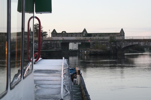
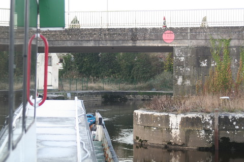
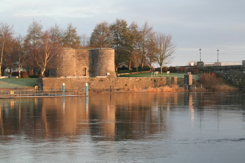
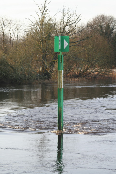
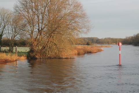
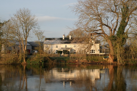
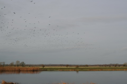
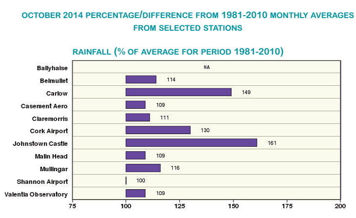
If I remember correctly, the amount of water available from Lough Ennell will not always provide enough (eg in a dry season) to keep the canal full. Still, this is a significant advance for Waterways Ireland and for Royal Canal enthusiasts.

So here we are, almost two years later, and the work of providing a supply from Lough Ennell to the Royal Canal, reckoned to be about a five-month job, has doubtless been long completed, no?

No.

The work has not yet started and Waterways Ireland will be lucky if it gets done within the next year.

As I understand it — and if, Gentle Reader, you have more information, do please leave a Comment below (your name can be kept out of public view if you like) — there are three sources of delay:

  • first, I understand that there is a technical issue about one of the conditions attached to the approval; it is felt that the condition is unworkable, but that getting it changed might take some time. I presume it’s one of the conditions 2(a) to 2(d) that I quoted two years ago and, looking at the proposed orders published in the press [PDF], I suspect it might be the requirement to maintain the lake level at or above 79.325 mOD Malin Datum. However, I don’t really know
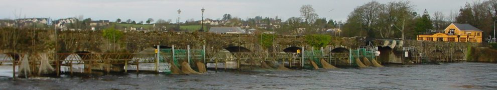
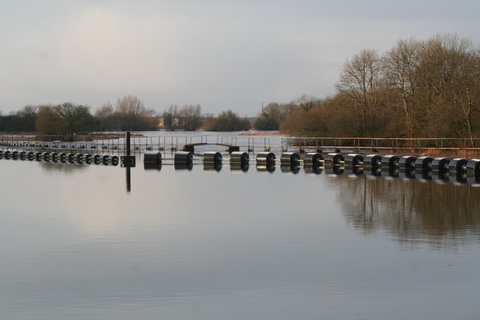
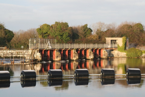
  • second, Waterways Ireland took over Clonsingle Weir, at the outlet from Lough Ennell, by Compulsory Purchase. Owners of mills, who generate electricity from the Brosna, have submitted claims for compensation. I understand that an arbitration hearing, lasting four days, is scheduled to be help in May 2015
  • third, responsibility for the scheme has moved from Westmeath County Council to Irish Water. Which may have other things on its mind.

Irish Water has published its proposed Capital Investment Programme [PDF] but Appendix 1, the Investment Plan Project Summary, is in a separate file [PDF]. Category B is headed Review Scope and Commence Construction and it includes

Mullingar Regional Water Supply Scheme (G) … Lough Ennell Abstraction.

I can’t work out what “(G)” means. A few items are so marked; a few others are marked “(H)”; most items have neither.

The Capital Investment Programme [CIP] document says:

 The CIP is dominated by contractual commitments entered into previously by Local Authorities, and which have now transitioned to Irish Water. In the 2014-2016 period, Irish Water will fund these contracts to completion and bring forward programmes and prioritised projects to commence. At the same time, it will progress a large portfolio of projects that are at the planning and design stage, reviewing their scope, budgets and, where appropriate, timing to favour maximising the performance of the existing assets through intensified capital maintenance that might allow deferral of major capital investment.

Emphasis mine. So that raises the possibility that Irish Water will decide not to fund the abstraction scheme but will rather opt to pay for continued pumping.

It is, of course, quite possible that I have misunderstood these difficult matters, so I will be glad to hear from anyone with better information.

Incidentally, reviewing Irish Water’s documents suggests to me that there are people there who know what they are doing and who have the expertise to manage large and complex operations. That differentiates them from the politicians in government and opposition, few of whom (as far as I can see) have any experience of running anything more complex than a parish social.


The monsoon is coming …

… perhaps. The water depth at Banagher has stayed at around 2.1 metres but that at Athlone has gone down to about 2.0 metres. Are TPTB lowering Lough Ree so that it can store the water from the autumnal rains? Information welcome.

Thump it on the thirteenth

Here is a screenshot from the OPW’s online waterlevel gauge for Athlone Weir. It shows the levels for the past 35 days. In recent days the waterlevel website has ceased to show the names or locations of the gauges, but 26333 is Athlone Weir.

Athlone waterlevel: 35 days to 14 February 2014

Athlone waterlevel: 35 days to 14 February 2014

Note the odd discontinuities: the level jumped up on 13 February and fell back on 13 February. Does the gauge get stuck every so often and have to be thumped to free it?

I do not know. I have reported both the discontinuities and the disappearance of the station names to the OPW.


Relieving Athlone

Parteen Villa Weir is sending large amounts of water down the original channel of the Shannon, and over the Falls of Doonass, to draw water off from the upper reaches of the river.

Castleconnell water level 20140210 264_resize

The footbridge at Castleconnell

Castleconnell water level 20140210 267_resize

Above the bridge

Castleconnell water level 20140210 269_resize

The downstream side of the bridge

Castleconnell water level 20140210 271_resize

A bumpy ride

Castleconnell water level 20140210 273_resize

At normal levels the bottom of the wall is several feet above the water


Levels below Parteen Villa have not yet reached those of 2009 and the channel can probably take more before folk get flooded.

The Old River Shannon site has some photos taken at Parteen Villa Weir.

Cutting and pasting

One of the problems with all this newfangled technology is that some things — like, for instance, copying a block of text from one document into another – are so easy that folk may forget to check their work afterwards.

Consider, for instance, the Office of Public Works, which seems to have a block of boilerplate text ready for answering written boilerplate questions from midlands TDs who have discovered that things get wet when it rains.

On 22 January 2014 Denis Naughten [Ind, Roscommon/South Leitrim, which — let it be admitted — The Lord intended to be rather boggy and sad] had this question:

To ask the Minister for Public Expenditure and Reform the steps being taken to address flood risks within the Shannon basin; and if he will make a statement on the matter.

The answer tells Mr Naughten about CFRAM — nothing he didn’t know before he asked, I imagine — but it included this sentence:

On foot of discussions between my colleague, Minister of State Hayes and the IFA, and with the cooperation of both the ESB and Waterways Ireland, a water level monitoring exercise is being carried out as part of the CFRAM process which will allow for analysis of water flows and levels at key points around the Lough Ree and Callows areas.

The highlighting is mine: it seemed a bit odd because this written answer was allegedly being given by Mr Hayes.

Mr Naughten had another Q&A here, but it’s not very interesting.


Matters of minor importance

Some recent(ish) discussions amongst the People’s Representatives. I haven’t time to analyse them all. All links courtesy of the estimable KildareStreeet.com.

Brendan Smith [FF, Cavan-Monaghan] wants a sheugh in Clones; he got the usual answer. And he allowed Jimmy Deenihan [FG, Kerry North/West Limerick] to announce, on 19 December 2013, the death of the suggested extension of the Erne navigation to Lough Oughter [loud cheers]:

Brendan Smith: To ask the Minister for Arts, Heritage and the Gaeltacht if he has received the feasibility study on the proposed extension of the Erne navigation from Belturbet to Killeshandra and Killykeen; and if he will make a statement on the matter.

Jimmy Deenihan: I am informed by Waterways Ireland that it commissioned a Strategic Environment Assessment for the possible extension of the Erne Navigation from Belturbet to Killeshandra and Killykeen.

On reviewing the environmental information from this process, Waterways Ireland considers that the environmental designations of this lake complex make the feasibility of the proposed navigation extension highly unviable. For that reason, I am advised that Waterways Ireland does not propose to pursue this project any further at this time.

Well, that’s one minor victory for sanity. Here’s how a dredger got to Lough Oughter in 1857.

Maureen O’Sullivan is anxious to recreate the economy of the eighteenth and nineteenth centuries by using canals for carrying cargoes. Especially on the Shannon–Erne Waterway, where commercial carrying was so successful before. [What is it about the Irish left?] Thank goodness that the sainted Leo Varadkar gave not an inch: someone should make that man Taoiseach, President and Minister for Finance. And Supreme Ruler of The Universe and Space.

The web-footed inhabitants of the midlands, who have discovered that they live in a flat area with rivers, keep wittering on about Shannon flooding, failing to realise that it is a message from The Lord, telling them to either (a) move to higher ground, eg Dublin, or build arks. On 15 January 2014 Brian Hayes told Denis Naughten, inter alia, that info from the recent OPW/CFRAM monitoring of water levels on Lough Ree (which I think was when the levels were lowered) would be placed on the OPW website “in the coming days”; I haven’t been able to find it yet so I’ve emailed the OPW to ask about it. And on 21 January one James Bannon said that he intends to introduce a bill setting up a Shannon authority, which will have magical powers. Well, if it doesn’t have magical powers it won’t be able to stop the Shannon flooding, but perhaps it’s designed to allow the unemployed landowners of Ireland another forum in which to demand taxpayers’ money to prop up their uneconomic activities.

Finally, a senator called John Whelan wants a longer consultation period on the proposed amendments to the canals bye-laws. I suppose I’d better read them  myself.

Levels

On 9 October 2013 minister Brian Hayes spoke in the Dáil about Shannon water levels, saying:

A meeting between the ESB, Waterways Ireland and the Office of Public Works to review the interim operating regime is due to take place shortly.

On 17 and 18 October 2013, in correspondence with Waterways Ireland, I learned that the meeting had not then taken place and that no date had been set. I have now sent WI another note asking whether the meeting has been held and, if it has, requesting a report on the proceedings and outcome.

In the meantime, I have put together two charts nicked from waterlevel.ie for Banagher and Athlone:

Athlone and Banagher water levels

Athlone and Banagher water levels

Both of them show the levels for the last 35 days. I’m sure that more data and much more sophisticated analysis would be required to reach any reliable conclusion, but my untutored impression is that, in what has been a fairly dry autumn, keeping Lough Ree low didn’t do much to keep Banagher low. If that is so, and if I’m right in thinking that this autumn was dry (see below), the outcome would not show whether lowering Lough Ree would help in a very wet season; it may be necessary to repeat the experiment next year while performing rain dances. I would be glad, though, to have comments from more erudite folk and, if I get any information from TPTB, I’ll publish it here. In the meantime, this CFRAM PDF provides background reading.

On the dryness: Met Éireann’s monthly report for September 2013 is headed “Dry everywhere; warm and dull in most places” while that for October says “Rainfall was above average except in parts of the West, Northwest and North”. Its report doesn’t, AFAIK, specify any stations in the Shannon catchment (apart from Shannon Airport), but those to the west were generally below average while whose to the east were above; it may be that the Shannon rainfall was moderate.

Lusmites rejoice

P J Norris commented here on the need for a walkway across Meelick Weir. The excellent KildareStreet.com tells us that the drought will end, as a Dáil written answer on 22 October 2013 showed.

Michael Kitt [FF, Galway East] had asked the Minister for Arts, Heritage and the Gaeltacht

… when it is proposed to reopen the walkway which spans the weir on the River Shannon in Meelick, County Galway; if funding has been provided for this work; if his attention has been drawn to the fact that this is an important local and tourist amenity; and if he will make a statement on the matter.

Jimmy Deenihan [FG, Kerry North/West Limerick] said

I am informed by Waterways Ireland that it is currently preparing a submission for planning permission to construct a new walkway over the River Shannon at Meelick. Indeed, environmental studies are underway to support the planning application.

I must advise the Deputy that construction work may only commence when all necessary permits have been received. It is Waterways Ireland’s intention to undertake works at the weir during 2014, subject to the appropriate statutory approvals being granted and financial resources being available.

Financial resources, eh? Perhaps a coin- (or note-)operated toll-gate on the walkway would be best.