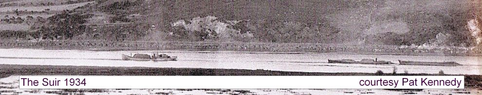
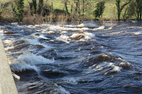
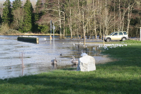
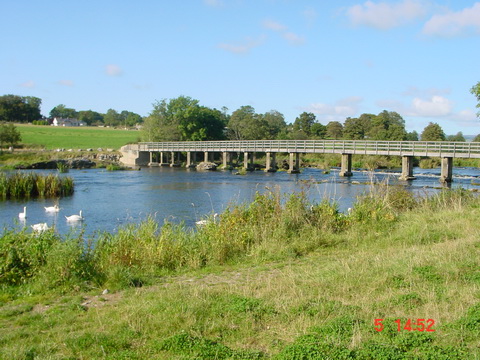
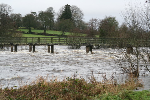
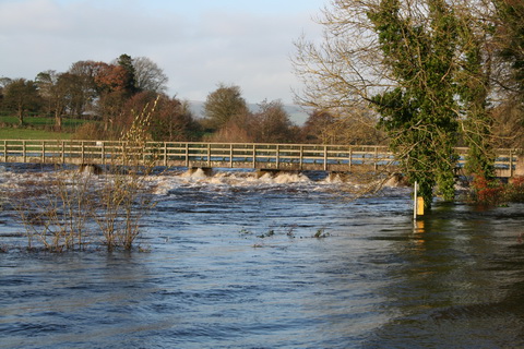
Boat-owners concerned about high water levels on Lough Derg will be glad to know that relief is in sight, although it may take a little while to arrive. Irish Water has taken over the project to send Shannon water to Dublin and is procuring something, although it is not at all clear what that is. The, er, news item is so far leading in the competition for least informative press release of the year.

-

Waterways and Means by Brian J Goggin available now -
Join 587 other subscribers
RSS links
Pages
- Waterways & past uses
- Saving the nation
- Turf and bog navigations
- The Bog of Allen from the Grand Canal in 1835
- John’s Canal, Castleconnell
- The Canal at the World’s End
- The Finnery River navigation
- The Lough Boora Feeder
- The Little Brosna
- The Lullymore canal as wasn’t
- The Roscrea canals
- The Monivea navigations
- Lacy’s Canal
- The Rockville Navigation page 1
- The Rockville Navigation page 2
- The Rockville Navigation page 3
- Rockingham
- The Colthurst canals
- The Inny navigation
- The lower Shannon
- The piers, quays and harbours of the Shannon Estuary
- Nimmo’s non-existent harbour
- The Doonbeg Ship Canal
- Querrin
- Kilrush and its sector lock
- The Killimer to Tarbert ferry
- The Colleen Bawn at Killimer
- Knock knock. Who’s there?
- Cahircon: not at all boring
- Ringmoylan
- The hidden quay of Latoon
- The stones of Kilteery
- The Maigue
- Sitting on the dock of the Beagh
- Massy’s Quay, Askeaton and the River Deel
- Saleen Pier
- The Lord Lieutenant’s Visit to Limerick — trip down the Shannon [1856]
- The Fergus
- The Limerick Navigation
- The boundaries of the Shannon
- The power of the Shannon
- The locks on the Limerick Navigation
- Plassey
- Worldsend, Castleconnell, Co Limerick
- The bridge at O’Briensbridge
- The Limerick Navigation and the Monmouthshire Canal
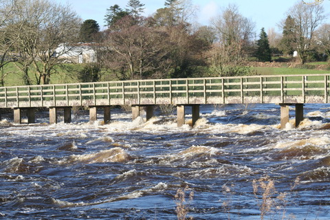
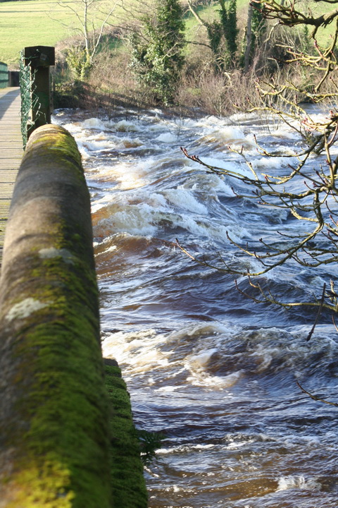
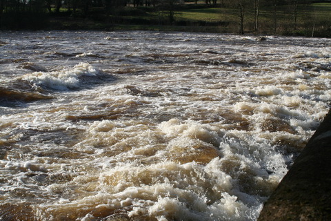
- The Limerick Navigation (upper end) in flood November 2009
- The Limerick Navigation (lower end) in flood November 2009
- The Limerick Navigation (tidal section) in flood November 2009
- Floods in Limerick (1850)
- Limerick to Athlone
- The piers, quays and harbours of the Shannon Estuary
- The middle and upper Shannon
- The Grand Canal
- Monasterevan, the Venice of the west
- The Grand Canal lottery
- Grand Canal carrying: some notes
- The dry dock at Sallins
- The Naas Branch
- The Mountmellick Line of the Grand Canal
- Dublin to Ballinasloe by canal
- The Ballinasloe Line
- A Grand Canal lock: Belmont
- South of Moscow, north of Geneva
- Water supply to the Grand Canal
- The Grand Canal Company strike of 1890
- The Royal Canal
- Water supply to the Royal Canal: the feeders
- The Lough Owel feeder
- The proposed Lough Ennell water supply to the Royal Canal
- From Clonsilla to Clew Bay
- Kinnegad and the Royal Canal
- The sinking of the Longford in 1845
- Steamers on the Royal Canal
- Leech of Killucan: horse-drawn boats on the Royal
- Horses on board
- Royal eggs
- Prothero on the Royal
- The whore who held the mortgage on the Royal Canal
- Waterways in Dublin
- The Naller
- Visit Dublin. Walk canals. Drink beer.
- The Broadstone Line of the Royal Canal
- Effin Bridge: its predecessors
- Between the waters
- The abandoned Main Line of the Grand Canal 1
- The abandoned Main Line of the Grand Canal 2
- The abandoned Main Line of the Grand Canal 3
- The abandoned Main Line of the Grand Canal 4
- Waterways of the south-east
- Waterways of Cork and Kerry
- Waterways of the west
- Waterways of Ulster and thereabouts
- People
- Systems & artefacts
- Irish waterways furniture
- Irish waterways operations
- Miscellaneous articles
- Irish inland waterways vessels
- Cots -v- barges: defining Irish waterways
- Waterways Ireland workboats
- Wooden boats on Irish inland waterways
- Traditional boats and replicas
- Non-WI workboats
- Older Irish working boats
- The barge at Plassey
- Dublin, Athlone and Limerick
- Waterford to New Ross by steam
- The steamer Cupid
- Liffey barges 1832
- Steam on the Grand Canal
- The Mystery of the Sunken Barge
- Steam on the Newry Canal
- Guinness Liffey barges 1902
- Up and under: PS Garryowen in 1840
- Watson’s Double Canal Boat
- The Cammoge ferry-boat
- The ’98 barge
- Late C19 Grand Canal Company trade boats
- Chain haulage
- Ballymurtagh
- The Aaron Manby and the Shannon
- A sunken boat in the Shannon
- Sailing boats on Irish inland waterways
- Some boats that are … different
- Square sail
- 4B mooring
- Irish waterways scenery
- Engineering and construction
- Irish navigation authorities
- Opinion
- The folly of restoration
- The Ulster Canal now
- The Ulster Canal 00: overview
- The Ulster Canal 01: background
- The Ulster Canal 02: the southern strategic priority
- The Ulster Canal 03: implementation
- The Ulster Canal 04: Ulster says no
- The Ulster Canal 05: studies and appraisals
- The Ulster Canal 06: the costs
- The Ulster Canal 07: the supposed benefits
- The Ulster Canal 08: the funding
- The Ulster Canal 09: affordability
- The Ulster Canal 10: kill it now
- The Ulster Canal 11: some information from Waterways Ireland (and the budget)
- The Ulster Canal 12: departmental bullshit
- The Ulster Canal 13: an investment opportunity?
- The Ulster Canal 14: my search for truth
- The Ulster Canal 15: spinning in the grave
- The Ulster Canal 16: looking for a stake
- The Ulster Canal 17: the official position in November 2011
- The Ulster Canal 18: Sinn Féin’s canal?
- The Ulster Canal 19: update to February 2012
- The Ulster Canal 20: update to April 2013
- The Ulster Canal 21: update to August 2018
- The Barrow
- A bonfire at Collins Barracks
- Living on the canals
- Waterways tourism
- Guano
- The Park Canal: why it should not be restored
- The Park Canal 01: it says in the papers
- The Park Canal 02: local government
- The Park Canal 03: sinking the waterbus
- The Park Canal 04: the Limerick weir
- The Park Canal 05: cruisers from the Royal Canal
- The Park Canal 06: What is to be done? (V I Lenin)
- The Park Canal 07: another, er, exciting proposal
- Accounting for risk
- Tax-dodging boat-owners
- Rail
- Waterways & past uses
Blogroll
boats
- Canal steamers [UK]
- Chris Deuchar's boating page
- Douglas Self retrotech and steam
- Grace's Guide: British Industrial History
- Heritage Boat Association
- Historic Inland Working Boats
- Irish maritime history
- irish shipwrecks database
- Kilrush & District Historical Society
- Lough Corrib charts and scans
- Railway and Canal Historical Society
Book sales
Industrial heritage
Inland waterways
Ireland
Overseas
Seafaring
Sources
