Tag Archives: quay

The Fergus estuary

I have a page about the Fergus estuary here with links from that page to others about places on the estuary (including Paradise).

Mediaeval fishweir at the Boarland Rock in the Fergus Estuary © Dr Aidan O’Sullivan, UCD 2008

Mediaeval fishweir at the Boarland Rock in the Fergus Estuary © Dr Aidan O’Sullivan, UCD 2008

The UCD School of Archaeology has, for many years, been investigating the Fergus estuary and has found remarkable evidence of settlement and activities on the estuary stretching back to the Iron Age (about 100 BCE) and the Bronze Age (almost 800 BCE). Read about the project here and see more photos of mediaeval fishweirs and earlier artefacts here.

The photo above is used in accordance with the terms set out here.

Northsouthery 121212

The North/South Ministerial Council reports here [PDF] on the most recent inland waterways meeting, which was held on 121212. Not much happened (or at least not much that is being revealed to the citizens and subjects). Sponsor departments are to think about having a board; there is still no money for the Clones Sheugh but an interagency groups is to find some [hint: look under the end of a rainbow] and it was John Martin’s last appearance as he will be retiring in March and the search for a new CEO has a process (which is important).

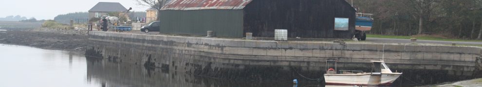
The interesting bit is that WI is to transfer some property at Harvey’s Quay, Limerick, to Limerick City Council, which is making a boardwalk. And something similar is happening in Tullamore. You’re nobody nowadays unless you have a boardwalk; their usefulness in Irish weather is not proven.

Finally, I noted a certain modesty in WI’s aims for 2013, no doubt in keeping with the tenor of the times:

Ministers discussed the main priorities for Waterways Ireland in 2013 and noted progress on the 2013 Business Plan and Budget. The priorities for 2013 include:

• ensure the navigations are open and all existing facilities operational during the main boating season from April to October
• to actively promote the waterways to extend and expand recreational use of the waterways in all its forms.


Ballycorick

I’ve updated my page on Ballycorick to take account of information provided in a Comment by Kenin Murphy, to whom I am grateful.

Some updates

Very often, when I’m visiting a waterway site, I take as many photographs as possible of anything that catches my eye, without worrying [at the time] about what an artefact is or what it does. Then, when I get back to my computer, I try to work out what everything was. Sometimes I find that the camera has recorded something I didn’t notice; sometimes I find there are aspects I just don’t understand (not being at all a technical person). In such cases, I put photos on this site and make it clear that I don’t understand them.

My hope is, of course, that a knowledgeable person will explain them, and that very thing has just happened with some pages on waterways of Ulster and thereabouts. John Ditchfield has very kindly explained several aspects of the machinery shown; I have inserted his explanations into the text on these pages:

I am very grateful to John for taking so much trouble and for sharing his expertise with me and with all who read these pages.

A gratifying display of loyalty

His Excellency the Lord Lieutenant took a trip on the Shannon Estuary in July 1856 on the City of Dublin Steam Packet Company’s vessel Erin-go-Bragh. He was greeted by demonstrations of loyalty from the populace, had dejeuner on board off Scattery Island and heard an address from the proprietary, clergymen, merchants, traders and inhabitants of Kilrush, read to him by Colonel Vandeleur. Here is the Freeman’s Journal‘s account of the trip.

Boats to return to Corbally Branch

Well, canoes, but better than nothing.

PS for “upstream” read “downstream”, as far as I can see.

Nimmo’s non-existent bridge

Here is an account of the building of the old bridge across the Blackwater at Youghal.

Who fears to speak …?

I have long maintained that our knowledge of the history of the use of Irish inland waterways is woefully inadequate. Apart from the operations of the Grand Canal Company, we know little about boats, owners or traffic in the nineteenth century and almost nothing about earlier years. I am therefore delighted to have been sent an article by Malcolm Reynolds about a River Shannon vessel from the eighteenth century; it is available here.

Bring back the Black

The Black Bridge at Plassey has been closed since the floods of November 2009. Its reopening seems to have a low priority; I suspect that is because the importance of the bridge in Ireland’s technological, economic, entrepreneurial and political history is not widely appreciated. Here is a page explaining some of the background and suggesting a context within which reopening might be justifiable.

Sallins

On 8 August 2012 Waterways Ireland applied to Kildare County Council for planning permission for a development at Sallins:

The construction of a new 210m fixed timber house boat mooring facility for 12 boats with electric and water service supply bollards, 45m of a fixed timber short term mooring facility, car parking bays for 12 cars, access pathway suitable for disabled access, and a sewage pumpout for boats.

The application is at pre-validation stage. Submissions are to be made by 11 September and the “due date” is 2 October 2012. The file number is 12645. I can find no additional documents or details.

To see the application, go to this page and install the download before clicking on “Link to Full Planning Enquiry System”. Cookies will have to be enabled.

IRBOA doesn’t seem to have the news on its site yet, but it is interesting to compare the current proposal with what was discussed at the IRBOA meeting in Sallins on 8 March [2011, I think].