Tag Archives: water level

Big it up for the OPW

I’ve just been reading some particularly nitwitted Dáil discussions and I need some time to calm down enough to report on them to the Learned Readers of this site. Let me just say that anyone who thinks that politicians cannot distinguish fact from fiction is absolutely right. But enough of that for the moment.

I reported earlier on an oddity in the results from the OPW’s Athlone waterlevel gauge. I emailed the OPW about it and a helpful chap got back on more or less immediately.

He explained that the data we see on the waterlevel.ie site is, as it were, live: raw unfiltered data with nothing added, nothing taken away. The same data goes in to the OPW and they spotted that the Athlone gauge was reading too high. They found the sensor was faulty; they have now adjusted it and the new, lower readings are correct.

The disappearance of the placenames is because of some work in progress on improving the website; they will be back.

He kindly pointed me to a list, in .xlsm format, downloadable from here; it shows all hydrometric stations in Ireland. It shows who operates them, whether they’re active and whether they use telemetry (which I take to mean that they can be monitored remotely). Unfortunately OPW itself doesn’t seem to have any gauges on Lough Derg and nor does Waterways Ireland. OPW does have a rather excitable gauge at Scarriff and gauges upstream of Meelick Weir and Meelick (Victoria) Lock. The ESB has gauges with telemetry at Ballyvalley (25073) and Killaloe (25074) but I can’t find any website giving the levels. If, Gentle Reader, you can find one, perhaps you would let us know.

The consoling part of dealing with the OPW is that you get the distinct impression that they know some useful stuff. Unlike, say, some folk working in Kildare Street ….

Thump it on the thirteenth

Here is a screenshot from the OPW’s online waterlevel gauge for Athlone Weir. It shows the levels for the past 35 days. In recent days the waterlevel website has ceased to show the names or locations of the gauges, but 26333 is Athlone Weir.

Athlone waterlevel: 35 days to 14 February 2014

Athlone waterlevel: 35 days to 14 February 2014

Note the odd discontinuities: the level jumped up on 13 February and fell back on 13 February. Does the gauge get stuck every so often and have to be thumped to free it?

I do not know. I have reported both the discontinuities and the disappearance of the station names to the OPW.


Limerick Boat Club

Video. NB I have no information on this myself and have no intention of going to inspect the site: it’s windy and wet in Limerick.

Relieving Athlone

Parteen Villa Weir is sending large amounts of water down the original channel of the Shannon, and over the Falls of Doonass, to draw water off from the upper reaches of the river.

Castleconnell water level 20140210 264_resize

The footbridge at Castleconnell

Castleconnell water level 20140210 267_resize

Above the bridge

Castleconnell water level 20140210 269_resize

The downstream side of the bridge

Castleconnell water level 20140210 271_resize

A bumpy ride

Castleconnell water level 20140210 273_resize

At normal levels the bottom of the wall is several feet above the water


Levels below Parteen Villa have not yet reached those of 2009 and the channel can probably take more before folk get flooded.

The Old River Shannon site has some photos taken at Parteen Villa Weir.

Canal tourists or canal pensioners?

The Village at Lyons 265_resize

La Serre

Nibbling yesterday on a morsel of cured salmon, with fennel and apple salad, lemon crème fraiche and lavender jelly, at the excellent La Serre restaurant at the Village at Lyons, I looked forward to walking outside afterwards, on to the canal bank, to view the many boats that would undoubtedly be moored there, above the thirteenth lock, as their owners lunched at La Serre’s sister institution, the Canal Café.

The thirteenth lock (and its wonderful O)

The thirteenth lock (and its wonderful O)

Judge of my surprise, then, when I found not a single boat outside. I realised, though, that boaters probably walked from nearby Hazelhatch and even from Sallins. For we know, do we not, that boaters are vital to tourism? Even Joe Higgins of the Socialist Party tells us so, which means that they must be out and about along the canals, spending money (and where better to spend it than at the Canal Café?).

The Canal Café, mere feet from the canal bank

The Canal Café, mere feet from the canal bank

But a difficulty has struck me. Mr Higgins’s position is that boaters have money available for discretionary expenditure, but Senator John Kelly tells us that most boaters are “retired couples from England who are receiving small English pensions”. So one politician tells us that boaters have disposable incomes and that they should not pay money to Waterways Ireland because they spend money in pubs and restaurants along the canals; another politician tells us that boaters should not pay money to Waterways Ireland because they have none to spare.

I find it difficult to reconcile these two positions.


Jimmy Deenihan, cricketer

Jimmy Deenihan, minister for waterways and some other stuff, supporter of the Lartigue Monorail in Listowel, is known to have played two forms of football: rugby and Gaelic. His cricketing expertise is perhaps less well known but, in a written answer to four Dáil questions yesterday, he showed his mastery of the straight bat.

I was surprised to find Bernard Durkan [FG, Kildare North] referring to “traditional canal boat dwellers”. I suppose it depends on your timescales: in my view, anything that began after 1850 isn’t really traditional.

Lowering Lough Ree

I reported in October and in November on the lowering of the level of Lough Ree, in advance of heavy rain, to see whether that would help to manage flooding on the Shannon Callows further downstream.

The interim data from the experiment is available on the OPW website here [seven-page PDF]. The conclusion is:

Conclusion
From the water level records, it is apparent that the closing of the gates at Athlone weir in anticipation of a rise in water levels on Lough Ree led to a temporary lowering of the Shannon water levels immediately downstream of Athlone. This possibly delayed inundation of the Shannon callows downstream of Athlone by a number of days. To determine whether the extent or depth of eventual inundation was in any way reduced by the experiment will require more detailed analysis by the CFRAM consultants. Data is available on request from Hydrometric Section if required.

It should be stressed that this is an interim report. This CFRAM background document [PDF] is still useful.

It is not clear to me why the state should spend any money improving the value of privately owned riverside land that is of marginal benefit to the economy.


Cutting and pasting

One of the problems with all this newfangled technology is that some things — like, for instance, copying a block of text from one document into another – are so easy that folk may forget to check their work afterwards.

Consider, for instance, the Office of Public Works, which seems to have a block of boilerplate text ready for answering written boilerplate questions from midlands TDs who have discovered that things get wet when it rains.

On 22 January 2014 Denis Naughten [Ind, Roscommon/South Leitrim, which — let it be admitted — The Lord intended to be rather boggy and sad] had this question:

To ask the Minister for Public Expenditure and Reform the steps being taken to address flood risks within the Shannon basin; and if he will make a statement on the matter.

The answer tells Mr Naughten about CFRAM — nothing he didn’t know before he asked, I imagine — but it included this sentence:

On foot of discussions between my colleague, Minister of State Hayes and the IFA, and with the cooperation of both the ESB and Waterways Ireland, a water level monitoring exercise is being carried out as part of the CFRAM process which will allow for analysis of water flows and levels at key points around the Lough Ree and Callows areas.

The highlighting is mine: it seemed a bit odd because this written answer was allegedly being given by Mr Hayes.

Mr Naughten had another Q&A here, but it’s not very interesting.


Matters of minor importance

Some recent(ish) discussions amongst the People’s Representatives. I haven’t time to analyse them all. All links courtesy of the estimable KildareStreeet.com.

Brendan Smith [FF, Cavan-Monaghan] wants a sheugh in Clones; he got the usual answer. And he allowed Jimmy Deenihan [FG, Kerry North/West Limerick] to announce, on 19 December 2013, the death of the suggested extension of the Erne navigation to Lough Oughter [loud cheers]:

Brendan Smith: To ask the Minister for Arts, Heritage and the Gaeltacht if he has received the feasibility study on the proposed extension of the Erne navigation from Belturbet to Killeshandra and Killykeen; and if he will make a statement on the matter.

Jimmy Deenihan: I am informed by Waterways Ireland that it commissioned a Strategic Environment Assessment for the possible extension of the Erne Navigation from Belturbet to Killeshandra and Killykeen.

On reviewing the environmental information from this process, Waterways Ireland considers that the environmental designations of this lake complex make the feasibility of the proposed navigation extension highly unviable. For that reason, I am advised that Waterways Ireland does not propose to pursue this project any further at this time.

Well, that’s one minor victory for sanity. Here’s how a dredger got to Lough Oughter in 1857.

Maureen O’Sullivan is anxious to recreate the economy of the eighteenth and nineteenth centuries by using canals for carrying cargoes. Especially on the Shannon–Erne Waterway, where commercial carrying was so successful before. [What is it about the Irish left?] Thank goodness that the sainted Leo Varadkar gave not an inch: someone should make that man Taoiseach, President and Minister for Finance. And Supreme Ruler of The Universe and Space.

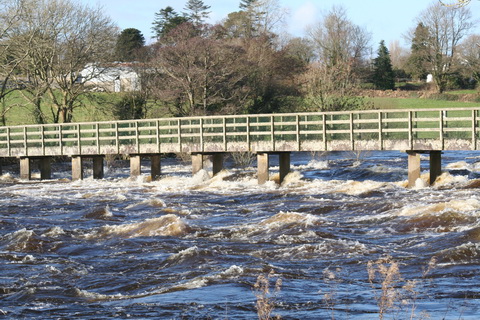
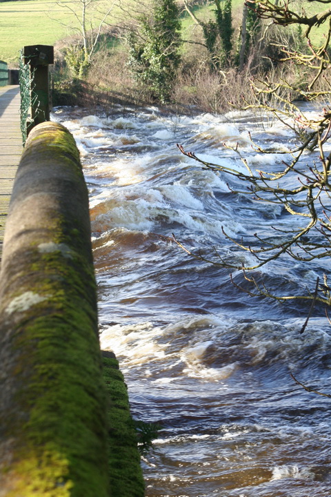
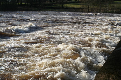
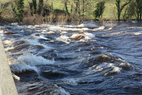
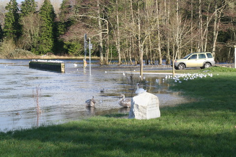
The web-footed inhabitants of the midlands, who have discovered that they live in a flat area with rivers, keep wittering on about Shannon flooding, failing to realise that it is a message from The Lord, telling them to either (a) move to higher ground, eg Dublin, or build arks. On 15 January 2014 Brian Hayes told Denis Naughten, inter alia, that info from the recent OPW/CFRAM monitoring of water levels on Lough Ree (which I think was when the levels were lowered) would be placed on the OPW website “in the coming days”; I haven’t been able to find it yet so I’ve emailed the OPW to ask about it. And on 21 January one James Bannon said that he intends to introduce a bill setting up a Shannon authority, which will have magical powers. Well, if it doesn’t have magical powers it won’t be able to stop the Shannon flooding, but perhaps it’s designed to allow the unemployed landowners of Ireland another forum in which to demand taxpayers’ money to prop up their uneconomic activities.

Finally, a senator called John Whelan wants a longer consultation period on the proposed amendments to the canals bye-laws. I suppose I’d better read them  myself.

Lough Derg floods: a book

If you happen to have €1400 or so to spare, you could buy Henry Trench’s 1879 book called Shannon Floods. Lough Derg level. The 25 Miles North from Killaloe with a double-page map and seven coloured plates. I have no connection with the seller — and no €1400 either, so I won’t be buying it.