Tag Archives: canal

From the [UK] Civil Service Quarterly

An interesting article [h/t celr] about the setting up of the Canal & River Trust, which runs (it says itself) 2000 miles of waterway in England and Wales. The article is not, perhaps, to be seen as an objective evaluation of the benefits of the UK’s Public Bodies Reform Programme, but the idea of transferring a large operation to the voluntary sector is an interesting one, as is the scope for volunteer donations and involvement (British Waterways, C&RT’s predecessor, had nothing like as high a proportion of lockkeepers as Waterways Ireland has).

I have occasionally been asked, by British folk, whether the possibility of transferring Waterways Ireland to the voluntary sector is being considered here. I have explained (a) that WI has nothing like as significant an independent (non-grant) income as BW had and (b) that any such transfer would require the rewriting of the Good Friday, St Andrew’s and (now) Stormont House Agreements. So we are stuck with the current arangements, which at present are leaving WI at the mercy of budget cuts, a disastrous pensions arrangement, disputes between its two governing departments and a nitwitted demand, from Sinn Féin and Fianna Fáil and perhaps from Fine Gael too, for a pointless canal reconstruction.


Map of Irish watercourses

A Google alert came up with this. Clicking on it opens it on a different background; clicking again increases it in size and a third click reduces it again. I can’t do anything else with it and I don’t know who produced it, but maybe others can do more. It’s very elegant anyway.


The Shannon in winter

Downriver from Shannon Harbour to Dromineer in December 2014. It began as a bright, cold morning.

Shannon Harbour to Dromineer December 2014 01_resize

Leaving Shannon Harbour after icebreaking between the locks

Shannon Harbour to Dromineer December 2014 02_resize

Flooding to the south-east

Shannon Harbour to Dromineer December 2014 03_resize

But southward, look …

Shannon Harbour to Dromineer December 2014 06_resize

The Brosna

Shannon Harbour to Dromineer December 2014 73_resize

Heading for Banagher Bridge 1

Shannon Harbour to Dromineer December 2014 75_resize

Keeping close to the pontoons

Shannon Harbour to Dromineer December 2014 98_resize

Heading for Banagher Bridge 2

Shannon Harbour to Dromineer December 2014 103_resize

Heading for Banagher Bridge 3

There is a YouTube video of the shooting of the bridge here. It seems to start automatically, including sound; I don’t know how to avoid that.

Shannon Harbour to Dromineer December 2014 107_resize

Looking back at Banagher

Shannon Harbour to Dromineer December 2014 116_resize

Colours

Shannon Harbour to Dromineer December 2014 124_resize

Invernisk

Shannon Harbour to Dromineer December 2014 129_resize

Shannon Grove

Shannon Harbour to Dromineer December 2014 134_resize

Current

Shannon Harbour to Dromineer December 2014 140_resize

Scarpering heron

Shannon Harbour to Dromineer December 2014 146_resize

Colours

Shannon Harbour to Dromineer December 2014 149_resize

Marker and gauge

Shannon Harbour to Dromineer December 2014 151_resize

House

Shannon Harbour to Dromineer December 2014 169_resize

Boats at Meelick

Shannon Harbour to Dromineer December 2014 170_resize

Meelick weir

Shannon Harbour to Dromineer December 2014 174_resize

East bank

Shannon Harbour to Dromineer December 2014 176_resize

Protective boom

Shannon Harbour to Dromineer December 2014 181_resize

Sluices

Shannon Harbour to Dromineer December 2014 198_resize

Through Meelick Lock

Shannon Harbour to Dromineer December 2014 205_resize

One bird

Shannon Harbour to Dromineer December 2014 213_resize

Many birds

Shannon Harbour to Dromineer December 2014 221_resize

Reeds

Shannon Harbour to Dromineer December 2014 226_resize

Architecture

Shannon Harbour to Dromineer December 2014 228_resize

Munster Harbour

Shannon Harbour to Dromineer December 2014 233_resize

Delaying Eamon Egan

Shannon Harbour to Dromineer December 2014 235_resize

Gateway to civilisation

Shannon Harbour to Dromineer December 2014 237_resize

Connacht Harbour

Shannon Harbour to Dromineer December 2014 239_resize

Lough Derg: weather has changed

Shannon Harbour to Dromineer December 2014 243_resize

Journey’s end, Dromineer


Matricide

A young woman, named Anne Macdonald, threw her mother into the Grand Canal, Dublin, last week, where the unfortunate woman was drowned. The daughter was excited to the unnatural act by a sudden fit of passion, on being called an opprobrious name by her mother.

Liverpool Mercury 1 January 1830

Nenagh Canal

Canal between Nenagh and the River Shannon

At a numerous and highly respectable Meeting of the Gentry, Merchants, Traders, and Freeholders of the Baronies of Upper Ormond, Lower Ormond, and Owney and Arra, held at Nenagh, County of Tipperary, on Wednesday, the 30th day of January, 1839.

PETER HOLMES, Esq, JP, and DL, in the Chair.

Moved by John Bayly, Esq; seconded by the Rev J H Poe, Rector of Nenagh:

Resolved — That we consider a Canal communication between Nenagh and the River Shannon, of vital importance to the prosperity of the town and neighbourhood, as increasing commerce, lessening the cost of fuel, facilitating intercourse with the sea ports of the country, and giving employment to the poor.

Moved by John Bouchier, Esq; seconded by the Reverend Ambrose O’Connor, PP of Nenagh:

Resolved — That we have heard with interest the Report of Mr Henry Buck, Engineer, on the proposed line of Canal; and recommend the adoption of the line he has surveyed.

Moved by John M’Keogh Dwyer, Esq; seconded by Thomas Maguire, Esq:

Resolved — That we recommend the adoption of the Prospectus that we have heard read.

Moved by Hastings Atkins, Esq; seconded by J J Poe, Esq:

Resolved — That we appoint Peter Holmes, Esq, a Commissioner, who is to name a second, the second a third, and so on, until the whole are appointed.

Moved by O’Brien Dillon, Esq; seconded by John Bayley, Esq:

Resolved — That the names of Lords Dunally, and Orkney be added to the list of Commissioners.

Moved by Doctor Quin; seconded by Doctor Dempster:

Resolved — That we recommend the proceedings of the Meeting to be published in the Nenagh Guardian, Limerick Chronicle, and other Papers, and that the Secretary be instructed to get printed 300 copies of the Prospectus.

Moved by John M’Keogh Dwyer, Esq; seconded by Thos Maguire, Esq:

Resolved — That we now enter into a Subscription list for Shares, according to the provisions of the Prospectus read at this Meeting.

PETER HOLMES, Chairman.
O’BRIEN DILLON, Secretary.

Mr Holmes having left the Chair, and Mr Bayley having been called thereto —

Resolved — That the thanks of the Meeting are due, and hereby given, to Peter Holmes, Esq, for his impartial conduct in the Chair, and for the spirited example he has set in being the first to subscribe for Fifty Shares.

JOHN BAYLEY, Chairman.
O’BRIEN DILLON, Secretary.

Dublin Monitor 7 February 1839

Wading in the water (not)

See the bottom of a lock (with no water in it). This is Carpenters Road Lock in London, which also featured here.

h/t CELR

Sorry, Longford

Waterways Ireland’s Feasibility Study into the Restoration of the Longford Branch of the Royal Canal is available for download [7 PDFs: main report + 6 appendices]. Skip straight to page 59:

6.5 Recommendation

Given the current financial climate and because of the associated costs, environmental issues and uincertainty regarding planning approval it is not recommended to pursue this project any further at this time.

The recent work undertaken in regard to the shared walkway/cycleway has protected the asset as a publicly owned recreational amenity and it is recommended that any outstanding property issues be resolved and finalised in order to complete the protection of the asset.

I hope that admirable recommendation survives the pre-election period.

By the way, there’s a snail ….

Saunderson’s Sheugh

The Minister for  Arts, Heritage and the Gaeltacht [who is also a Fine Gael TD for Cavan–Monaghan] spoke at the meeeting of the Joint Oireachtas Committee on Environment, Culture and the Gaeltacht on 25 November 2014. She said:

In addition to progressing North-South co-operation, my key priority is progressing the first stage of the Ulster Canal project from upper Lough Erne to Castle Saunderson, near Belturbet, County Cavan. I am working on this with the Government and other key partners, including the North-South Ministerial Council and Waterways Ireland. […]

It sounds, then, as if the minister intends to get work started on the Clones Sheugh, but only as far as Castle Saunderson, where there is a scouting establishment. The route from Quivvy Lough (location of the Quivvy Marina) is along the Finn River; the first 5.5 km of the route would be in the river and the last 8.5 km to Clones in a canal. The route to Castle Saunderson would, I imagine, require dredging and the removal of rocks as well as work on [or replacement of] Derrykerrib Bridge [I have not read all the details].

It would, of course, be faster to get there by road, but no doubt lots of people will travel from Foreign Parts for the excitement of seeing Castle Saunderson from the water and paying tribute to the memory of a stout Orangeman and founder of the Irish Unionist Alliance.

No mention of the treasure-hunting group who are to find the money, but there’s an election in the offing so money won’t be a problem. Until afterwards.

Quivvy to Castle Saunderson [OSI ~1840]

Quivvy to Castle Saunderson [OSI ~1840]

The minister also said:

Regarding the Ulster Canal, which stretches from upper Lough Erne to Castle Saunderson, we hope to get the project started on that section because that is the one part of the inland waterway system that has not been developed. If we get that done, the Ulster Canal will connect into Lough Neagh. That means we will have a complete network of waterways in Ireland, which is very important. It is also a cross-Border project, and there is a peace dividend in terms of that project. It is very important in terms of cross-Border relationships. It is one shovel-ready project that can be progressed.

The minister said that “a complete network of waterways in Ireland […] is very important”. She did not say why and I can think of no possible economic justification for the creation of such a “network”. Nor is it clear what the “peace dividend” is. But the phrase that evoked most terror is “shovel-ready project”, which I take to mean something that might buy votes in the next election.

The minister’s predecessor, Éamon Ó Cuív, a Fianna Fáil TD for Galway West, said:

I welcome the Minister’s continuation of the work on the Ulster canals. There was quite a bit of work done on that in my time and I was very anxious to see it progress on a step-by-step basis. I was going to bring it to Clones, I am not sure whether the place the Minister mentioned is further or nearer than that.

The minister interjected:

It is not as far as Clones. We will start it anyway and we will get it there.

And Mr Ó Cuív continued:

I take the view that even if she were to get it half a mile, we should just nibble away at it until we get it finished. It is of strategic national importance and if we could connect Coleraine, where I was the other day and where my poor car is getting mended, all the way down the coast through Lough Neagh down to Shannon and back up the canals, it would be a fantastic facility for the island. I will not be heard complaining in any way that it is in the Minister’s constituency – that just happens to be a happy coincidence in this case.

Actually, although both Quivvy Marina and Castle Saunderson are in the Free State, most of the River Finn route is in the United Kingdom of Great Britain and Northern Ireland.

It seems that I must cease to speak of the Clones Sheugh: it’s Saunderson’s Sheugh. I suppose that, if reaching Castle Saunderson were enough to shut up the Shinners, who seem to be madly keen on Sheughery for some reason that is hidden from me, that might be a bargain: it would certainly be better than going all the way to Clones.

My OSI logo and permit number for website


Down to the sea in steps

On 28 January 1907 James Robinson Kilroe [near the bottom of the page] of H M Geological Survey read to the Royal Irish Academy a paper on “The River Shannon: its present course and geological history” [Proceedings of the Royal Irish Academy Vol XXVI Section B No 8 Hodges, Figgis & Co Ltd, Dublin; Williams & Norgate, London 1907]. I thought that Plate V was interesting.

Shannon Derg to sea

Plate V

Kilroe wrote:

It will be perceived that instead of the river being shallow over the unyielding Silurian slate-rock, set almost vertically, and striking across the river-course, it is deeper than over the limestone of Lough Derg, and much deeper than over the comparatively easily eroded Old Red Sandstone at Killaloe. The river-bed actually drops below the datum line above the town, while at the town it is 100 feet above datum.

Old Red Sandstone strata are here to be seen in the river-bank, and Silurian rocks in situ in its bed. A barrier is thus formed, partly of Silurian, and partly of Old Red Sandstone rocks, which without the artificial impounding weir would retain the waters of Lough Derg to a depth of some 104 feet opposite Derrycastle — two miles above Killaloe.

One might have expected to find a fairly level shallow bed from Killaloe northward, a sudden drop from slate-rock to the sandstone floor, and  a pronounced wide, well-formed valley in the limestone district southward to Limerick.

None of these elements exist; instead, we have the formidable barrier at Killaloe, naturally damming up a considerable depth of water in Lough Derg, and the river falling away southward by a series of rapids which correspond with drops in the canal, south of O’Briensbridge […], along an alternative course, possibly one used by a branch of the Shannon.

Here is an extract from the Plate V map, showing the steps of the (pre-Ardnacrusha) Limerick Navigation between Lough Derg and the sea.

Shannon Killaloe to Limerick

The steps of the canal (click to enlarge)

Upstream

Kilroe wrote of Lough Ree:

The waters of Lough Ree stood some 10 feet higher within recent times than they now do, as proved by evidence of solution, with under-cutting of limestone blocks, to be seen about five miles north-west of Athlone, close to the railway, in the townland of Cornaseer.

Under these conditions the lake must have been, perhaps, twice its width, and for a considerable period. Its ancient surface-level is clearly indicated by the caps of the mushroom-shaped blocks.

And of the Shannon between Lough Ree and Lough Derg:

The extreme flatness of the river between Athlone and Meelick is such that, consequent upon the completion of the Suck Drainage-works in 1892, it was found that the callows along the Shannon above the confluence of the Suck at Shannonbridge were much more liable to sudden and frequent floodings than they previously had been.

The more rapid discharge of the Suck waters into the Shannon, before ordinary extra water had time to pass away, had the effect of modifying the regimen of the main stream to an extent which resulted in an action at law [La Touche -v- The Suck Drainage Board].

I have found only one account of that case, in the Freeman’s Journal of 1 July 1893. The plaintiffs, Messrs Harrison and La Touche, owned land at Cappaleitrim, on the west bank of the Shannon above Shannonbridge. They said that the actions of the Suck Drainage Board had caused their lands to be flooded:

[…] that the defendants brought water from the Suck into the Shannon, containing a drainage of 40 miles, with such velocity and such volume that the Shannon was penned back, and that the back water caused the damage to the lands complained of.

[…] The jury disagreed and were discharged.

I don’t know whether the matter ever again came before a judge.

Royal Canal drawbridge

According to the Freeman’s Journal of 5 April 1837, Henry Garnett was

superintendent or agent to the èxtensive and highly respectable firm of Purcell and Jameson, coach proprietors.

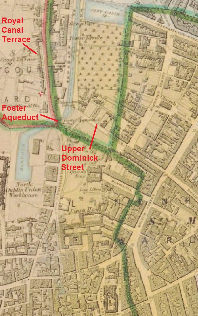
Their offices were in Sackville Street. On Sunday 2 April 1837 Mr Garnett had been on his way home to [Royal] Canal Terrace when

as he ascended the hill at the bend of Upper Dominick-street he met a man habited in a dark cloak, and having a cap on his head, who, after looking him steadfastly in the face, opened the cloak, and fired at him.

The man was not more than a yard away, so close that the powder scorched Garnett’s hand, but the bullet struck a suspender button, wounding but not killing the victim.

The scene of the crime

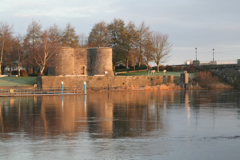
The scene of the crime [OSI ~1840]

William Cagburn heard the shot and also heard Garnett calling out

I am shot — stop the murderer, he has run in the direction of the aqueduct.

Cagburn gave chase:

He instantly pursued, crossed the draw-bridge, and came under the aqueduct, when he saw the prisoner running along the Phibsborough road.

Cagburn and the watchman seized the man; the watchman took two pistols from him and another witness found a third, discharged, pistol nearby on the pathway.

The prisoner, Christopher Clanchy, had been a road maker for eight years. The Freeman’s Journal said:

While a contractor for repairing part of the Ashbourne road, in the employment of Messrs Bourne, he [Clanchy] was allowed to travel free by Mr Purcell’s coaches, and Mr Garnett in the discharge of his duty having occasion to withdraw this privilege, hence proceeding his desire to be revenged. […] We are happy to state Mr Garnett is not likely to suffer any inconvenience from the injury.

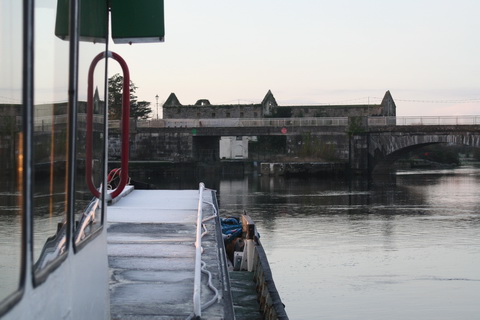
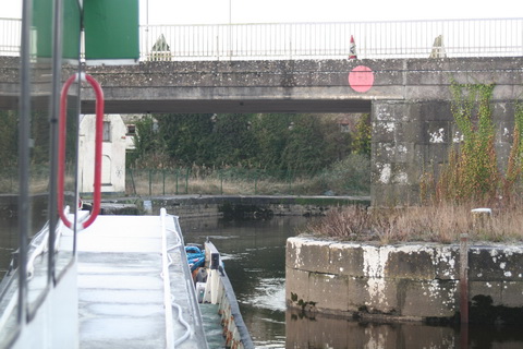
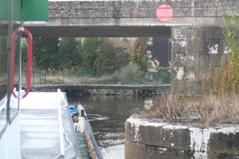
But of more interest for this site is the route taken by William Cagburn. What or where was the drawbridge he crossed?

Foster Aqueduct

Upper Dominick Street and the Foster Aqueduct [OSI ~1840]

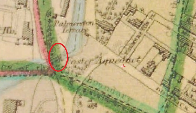
I haven’t come across [or at least I haven’t noticed] any previous mention of a drawbridge in this area. I presume that it was across the canal. And, looking closely at the map extract above …

Possible site of drawbridge

Possible drawbridge [OSI ~1840]

… I see what might be a bridge just to the left of the F of Foster. It shows up more clearly on the black and white OSI map. At Clanchy’s trial before the Commission of Oyer and Terminer, reported in the Freeman’s Journal of Monday 26 June 1837, the bridge was said to be a wooden bridge; George Cayburn [probably the William Cagburn named in the earlier report] described it as “the swinging bridge”.

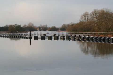
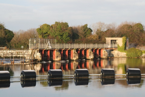
Perhaps Mallet’s Insistent Pontoon merely replaced an old nuisance with a new.

Clanchy, incidentally, was found guilty: there were suggestions that he was insane, but the jury rejected them. Baron Richards said [Freeman’s Journal 1 July 1837]

The court had no discretion but to pass the extreme sentence of the law, that he should be hanged by the neck […].

Purcell, Garnett’s employer, had requested a commutation of his sentence; Richards said that it was open to Clanchy to memorial for a commutation, and the court would put no obstacle in his way; indeed it hoped he would meet the mercy “which he would have denied his intended victim”. I do not know what happened to Clanchy.

Update December 2016

The Warder and Dublin Weekly Mail of 26 September 1835 mentions the bridge:

Monday night a respectable looking elderly man fell into the Royal Canal Basin, at the Broadstone, on the Dominick-street side, within a few yards of the draw bridge.

A canal employee called Keybourne hauled Mr White out within a few minutes, but he was DOA at the Richmond Hospital.

This seems to confirm that the bridge was moveable and was where the OSI map suggests.

From the BNA

My OSI logo and permit number for website