Tag Archives: flow

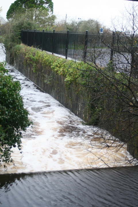
The current at Killaloe

I have been known to complain about the absence [on the interweb] of information about the state of the Shannon downstream of Banagher and Meelick.

Waterways Ireland

On the Waterways Ireland website, on the “About Us” menu, there’s a “Water Levels” option which takes you to this OTT Hydromet page. Perhaps my security settings are too high (or too eccentric), but at the top of the page all I see is

Alternate HTML content should be placed here. This content requires the Adobe Flash Player. Get Flash

At the bottom I read

Click here to obtain list of todays 9am Values. Please Note – Levels are recorded in meters to MSL Malin Head.

There is also a disclaimer.

The link goes to this page where the locations of various gauges are categorised by waterway. The furthest south [on the Shannon] I can find is …

Meelick Weir Gauge SS_MEELICK Water level 0001 32.62m 2018-07-07 07:30:00 5400

… from which I deduce that the water level at Meelick Weir is 32.62 metres above mean sea level at Malin Head. From that, of course, I can deduce the depth of the water at Meelick, or I could if I knew how far the bed of the river was above MSL Malin Head, and by charting the daily returns I could see whether the level was increasing or decreasing.

OPW

Alternatively, I could use the OPW’s gauge at Banagher, only a little way upstream, which shows me the depth, the change over 35 days and the level in relation to various percentiles of previous levels. That is a lot easier to read and a lot more useful: although a measure of flow would be more useful still, I can assume that a high level will be accompanied by a faster flow.

ESB

I have recently discovered that the ESB has a page with (admittedly for a small number of sites) information in a more user-friendly format than either WI or the OPW. To find it from the home page, select “Our Businesses”, then “Generation & Energy Trading”, then “Hydrometric Information”, then “River Shannon”, then “Beware of the leopard”. Alternatively, try www.esbhydro.ie/shannon for a list of PDFs.

Either way, the files available include

  • a hydrometric forecast for the Shannon
  • one-year charts showing levels at each of five locations: Bellantra sluices, Lough Ree; Thatch, Lough Ree; Athlone Weir downstream; Portumna Bridge; Pier Head, Killaloe
  • even more useful for anyone going near Killaloe Bridge, the total flow [in cubic metres per second] at Parteen Villa Weir and at Ardnacrusha.

Here, in flagrant breach of the ESB’s copyright, is the chart for Parteen Villa Weir:

The flow at Parteen Villa Weir

The flow has been pretty well flat, at 0, for some time. The Parteen and Ardnacrusha charts have accompanying tables giving the figures for the last 30 days; here are those for Ardnacrusha:

The flow at Ardnacrusha

Each of Ardnacrusha’s four turbines uses about 100 cubic metres per second [cumec]. The flow through Parteen Villa Weir is divided between the old course of the Shannon [which must get 10 cumec] and the new channel through Ardnacrusha. The combined flow through Parteen has been 11 cumec for the past week, and Ardnacrusha has been getting nothing (except a tiny amount on 3 July). That explains why the level of water at Castleconnell, on the old course, is slightly higher than normal summer levels (11 rather than 10 cumec).

And with no water going through Ardnacrusha, the level of Lough Derg is normal (see the chart for Killaloe) and there is no strong current at Killaloe.

Note, by the way, that the levels shown by the ESB are referenced to the older Poolbeg ordnance datum, not the Malin Head used since 1970: “Poolbeg OD was about 2.7 metres lower than Malin OD.”

Other sites?

If, Gentle Reader, you know of any other accessible web pages with user-friendly information on flows or depths on the waterways, do please leave a Comment below.


What’s a cumec, Daddy?

I don’t know, but here’s a picture of 415 of them flowing through Castleconnell. [Update 13 December: that may be only 405 cumec.]

Castleconnell 20151212 10_resize

415 cumecs on 12 December 2015

Actually, a cumec is one cubic metre of water per second, which is roughly one ton per second, which is a lot of water. And 415 cumec is the amount that, according to the blatts, the ESB is currently letting down the original course of the Shannon from Parteen Villa Weir; the minimum flow in that channel, as seen in summer, is 10 cumec.

Castleconnell 12 December 2015

Castleconnell 20151212 02_resize

Younger trees getting their feet wet

Castleconnell 20151212 11_resize

Who’d have guessed?

Castleconnell 20151212 14_resize

Below the bridge

Castleconnell 20151212 21_resize

Above the bridge

Castleconnell 20151212 34_resize

Stormont

Castleconnell 20151212 37_resize

Pump

Castleconnell 20151212 40_resize

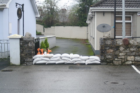
Sandbags

Castleconnell 20151212 42_resize

Sandbag Central

Castleconnell 20151212 43_resize

Sandbags filled here for distribution

Castleconnell 20151212 46_resize

Army engineers

Castleconnell 20151212 50_resize

More equipment arriving

Clonlara 11 December 2015

Headrace Clonlara 20151211 01_resize

Ardnacrusha headrace, said to take 400 cumec

PEC Errina Bridge 20151211 04_resize

Errina bridge on the Plassey-Errina Canal

PEC Errina Bridge 20151211 01_resize

The stop planks seem to be quite effective …

PEC Clonlara upstream 20151211 01_resize

… as there is little water getting down the canal to Clonlara bridge

Park Canal 9 December 2015

Park Canal 20151209 01_resize

Depth gauge at Park Lock

Park Canal 20151209 03_resize

Lock chamber

Park Canal 20151209 04_resize

Full canal upstream


Hamilton Lock

Victoria (Meelick) and Hamilton Locks (OSI ~1900)

Victoria (Meelick) and Hamilton Locks (OSI ~1900)

Lord Dunkellin: Do you know the Victoria lock at Meelick?

Sir Richard Griffith: I do.

Victoria Lock, Meelick

Victoria Lock, Meelick

Dunkellin: Do you know what is called the Old Cut, the old canal?

Griffith: Yes.

Dunkellin: The Victoria lock is a new work, is it not?

Griffith: It is.

Dunkellin: Should you be surprised to hear that vessels do not use that frequently, but go by the old cut?

Griffith: In times of very high flood I am aware that the canal boats find it advisable and beneficial to go by the Hamilton lock, on the old cut, in preference to the other.

Dunkellin: Prima facie, one would have thought that a new work like the Victoria lock would have the effect of regulating the state of things?

Griffith: It arises from the Counsellers’ Ford, as it is called, above Meelick; it has not been sufficiently excavated, and there is a strong current, and the boats are not able to get up to it in times of high flood.

Dunkellin: Then the boats made use of the old canal instead of the new lock?

Griffith: Under those peculiar circumstances they did.

Evidence of Sir Richard Griffith to the Select Committee on the Shannon River 12 June 1865

My OSI logo and permit number for website

Backtracking the Barrow trackway

Some time ago I put up a page about the Barrow trackway [towing-path]. For some reason, the page disappeared shortly afterwards. I have now recreated it; unless or until it disappears again, it is here.

Ballygalane on the Blackwater

Lismore Canal lock 28_resize

The Lismore Canal lock

The only lock on the Lismore Canal is at Ballygalane, on the River Blackwater. Here is a new page about the canal, with photos of some of its important features.

Waterside Belturbet

Here is a small amount of information about Belturbet and some of its industrial heritage. The photos were taken on a brief visit in July 2011.

Crossing the Barrow

The trackway [towing-path] on the River Barrow changes from the east {left) bank to the west at Leighlinbridge and back again at Graiguecullen/Carlow.

It seems to me that there may have been some difficulties in getting horse-drawn boats from one side of the river to the other and I have found no evidence on how it was done, so here is some speculation instead.

The Deel navigation

The Deel linked the Co Limerick town of Askeaton to the south side of the Shannon Estuary. Here is a page about the navigation and some of its quays. Note that it is a long page with many maps and photos, although they’re all reduced in size to minimise the strain on tinterweb.

Plassey in 1851

Plassey August 2010 37_resize

Free the Black Bridge

Here is a page about a cot race at Plassey in 1851.


Two Limerick footbridges

The Black Bridge at Plassey has long had a place in the hearts of Limerick people. It was damaged in the floods of 2009 and has been closed to the public ever since. Limerick Council says it can’t afford to repair it. Limerick Council is, as far as I can see, in breach of the terms of its lease of the bridge from the Department of Finance; the Department of Finance could, but has chosen not to, insist that the Council repair the bridge.

In the meantime, the Minister for Finance, for reasons best known to himself, wants a new, er, iconic footbridge in Limerick city and is prepared to spend €6 million of taxpayers’ money, via Fáilte Ireland, on a structure that can scarcely avoid blocking some of the finest views in the city.

Now, the Limerick Leader tells us, the ghastly edifice is to cost almost €18 million: €6 million from the Minister for Finance (who represents Limerick), €4 million to be borrowed and €7.8 million from the leprechauns’ pot of gold under the thorn bush. Or somewhere. Even Fianna Fáil councillors think this is insane, which is saying something.

This ridiculous proposal should be abandoned immediately and a much smaller sum should be spent instead on repairing the Black Bridge as part of a European Route of Industrial Heritage.

The Minister’s €6 million is a gift-horse that should not only have its teeth inspected: it should be taken out and shot and its carcass sent to the burger factory.