Category Archives: Waterways management

Hooks

Statutory Instrument No 198 of 1964

GRAND CANAL BYE-LAW (CONFIRMATION) ORDER, 1964

I, ERSKINE H CHILDERS, Minister for Transport and Power, in exercise of the powers conferred on me by section 22 of the Transport Act, 1950 (No 12 of 1950), and the Transport, Fuel and Power (Transfer of Departmental Administration and Ministerial Functions) Order, 1959 (SI No 125 of 1959), hereby order as follows:

  1. This Order may be cited as the Grand Canal Bye-law (Confirmation) Order, 1964.
  2. The bye-law (set out in the Schedule to this Order) made by Córas Iompair Éireann on the 7th day of November, 1963, in lieu of Bye-law No 37 (confirmed by the Grand Canal Bye-law (Confirmation) Order, 1953 (SI No 162 of 1953)) is hereby confirmed and shall come into operation on the 5th day of August, 1964.

SCHEDULE

No person navigating any vessel on the canal shall have on board the same—

(1) passengers or persons exceeding twelve in number in addition to her duly appointed crew; or

(2) any scythe, hook, or other instrument for cutting grass or corn unless the same bona fide forms part of the cargo carried for hire; nor shall any such person use the same on the canal or towing-path, or on any land adjoining the canal or towing-path.

GIVEN under my Official Seal, this 5th day of August, 1964.

ERSKINE H CHILDERS, Minister for Transport and Power

EXPLANATORY NOTE

The effect of this Order is to remove the restrictions imposed by the former Bye-law No 37 of the Grand Canal Bye-laws on the carrying of firearms and fishing tackle on vessels traversing the Grand Canal.

Stolen from www.irishstatutebook.ie

The speed limit in Athlone

The following photographs (and many others) were taken from the Watergate in Athlone on Sunday 5 August 2018. An IWAI Rally was in progress and the Lough Ree Yacht Club’s annual regatta was beginning, but there is of course no suggestion that the boats and boaters shown in these photos had any connection with either of those august institutions.

No doubt it is difficult to estimate speed

I do not know what is happening here

The jetski was relatively harmless

A large BRIG RIB, I think

Madarua goes upstream

Madarua goes downstream

Madarua alongside a cruiser

Madarua upstream again

Madarua upstream again

A busy boater: up …

… still going up …

Down

Up again

Down again

A red RIB

This one is almost sedate

Spotting the photographer

Three RIBs coming downstream (the nearest is not one of the three)

Three RIBs travelling more slowly below the railway bridge

The Watergate

There is, I believe, a 5 km/h [~2.7 knots] speed limit for boats passing through Athlone. The area covered includes the river at the Watergate and upstream for some distance above the railway bridge.

Paint

Shannon–Erne Waterway marker August 2018

One side of the marker is intended to be white, the other red. But which is which?


Swiss army knife

Ten years ago this site used the term “Swiss army knife” to describe Waterways Ireland’s Watermaster “amphibious multipurpose dredger“. Carlow Live says that Waterways Ireland now use the term themselves.

Exciting news for Clones

Goodbye Clones Sheugh, hello Clones Duckpond.

Canal Boats for sale

The Directors of the Grand Canal Company hereby give notice that they will SELL, to such parties as may require them, NINE SWIFT PASSAGE BOATS, and TWO HEAVY NIGHT PASSAGE BOATS, several of which are in perfect repair, and of the following dimensions, viz:—

FLY BOATS

Average length, from Stem to Stern, 60 feet, and average breadth of beam, 6 feet 6 inches.

NIGHT BOATS

Average length 60 feet, and breadth of beam, 7 feet 9 inches.

Applications from parties desirous of purchasing same to be addressed to the Secretary.

By Order, JOHN M’MULLEN, Sec, Grand Canal House, William-street,
11th February, 1848

Dublin Evening Mail 25 February 1848

Liveaboards

I do hope that Waterways Ireland finds inspiration in this story from the Grauniad, wherein we learn that the Canal and River Trust, which manages many waterways in England and Wales, is able to charge over £12000 for city-centre moorings.

Assistance to canals in Ireland

The assistance given to canals belonging to companies in Ireland in the last and commencement of the present century was chiefly in the form of loans of public money or by grants from special or general taxes; but we have been unable to obtain from the records of inland navigation in Ireland a complete account of the public loans which were made for such purpose.

Report of the Commissioners appointed to inspect the accounts and examine the works of Railways in Ireland, made to the Lords Commissioners of Her Majesty’s Treasury HMSO, London 1868

How true those words are even today.

I would be grateful if anyone could tell me the full cost of the restoration of the Royal Canal and the Ballinamore & Ballyconnell Canal, now the Shannon–Erne Waterway.


The current at Killaloe

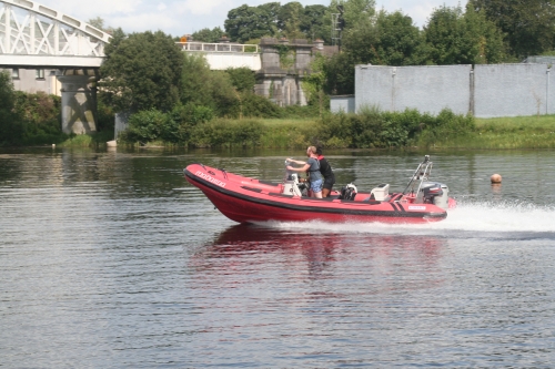
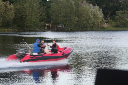
I have been known to complain about the absence [on the interweb] of information about the state of the Shannon downstream of Banagher and Meelick.

Waterways Ireland

On the Waterways Ireland website, on the “About Us” menu, there’s a “Water Levels” option which takes you to this OTT Hydromet page. Perhaps my security settings are too high (or too eccentric), but at the top of the page all I see is

Alternate HTML content should be placed here. This content requires the Adobe Flash Player. Get Flash

At the bottom I read

Click here to obtain list of todays 9am Values. Please Note – Levels are recorded in meters to MSL Malin Head.

There is also a disclaimer.

The link goes to this page where the locations of various gauges are categorised by waterway. The furthest south [on the Shannon] I can find is …

Meelick Weir Gauge SS_MEELICK Water level 0001 32.62m 2018-07-07 07:30:00 5400

… from which I deduce that the water level at Meelick Weir is 32.62 metres above mean sea level at Malin Head. From that, of course, I can deduce the depth of the water at Meelick, or I could if I knew how far the bed of the river was above MSL Malin Head, and by charting the daily returns I could see whether the level was increasing or decreasing.

OPW

Alternatively, I could use the OPW’s gauge at Banagher, only a little way upstream, which shows me the depth, the change over 35 days and the level in relation to various percentiles of previous levels. That is a lot easier to read and a lot more useful: although a measure of flow would be more useful still, I can assume that a high level will be accompanied by a faster flow.

ESB

I have recently discovered that the ESB has a page with (admittedly for a small number of sites) information in a more user-friendly format than either WI or the OPW. To find it from the home page, select “Our Businesses”, then “Generation & Energy Trading”, then “Hydrometric Information”, then “River Shannon”, then “Beware of the leopard”. Alternatively, try www.esbhydro.ie/shannon for a list of PDFs.

Either way, the files available include

  • a hydrometric forecast for the Shannon
  • one-year charts showing levels at each of five locations: Bellantra sluices, Lough Ree; Thatch, Lough Ree; Athlone Weir downstream; Portumna Bridge; Pier Head, Killaloe
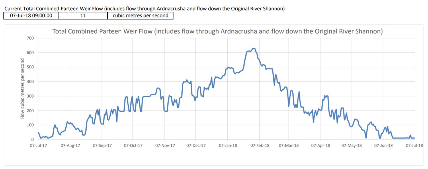
  • even more useful for anyone going near Killaloe Bridge, the total flow [in cubic metres per second] at Parteen Villa Weir and at Ardnacrusha.

Here, in flagrant breach of the ESB’s copyright, is the chart for Parteen Villa Weir:

The flow at Parteen Villa Weir

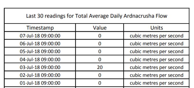
The flow has been pretty well flat, at 0, for some time. The Parteen and Ardnacrusha charts have accompanying tables giving the figures for the last 30 days; here are those for Ardnacrusha:

The flow at Ardnacrusha

Each of Ardnacrusha’s four turbines uses about 100 cubic metres per second [cumec]. The flow through Parteen Villa Weir is divided between the old course of the Shannon [which must get 10 cumec] and the new channel through Ardnacrusha. The combined flow through Parteen has been 11 cumec for the past week, and Ardnacrusha has been getting nothing (except a tiny amount on 3 July). That explains why the level of water at Castleconnell, on the old course, is slightly higher than normal summer levels (11 rather than 10 cumec).

And with no water going through Ardnacrusha, the level of Lough Derg is normal (see the chart for Killaloe) and there is no strong current at Killaloe.

Note, by the way, that the levels shown by the ESB are referenced to the older Poolbeg ordnance datum, not the Malin Head used since 1970: “Poolbeg OD was about 2.7 metres lower than Malin OD.”

Other sites?

If, Gentle Reader, you know of any other accessible web pages with user-friendly information on flows or depths on the waterways, do please leave a Comment below.


Ardnacrusha tours 2018

Tours of the Ardnacrusha power station are available again this year; info here.