Tag Archives: Kingstown

The PS Clarences

A steamer called the Clarence served on the Shannon estuary in the 1830s. There are different accounts of when she left the Shannon. Here is an attempt at resolving the problem.

Clydebuilt

According to the Clydebuilt database of ships on www.clydesite.co.uk, a paddle steamer called the Clarence was built in 1827 and “launched on” by Robert Napier of Govan. A note to the entry says that this was presumably the same vessel as that listed for Denny.

The Denny entry says that a 70-ton wooden paddle steamer called the Clarence was “launched on” in 1827 by William Denny and A McLachlan of Dumbarton for R Napier. Its owners are listed as R Napier and, from 1829, “Inland Steam Nav Co, Limerick”; it is said to have run between Limerick and Clare Castle on the River Shannon between 1829 and 1840.

Clydeships

The Clydeships database has one entry for Clarence, a wood paddle steamer launched in 1827 by Messrs Lang & Denny of Dumbarton. A passenger vessel, its tonnage is given as 60 nrt, 70 om, 60 nm. Its dimensions are given as

Length 92′ 0″
Breadth 16′ 3″
Depth 8′ 0″
Draft —

Its 45hp beam engine was supplied by Robert Napier & Sons and its first owner was Robert Napier of Glasgow; it served Glasgow, Greenock and Helensburgh. It is said to have been owned by the Carlisle Canal Company (The Carlisle and Annan Steam Navigation Company) from 1839 and used for passenger tendering and for towing between Annan Water-Foot and Port Carlisle. Its dimensions in 1839 are given as 96.9 x 15.1 x 8.0 ft. It went on fire in 1846 and, after repair, was used on the Eastham Ferry service on the Mersey. The Clydeships site does not mention any service in Ireland.

McNeill

D B McNeill, in Irish Passenger Steamship Services Volume 2 South of Ireland (David & Charles, Newton Abbot 1971) says that the Clarence, built in Dumbarton in 1827, was the first steamer on the Shannon estuary [he omits the Lady of the Shannon, the Mona and the Kingstown], having been reported in 1829 as working between Limerick and Clare Castle. He says

Trade must have been bad, for in 1833 she was back on the Clyde working from Gareloch.

He agrees that Clarence was a wooden paddle steamer built in Dumbarton; he gives her dimensions as 92 ft by 16 ft, with a single-expansion steam engine; he says she was broken up around the 1840s.

McRonald

Malcolm McRonald, in his invaluable The Irish Boats Volume 1 Liverpool to Dublin [Tempus Publishing Limited, Stroud 2005], says that the City of Dublin Steam Packet Company operated the Mona on the Shannon estuary in 1829 and the Kingstown in 1830, then abandoned the estuary later in 1830 and resumed it in 1832 [the Kingstown operated on the estuary until at least the end of November 1830 and was there in April 1831]. The service was resumed, McRonald says, “using the chartered Clyde steamer Clarence“, which also operated there in 1833 and 1834.

Clarence was back on the Clyde in 1835, but returned to Limerick by 1837, to operate a service from Limerick to Clarecastle and Ennis. […] Clarence was sold to the Carlisle Canal Co in 1838, but there is conflicting evidence over her date of departure from the Shannon. She was advertised on the Clare service as late as April 1840, although the local Carlisle newspaper had expected her in service there in June 1838. [page 20]

In the fleet lists, McRonald shows the Clarence as having been 96′ 10″ X 15′ 2″ X 8′ 0″, 70 gross tons, made of wood, with a 45hp condensing steam engine. She was built, he says, in 1827 by James Lang of Dumbarton, for Robert Napier of Glasgow, who also provided the engines. She was chartered to the City of Dublin Steam Packet Company from 1832 to 1839, then sold to the Carlisle Canal Co.

One or two?

The accounts by McNeill and McRonald suggest that there was a single steamer called the Clarence, which moved to the Shannon in 1829 [McNeill] or 1832 [McRonald], then to the Clyde in 1833 [McNeill] or 1835 [McRonald], then back to the Shannon in 1837 before being sold to the Carlisle Canal Company in 1838 or 1839 [McRonald]. McRonald does note, however, that the Clarence was advertised as running on the Shannon in 1840.

Steamers did move between stations and owners or operators, and could thus serve in two areas in the same year. However, I think that the evidence of the Clarence‘s activity on the Shannon is strong enough to show that there must have been two steamers with that name: one which started on the Clyde and was bought by the Carlisle Canal Company in 1839, the other serving on the Shannon until 1841.

The years 1833 to 1837

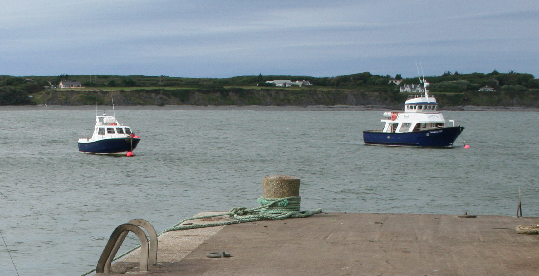
McNeill says that the Clarence was back on the Clyde in 1833. The Morning Post of 27 August 1833 quoted the Limerick Chronicle of 21 August 1833, which said that the Clarence had carried Captain Brown’s company of the 28th Regiment from Limerick to Kilrush on the previous day; it had also carried some detachments to the forts of Tarbert and Carrig Island. There are similar reports for July and September.

McRonald says that the Clarence operated on the Clyde between 1835 and 1837. Yet she is shown operating on the Shannon in City of Dublin Steam Packet Company ads for June, July, August and October of 1835, for every month in 1836 and for every month in 1837.

From 1838 onwards

To judge by the local newspapers, it was in 1839, not 1838, that Carlisle acquired a Clarence steamer. The Carlisle Journal of 12 January 1839 said that the canal company and the two steam companies had purchased a steamer called Clarence from Robert Napier of Glasgow: 96′ X 16′ X 8′ depth of hold, with a 45 hp engine and very handsome cabins, being “fitted up entirely for passengers”, although she was intended to tow lighters too. She was having an overhaul and a new boiler and was expected in Carlisle in two or three weeks.

On 23 February 1839 the Carlisle Patriot carried an ad seeking a master for the Clarence; it seems that Thomas Maling got the job, as the Patriot named him as master in its report, on 20 April 1839, of a collision involving the Clarence. On 1 July 1839 she took fifty gentlemen — the Managing Directors of the Carlisle and Newcastle Railway, the Commissioners of the Nith Navigation, the members of the two Carlisle and Liverpool steam navigation companies, all invited by the Commissioners of the Carlisle Canal Company — on a voyage of inspection of the buoyage of the Solway. Dinner was provided by Mr Gray of the Coffee House but, after the meal, the toasts and the speeches, several of the gentlemen were seasick on the way home. The voyage was reported in the Ayr Advertiser, or West Country Journal on 4 July 1839 and in the Carlisle Journal on 13 July 1839.

It is clear, then, that there was a Clarence on the Solway Firth in 1839. However, both during and after 1839 the Clarence continued to be advertised as serving on the Shannon. A long-running series of ads promoted “Cheap travelling between Dublin and Limerick” using the boats of the Grand Canal Company from Dublin to the Shannon and the steamers of the City of Dublin Steam Packet Company on the inland Shannon and its estuary. The estuary section began

GARRYOWEN, KINGSTOWN AND CLARENCE
Steamers on the Lower Shannon

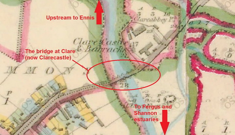
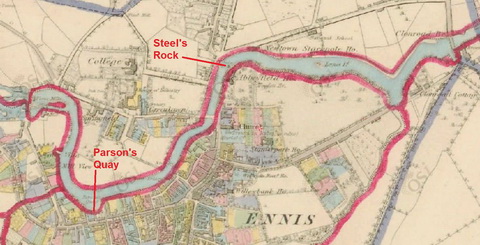
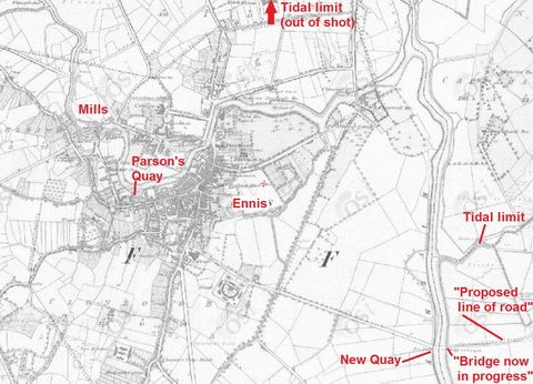
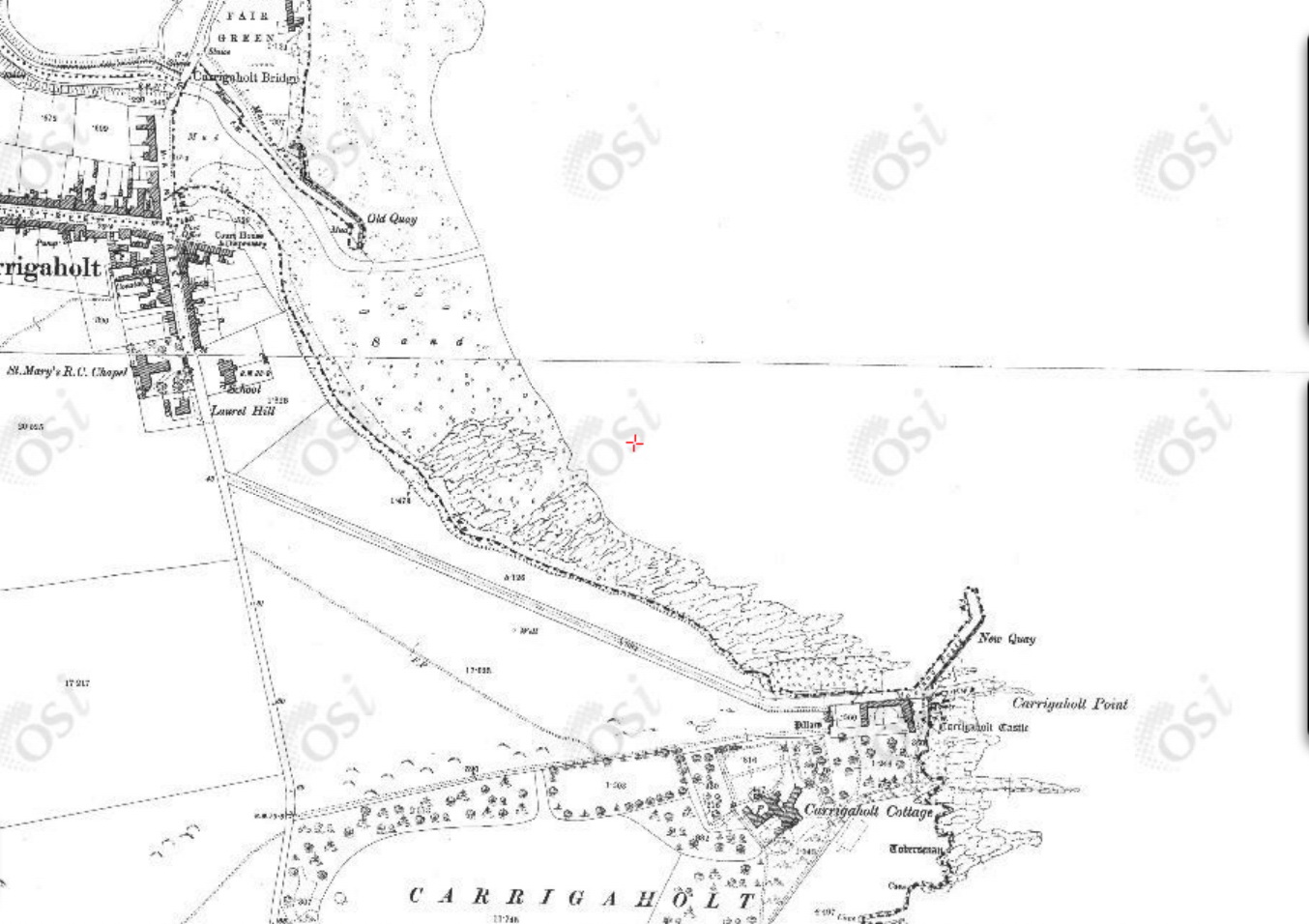
The ads appeared in many Irish newspapers and the series ran until 13 March 1841 when it appeared in the Warder and Dublin Weekly Mail. The ads were not updated to reflect seasonal changes in the estuary steamers’ sailings, but a paragraph about the service from Limerick to the town of Clare [now Clarecastle, near Ennis] was dropped in 1840. That presumably signified the ending of the service, but the Clarence continued to be listed amongst the estuary steamers until the ad’s final appearance in March 1841.

Up to December 1840, the City of Dublin Steam Packet Company ran its own series of ads, promoting its Irish Sea as well as its inland services, and listing its vessels. The list included the Clarence and the Kingstown amongst those “Plying on the Shannon”, for instance in the ad in the Dublin Weekly Herald of 12 December 1840. That ad does not seem to have been used in 1841.

The company also advertised in local newspapers: in 1839 the Clarence was mentioned in ads in the Clare Journal, and Ennis Advertiser on 2 May, 2 September, 7 October and 16 December. The same paper mentioned the Clarence in news reports on 30 May 1839 and 7 May 1840.

In 1841 the City of Dublin Steam Packet Company bought the Dover Castle from a rival operator on the Shannon estuary; its new-built iron steamer Erin go Bragh also joined the estuary fleet. The Clarence and the Kingstown seem to have left the estuary service at or around that time, the Clarence going first: the company’s ad in the Limerick Reporter of 9 March 1841 mentions the Kingstown and the Garryowen but not the Clarence.  By 11 May 1841, ads in the same paper listed the Garryowen and the Erin go Bragh; the Kingstown was no longer mentioned.

I have not been able to find any information about the history of the Clarence before it came to the Shannon estuary or after it left the estuary service. However, because there is so much evidence that a Clarence was still in service on the estuary after a Clarence was bought by the Carlisle Canal Company, I cannot accept that the two Clarences were the same vessel. I believe that there must have been a Shannon Clarence as well as a Clyde/Carlisle Clarence.

Sources

The newspapers referred to here were found on the British Newspaper Archive, a service is owned and run by Findmypast Newspaper Archive Limited in partnership with the British Library.

Holiday tours in Ireland VII

On Lough Derg

There are two Lough Dergs in Ireland. One is in the County of Donegal, within four and a half miles of Pettigoe, and is celebrated for its St Patrick’s Purgatory. The lake is but six miles long and four miles broad, and can hardly vie for scenery with its namesake in the south.

In order to reach this, probably one of the most exquisitely beautiful loughs in Ireland, it is necessary to make for the town of Killaloe. This can be done by leaving Euston at a quarter-past ten at night, when Killaloe is reached by 3.10 the following afternoon; or should the tourist prefer the Irish mail, he can leave at a quarter to nine in the evening and arrive at Killaloe at half-past eleven the following morning.

Few Irish towns contain so many antiquarian relics, combined with such beautiful scenery, for Killaloe stands on a hillside tufted with wood and surrounded by mountains. The old cathedral occupies the site of a church founded by St Dalua, in the sixth century. The present building dates from the twelfth century, with a central square tower whose effect is somewhat spoiled by a  modern crown. Its gem is a Hiberno-Romanesque doorway, which has, unfortunately, been blocked into the south wall of the nave. The precincts also contain a small stone-roofed church, said to date as far back as the sixth century.

The fishing is generally extremely good, though many prefer Castleconnell, some five miles to the south on the road to Limerick. In any case few portions of the United Kingdom furnish better salmon fishing than that reach of the river Shannon that lies between Killaloe and Castleconnell.

Lough Derg must, however, remain the greatest attraction of the district. It is twenty-three miles in length, and varies in breadth from two to six miles. Nothing can surpass the loveliness of the scene, especially on a fine summer’s day. On the one side the well-wooded and smiling hills of Limerick and Tipperary, where Thomthimia, with its slate quarries, slopes down to the water’s edge; while on the other the darker and more rugged mountains of Slieve Bernagh, Ballycuggeren, and the Crag form the most effective contrast.

Kincora was once the residence of Brian Boroimbh, King of Munster, and its magnificence was long the main theme of the ancient bards. But little now remains of the ancient palace beyond a long circular earthen fort, with a single vallum some twenty feet in height.

Inishcaltra or the Holy Island is, however, well worth a visit, and for this purpose it would be better to utilize the local service from either Scariff or Killaloe to Mountshannon, which faces the island. It possesses a round tower some eighty feet high, and seven churches, or cells, and oratories, the most remarkable of which is that of St Caimin, originally erected by him in the seventh, but subsequently rebuilt by Brian Borombh in the tenth century.

Scariff may this year be approached by steamer, and is a very prettily situated village, within access by road of Woodford, in County Galway, and Ennis in County Clare. The steamer then crosses the lake to Dromineer, at the mouth of the Nenagh river, where the ruins of the castle stand out with such picturesque effect. The bay is one of the most popular resorts, both of the angler and of the yachtsman; for to the latter it has earned a well-deserved reputation for its annual regatta.

The steamer then stops at Williamstown while a boat from Kilgarvan occasionally lands passengers and conveys them to the steamer. As soon as the new jetty has been constructed by the Board of Works, Woodford will be equally accessible; but there is no doubt that the approach to Portumna pier at the head of the Lough, lying as it does between the well-wooded demesnes of Portumna Castle on the one side and Belleisle and Slevoir on the other, presents one of the finest pictures that the lake discloses, for there we see the most striking contrast between the tame verdure of the river Shannon and the bold mountain scenery of Lough Derg.

It would be tedious to dwell on the varied beauties of those innumerable seats that dot the shores of the lake on all sides; suffice it to say that few parts of the United Kingdom present as many diverse attractions as this wide expanse of water. Much as one may appreciate Loch Lomond, Loch Maree, or the Caledonian Canal, this Irish lough certainly surpasses them; and much gratitude is due to the Shannon Development Company for bringing within such easy access of the average tourist a wealth of scenery that certainly equals, if it is not finer, the finest spots that either Scotland, Norway, or Switzerland can offer.

This is, however, but half the trip from Killaloe to Athlone. Portumna is chiefly remarkable for the ruins of a Dominican priory founded in the thirteenth century, as well as for the Castle, the property of Lord Clanricarde, in which he has not resided since his succession to the estate. The village of Lorrha, three miles further up, also contains the ruins of a Dominican abbey, an oblong pile 120 ft long, as well as a castle and two old ecclesiastical buildings called by the peasantry the English churches, owing to their having been built by Norman settlers.

The river now assumes a totally novel character, winding by graceful curves through low-lying but rich meadow lands. Their luxuriant appearance is largely due to the fact that they are usually submerged under the waters of the river during the winter months.

Meelick Abbey is next passed. It was founded by the Franciscans in the twelfth century, and was at one time a sumptuous structure, but is now a roofless and mouldering ruin; and a beautiful pillar which formerly supported the arches on the south side has been torn away with ruthless vandalism, in order to make headstones for the graves in the cemetery.

Banagher can boast of a fine stone bridge, opened some fifty years ago to replace the preceding structure, which displayed no less than twenty-three arches of various forms, with massive piers between, and was so narrow that only one carriage could pass at a time.

Shannon Harbour is best known from the description of its hotel in Lever’s Jack Hinton, but that building is now let in tenements. Shannon Bridge is one of the three fortified passes built to guard the Shannon, and is but four miles from Clonfert, whose cathedral, now being restored, contains one of the finest Hiberno-Romanesque doorways to be found in the three kingdoms.

Few spots, however, offer greater attractions to the antiquary than do the celebrated seven churches of Clonmacnoise. The most remarkable of these are the Diamhliag Mhor or Great Church, which dates from the fourteenth, and Fineens Church, built in the thirteenth century. The former was originally the work of Flann, King of Ireland, in 909, and contains several bits, more especially the sandstone capitals of the west doorway, that may be traced to the earlier period. Besides these churches, there is much to be seen at Clonmacnoise, which includes among its ruins the episcopal palace and castle of the O’Melaghlins, a nunnery, two round towers, Celtic crosses, and inscribed stones. The grand cross, formed of a single stone 15 ft high and elaborately carved, surpasses every other in beauty of execution and elaborate detail.

Though the tourist may gaze upon Clonmacnoise as he approaches and leaves it and enjoys a particularly fine view of its beauties as he passes by the curve of the river on whose banks it is situated, no provision has yet been made to enable him either to land or to make a closer acquaintance of its many beauties as he passes by. This is due to the refusal on the part of its proprietor to meet the proposals of the company. It is, however, to be hoped that more favourable terms may be made in the future, as the traveller must now proceed straight to Athlone and visit the ruins from there either by road or by water.

Much more might be said of Lough Derg as well as of the Shannon from Killaloe to Athlone. Fair hotel accommodation may be obtained at Killaloe, Dromineer, Portumna, and Athlone at from eight to nine shillings a day. Lodgings can also be procured at Killaloe, where the proprietors have learned to cater for the requirements of those anglers who frequent this highly-favoured spot.

Return tickets may be obtained from Euston to Killaloe by the North Wall at
£4 13s 6d first, £2 16s second, and £2 third class. Lough Derg may also be visited from Athlone by the Midland Great Western Railway from Broadstone. The fares by Kingstown and the mail are somewhat dearer.

Pall Mall Gazette 1 August 1898

From the British Newspaper Archive run by Findmypast Newspaper Archive Limited, in partnership with the British Library.

Travelling

Newry steam-packet

The Waterloo will sail hence for Warren’s Point, This Day (FRIDAY) the 16th instant, at Three o’clock; on TUESDAY the 20th, and SUNDAY the 25th instant.

Dublin steam-packets

The Mountaineer, C H Townley, will sail hence for Dublin, on SUNDAY next, the 18th instant, at Three o’clock.

The Belfast will also shortly resume her station between this Port and Dublin. These being the only Steam-packets which land their Passengers AT THE CITY, by them the Public avoid the dangerous landing at Dunleary in small boats, the hazardous and expensive mode of conveyance thence to Dublin (a distance of several miles), the disagreeable disputes with boatmen, the impositions practised by the lowest order of society, with various other difficulties; against which the complaints are universal.

Days of sailing from Liverpool will be, Sunday, Tuesday, Thursday, and Saturday.

Apply at the Packet-office, bottom of Redcross-street, or to WILLIAM STEWART.

Liverpool Mercury 16 May 1823

From the British Newspaper Archive run by Findmypast Newspaper Archive Limited, in partnership with the British Library.

The madness of Daniel O’Connell

In 1828 Daniel O’Connell was elected to the House of Commons for County Clare. As a Roman Catholic, he could not take the Oath of Supremacy [Frizzell, the illustrator, seems to have got his date wrong] and so could not take his seat, but the Emancipation Act 1829 removed that obstacle. However, it was not retrospective, so O’Connell had to stand again in County Clare; he was elected unopposed in July 1829.

On Sunday 31 January 1830 “The Patriotic member for Clare, Daniel O’Connell Esq, sailed from Howth […] at 8 o’clock, for England, to attend his Parliamentary duties” [Tipperary Free Press 3 February 1830] and when Parliament resumed on Thursday 4 February 1830

Daniel O’Connell Esq took the oaths prescribed by the Catholic Relief Bill, and his seat as a member for the county of Clare. The honourable member seated himself on the third row of the opposition side of the house, and exactly opposite to Mr Peel.

[London] Standard 5 February 1830

O’Connell’s letter

Before he left Ireland, O’Connell issued a letter to “the people of the County of Clare”; according to the Morning Post of 20 January 1830 it was issued from the Parliamentary Intelligence Office, 26 Stephen-street, on 15 January 1830. It began

MY FRIENDS AND BRETHREN — I take up the pledges which I made to you when I called on you to repose in me the high and awful trust of being your Representative. I will endeavour honestly to redeem those pledges.

For this purpose I propose to leave Dublin on the 26th of this month. I go off at the commencement of Term, and I shall be absent for two, if not three, entire Terms. Men will sneer at me for talking of these sacrifices to public duty, who, themselves, seek their own individual advantage in all their political exertions. I readily consent, and will proceed to do my duty to you with alacrity, zeal, and perseverance.

There was more along those lines, and then he said

My Parliamentary duties will naturally divide themselves into two distinct branches: the first relates to your local concerns; the second, to those mighty interests in which your prosperity is involved with that of all Ireland.

There were four local concerns: two about canals and two about ports.

An asylum harbour

West Clare [OSI ~1900]

West Clare [OSI ~1900]

The first port proposal was to build an “asylum harbour” on the west coast. An asylum harbour was a port that provided refuge in storms: Kingstown [Dun Laoghaire] was an asylum harbour (amongst other things). O’Connell thought an asylum harbour on the west coast would provide a safe haven for vessels coming across the Atlantic, feeling the force of the Gulf Stream and the prevailing westerly winds: they risked being “embayed on the iron-bound coast between Loop Head and Hag’s Head” where the Cliffs of Moher are. It is not clear how vessels could safely enter such a harbour, given that it would require them to come close to the lee shore, but O’Connell said

The existence of an asylum harbour on Malbay would be of the greatest value to the trade of the British Isles. I do hope to be able to realise this project, in the execution of which the talents of my most valued friend THOMAS STEELE would be found to be most highly beneficial to that county which he adorns by his abilities and patriotism.

O’Connell no doubt had in mind Thomas Steele’s talents as a urinator.

Carrigaholt and Kilrush

O’Connell also wanted

[…] the construction of two suitable piers, with other works, completely to protect shipping; the one on the Bay of Carrigaholt, the other on Scattery or Kilrush Harbour.

The commerce of Kerry, Clare, and Limerick, are interested in these works. We shall certainly obtain the powerful assistance of the patriotic Member for Limerick. His assiduity, information, and public spirit, render him a model which Irish representatives should imitate.

He wasn’t quite as complimentary about Thomas Spring Rice a few years later, when O’Connell’s five-hour speech in favour of the repeal of the Acts of Union was topped by Spring Rice’s six-hour contribution.

Here is a page about Kilrush. I haven’t done a page about Carrigaholt so there follows some information to fill the gap until I get around to doing it properly.

The earlier pier at Carrigaholt was built by Alexander Nimmo and was more successful than his harbour down the road at Kilbaha. Despite the description on the DIA site, I assume that it is the one shown on the 6″ OSI map.

Carrigaholt map 1

The old quay at Carrigaholt (OSI ~1840)

Here’s a photo.

Carrigaholt August 2011 7_resize

The old quay at Carrigaholt as extended

Commander James Wolfe’s Sailing Directions [PDF], compiled some time before 1848, say

Round Kilcradan, to the northward, and protected by it, is the anchorage or Road of Carrigaholt. It is a very fine secure anchorage with all winds from the westward, but from the ENE to S much sea prevails, though not heavy enough to endanger a vessel well found in ground tackling. With SW gales, a long rolling swell sets in round Kilcradan Point, which renders riding here at those times very uneasy. These roads have the advantage of being free from any great strength of tide.

The ground is level all over the road, but from six fathoms it shoals gradually towards the shores; the bottom, of sand over clay and mud, is generally considered good holding ground. The best anchorage for a large ship is with the top of Ray Hill in one with the Coast-guard Watchhouse W ¾ N, and Moyarta Lodge, just open of the point on which Carrigaholt Castle stands, nearly N ½ W in 5½ to 6 fathoms low-water springs.

The shore forms two smaller bays, the northern of which takes its name from the village which stands on its shores, and the southern is called Kilcradan. Both are very flat and shallow; in the latter there is a coast-guard station, but it is not a boarding station. The village is a poor miserable place, and does not afford supplies of any sort, nor can a ship complete water here. At the village is a small pier, accessible only (to loaded boats) at high water. It is used by the turf-boats, though most of these load on the beach.

Carrigaholt Castle, a high square tower on the point, and the chapel, a cruciform building, with its belfry, are very conspicuous objects.

As those directions were written some years ago, I suggest that you should not use them for navigating nowadays. You can tell that they are out of date because the village does now afford most excellent supplies, chiefly in the Long Dock. The Long Dock does not, alas, seem to have updated its website since 2006, having gone over to the Dark Side of FaceTweet which, at least to me, is impossible to search, so I can’t point you to a list of the interesting beers the Long Dock stocks in addition to its excellent food.

My spies tell me that, if you happen to be driving a barge from, say, Donegal to Limerick — not that I’m encouraging you to do anything of the sort — Mr Luke Aston of the Carrigaholt Sea Angling Centre will be able to advise on moorings. He’s got a Lochin, so he must be sound. You can have a day’s sea angling with him or a day watching dolphins with Geoff Magee (to whom I owe a glass of sherry), followed by a meal at the Long Dock: what more could you want?

Carrigaholt new harbour 24

Luke Aston’s Lochin [I assume] and Geoff Magee’s Draíocht

Well, if you were Daniel O’Connell, you’d want a new pier or quay.

Carrigaholt map 2

Carrigaholt old and new quays [OSI ~1900]

The old quay was extended at some stage and a new quay was built at the castle. I don’t know have dates for either of those, but I think the new quay was built as a fisheries pier in the 1890s. If, Gentle Reader, you know the dates, and can save me from having to plough through years of Board of Works reports, do please leave a Comment below.

If O’Connell had any role in having the old pier extended, that would have been the only one of his four local concerns on which he had any success, although he could also claim a minor supporting role in having the pier at Cappa, Kilrush, extended in the 1840s.

Carrigaholt new harbour 30_resize

Carrigaholt new quay seen from the old quay

The canal to Ennis

Daniel O’Connell’s third local concern was

The opening of the navigation of the Fergus to Ennis, so as to make that town a sea-port. The tide rises about half a mile beyond that town; and if there were a short canal cut near the village of Clare, of about 300 yards, vessels of burden could deliver their cargoes at Ennis, and carry away the produce of the country to the most remote markets.

This was a proposal that came up several times, but it was never implemented. The Shannon Commissioners built a fine quay at Clare [now Clarecastle] in the 1840s, but they left it as the head of the navigation.

Wolfe’s Sailing Directions made it clear that the passage of the Fergus estuary was not to be undertaken lightly:

A mile to the eastward of the Beeves is the principal and only navigable entrance to the River Fergus, which comes from the NNE amid vast banks of mud, and numerous islets and rocks. Having passed the Beeves, steer up for Feenish Island till you bring the tall square tower of an old castle (called Court Brown) in one with the north point of Low Island, WNW¼W, which is studded with white houses.

You must then keep rather more to the northward for the round hill of Coney Island, until Cannon Castle is in one with the peak of Grady Island, W¼S, when you must bear away for the east point of Coney Island; you will then shortly come into five and six fathoms, where you must anchor with the sharp peak of Coney Island bearing N by E and Cannon Castle WSW1/3W in about six fathoms soft muddy bottom.

Grady's and Cannon Islands from off Innish Corker [Admiralty Surveyors 1841 by kind permission of the UK National Archives]

Grady’s and Cannon Islands from off Innish Corker [Admiralty Surveyors 1841 by kind permission of the UK National Archives]

Beyond this it would be impossible to proceed without a pilot. The river beyond Coney Island winds through vast banks of mud, extending from 1 to 1½ miles from the shore, decreasing gradually in width from 600 yards, and varying in depth from nine to three feet up to the town of Clare, nearly seven miles in a direct line, and nine following the channel.

At Clare the bed of the river is dry at low water, but there is a quay, alongside of which vessels load. Clare is a miserable place, though the shipping port of Ennis. It is a military station.

Pilots may be had at Low Island, but no vessel above 150 tons should go up to Clare.

Clare_resize

The bridge at Clare[castle] [OSI ~1840]

As well as a lock, some opening mechanism would have been required for vessels to get though the bridge, which was not the current flat structure; here is a photo of the old bridge.

Clarecastle Fergus Navigation June 2007 07_resize

Looking from the Shannon Commissioners 1840s quay at Clare towards the bridge

Clarecastle November 2014 16_resize

Clarecastle gandalows at the quay

Clarecastle old quay from far side 03_resize

The quay from across the river

Very low water at Clarecastle 5_resize

Low water at Clarecastle

The interesting thing is that, even though a boat could not pass through Clarecastle to the estuary, there must have been some navigation on the Fergus; I would like to know more about what and how much was carried when. There was a quay, Parson’s Quay, in Ennis …

Ennis_resize

Parson’s Quay in Ennis [OSI ~1840]

… and another quay further downstream. I put the next map in black and white to make it easier to see things; it’s scaled down from the Ennis map.

Quays_resize

Ennis and district [OSI ~1840]

The map also shows that O’Connell was right about the tide: it did flow well above Ennis.

The other canal

Although the first three proposals were not implemented, and probably would have been either uneconomic or unsuccessful, they weren’t absolutely bonkers. His fourth idea, though, was nuts.

The fourth local concern relates to a communication by a canal from the bay of Galway to Limerick. The point of junction should be somewhere in the neighbourhood of Killaloe. The entire of the western and midland counties of Ireland would derive great advantage from such a canal.

Getting through the hills above Killaloe would have been fun. But the real problem with the proposal is that O’Connell fundamentally misunderstood the nature of the Irish economy. Each Irish port served its own hinterland, shipping out its produce and shipping in coal, timber and other overseas goods. But the ports did not need to trade with each other, as each performed the same function.

The exception to that was created by the application of steam on the inland Shannon, which allowed perishable produce from the Limerick area to be carried across Ireland for export through Dublin to Britain. That role was soon taken over by the railways.

But there was no point in connecting two westward-facing ports by canal: if they needed to trade with each other, they could do so by sea.

My OSI logo and permit number for website

Rail

In evidence to the Select Committee appointed to inquire into the amount of advances made by the Commissioners of Public Works in Ireland on 22 May 1835 James Pim, Treasurer to the Dublin and Kingstown Railway, said:

1431. Can you tell the average length of time which the [horse-drawn] cars took in going [between Dublin and Kingstown/Dun Laoghaire], and the distance? — I should think the average length of time taken by the cars after they got in motion, was probably 45 or 50 minutes, from Dublin to Kingstown.

1432. Are you not able to do it in 11 minutes? — Easily.

I’ve just had a look at the DART website. As far as I can see, the DART takes 19 minutes to travel from Dublin Pearse [Westland Row] to Dun Laoghaire [Kingstown]. Is the difference attributable to the number of stops?

What happened to the Wingate?

On 22 September 1870 the Irish Times said that the owner of the new steam launch Wingate was

 willing, in case of six or eight gentlemen joining, to defray the expenses of making a cruise through the Grand Canal, down the Shannon to Limerick, and then up the river to its source.

The notice said that the launch would steam through Loughs Allen, Kay [now Key], Dee and Derg. I don’t know where Lough Dee is: perhaps it’s a typo (or printo) for Ree. There would be a side-trip to Lough Gill, taking the Lady of the Lake steamer to Sligo, and the launch would then take the Leitrim Canal (now the Shannon–Erne Waterway) to the Erne, covering the whole of it from Belturbet to Belleek.

After that, the Wingate would travel by the Ulster Canal to Lough Neagh and Coleraine, returning “either by Newry or the Royal Canal” to Dublin. It is not clear how the Royal Canal (which links Dublin to the Shannon) could form part of a route from Lough Neagh to Dublin.

Whoever wrote the notice suggested that the cruise would take ten days, which suggests a degree of optimism not consonant with a knowledge of the distances involved.

An ad appeared in the next day’s paper, offering for sale the Wingate, a composite steam screw launch lying at Kingstown (Dun Laoghaire), and saying that a cruise of 10–12 days, only as far as Lough Erne, could be arranged pending sale.

According to the invaluable Clydebuilt database, a launch called Wingate was built by T Wingate & Company of Glasgow in an unspecified year. But why was a new launch being offered for sale?

Richard Heaton’s genealogy website includes a collection of newspapers, and one of them, the Supplement to the Warder for 3 [not 31] September 1870, has an account of how the Wingate reached Dublin (Kingstown) from Scotland, where the owner had failed to find half a dozen hardy souls willing to accompany him on a tour of the Western Isles and the Highlands. This is scarcely surprising as the Wingate was an open launch only 35 feet long.

So who owned the Wingate? Did the owner manage to reach the Irish inland waterways, or was he forced to sell his launch? I would welcome more information.