Category Archives: Ashore

Big it up for the OSI

I don’t know whether there is any official award scheme for contributions to historical research but, if there is, I reckon Ordnance Survey Ireland should get one. By making available, free, online versions of the OSI 6″ [~1840s] and 25″ [~1900] maps, they have provided amateur historians with an invaluable resource.

Using their public viewer, you can go to somewhere like Lecarrow, on Lough Ree, and look at what it was like before the Famine, around the start of the twentieth century or, using the Ortho options, in 1995, 2000 and 2005. As well, of course, as a bang-up-to-date map of Lecarrow today.

The most recent map was updated recently and the site fell over altogether for a while, then operated without the historical maps for another while. I suspect that I wasn’t the only person to realise, while it was down, how valuable the site was (and how far superior, at least for historical study, to the godawful Ordnance Survey of Northern Ireland version).

So big it up for Ordnance Survey Ireland: delighted it’s back up again.

Re-invention or re-creation?

I realise that many folk visit this website in order to find out what is hip and trendy, cool and with-it, in all sorts of fields, from beer to boating, casual dining to cost-benefit analysis. So, in order to keep readers down wid da kidz in da hood [as the young folk say], I’ve been checking out the latest, baddest [which means ‘goodest’, I gather, or what in the old days we would have called ‘best’], grooviest developments on tinterweb. It’s a thing called FaceTweet, and those cool dudes at Waterways Ireland have one of them. Hep to the jive, daddy-o [which means ‘How perfectly splendid, old boy’.]

As far as I can see, FaceTweet is in general intended for folk whose attention span renders them unable to read more than a single paragraph of continuous prose. But brevity is sometimes the soul of wit and good goods come in small parcels [sentiments for whose veracity I have not found peer-reviewed evidence]. And I was interested in Waterways Ireland’s self-description on the page:

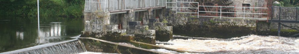
Waterways Ireland is the Recreation Authority for over 1000km of Ireland’s Inland navigable waterways.

That phrase, Recreation Authority, does not occur in Waterways Ireland’s Business Plan 2015 [as approved by the North South Ministerial Council on 18 December 2014 and screwed up by the Council shortly afterwards] or in its Corporate Plan 2014–2016 [ditto]. Nor, according to its own search engine, is the phrase used on Waterways Ireland’s proper website [the search engine rather bafflingly reports “We don’t have any refiners to show you”].

Yet the concept of Waterways Ireland as a Recreation Authority is almost entirely in tune with the thinking underlying both of the plans and it is the neatest encapsulation I have yet seen of what WI is about.

I put in ‘almost’ there because the Corporate Plan‘s Executive Summary includes this:

Central to our vision for the future is the development of recreational, heritage and environmental opportunities that link people, history and nature, providing both local communities and visitors with compelling reasons to spend more time in the waterways environment.

While I’m all — well, somewhat — in favour of heritage and environment, the words seem to sit uneasily in that sentence: added as a form of ritual obeisance to the shade of Michael D Higgins, who ripped the rivers and canals from the sheltering embrace of the Office of Public Works engineers and proclaimed the waterways to be heritage artefacts. Heritage is no longer of great interest to TPTB and most people’s experience of it [whatever it is] is as entertainment or recreation; much the same applies to environment, which — for most people — is of interest only as providing a scenic background for more interesting activities.

So both heritage and environment can be subsumed under the heading of recreation, leaving Waterways Ireland with a neat, well-focused description of itself, a subheading for its title, and one that matches its Mission and Vision.

Mind you, it’s not entirely clear what a recreation authority is — Google finds relatively few [129000] instances of the term’s use, most of them in the Americas — but that might be no harm.

Waterways Ireland — the recreation authority

Hep to the jive, daddy-o: I like it.


Chains at the Black Bridge

It seems that the city edition of the Limerick Leader dated Saturday May 16 2015 carries a story saying that funding has been approved for the repair of the Black Bridge at Plassey. I can’t find the story on the Leader‘s website and I can’t find anything about it anywhere else [there is a limit to the amount of my life I am willing to spend trying to find anything on the Limerick Council website] except on the Leader‘s FaceTweet page, where I can expand the city edition front page.

There is a photo of several councillors, which of course is wonderful: no day is wasted if it offers an opportunity of looking at a photo of local councillors, especially important ones with chains.

From what I can read of the text, it seems that “councillors in City East” [which is not one of the Limerick districts listed here] are willing to spend €50,000 “to start work to make the walkway safe again”. And they hope that Clare County Council, the University of Limerick and Waterways Ireland will “also row in behind the project”.

Now, half a loaf is better than no bread, and €50,000 is better than a poke in the eye from a blind horse, but it’s not going to go very far towards the cost of repairing the Black Bridge. I don’t known whether it would even cover the cost of a full survey.

I’m sure that Waterways Ireland would be delighted to help, if the Department of Fairytales hadn’t raided its coffers to pay for Saunderson’s Sheugh. I have reason to believe that the university was willing to help — and that Clare County Council was not. I submitted a Freedom of Information request to the university, asking it for [recent] records relating to the Black Bridge. The university gave me three extracts from meetings of the Limerick Smarter Travel Steering Group:

9 January 2013
Funding not in place for Black Bridge

21 November 2013
Black Bridge: UL indicated that funding may be available from UL. LST [Limerick Smarter Travel] has indicated funding in the order of €100,000. UL may be able to mach [sic] this. Request for funding to be made formally to UL by LCCC and to include surveys and reports on bridge to date.

18 September 2014
RR said UL have set aside €100,000 towards Black bridge refurbishment but will need matched funding from LA [presumably local authority]. Black bridge will require a detailed study to identify what repair work will need to be carried out, also an AA study will be required, and proper consents from ABP [An Bord Pleanála?]. Funding currently not available from LA.
PON spoke to Clare Co Co. No funding available from them.
PC Department will not fund a pedestrian bridge.
RR can we look for alternative funding options, UL will ring fence for the moment.

An AA study is, I think, an Appropriate Assessment, a sort of employment creation scheme for bird-watchers who can read European directives [and sooner them than me].

The point to be remembered here is that Limerick County Council leased the bridge and undertook to keep it in repair; there is no obligation on Waterways Ireland, Clare County Council or the University of Limerick to spend a penny on it. The two parties on whom lies the responsibility for repairing the bridge are the Limerick Council and the Department of Finance, which latter has the power, under the lease, to do the work and charge it to the council. That would be a better use of its time and money than an unnecessary and intrusive footbridge in the middle of Limerick.

Riverfest in Limerick

Riverfest is an annual, er, happening in Limerick. I don’t know much about it: I’ve never been because I dislike both crowds and festivals and it would take something remarkably interesting to outweigh my dislike and persuade me to attend any part of the thing. I took notice of this year’s event only because I wanted to find out what streets would be closed to traffic; the festival organisers did not, alas, think to provide a map showing the closures.

I have only two other comments on the event:

  • the brochure [PDF] mentions a workshop called “Craft a River” but doesn’t say what, or indeed where, it is
  • in a city whose history is so intertwined with that of the food industry, and which has, in the Milk Market, the best Irish market outside Cork, it seems ludicrous to import a “continental market” instead of showcasing local producers.

But I acknowledge that I am not really entitled to comment; Brian Leddin, on the other hand, has a better informed view.

Hurrah for the red, white and orange

Colour discrimination seems to be rampant in Ireland. Of the sets of colours [red, white and blue] and [green, white and orange], there is Official Endorsement of two, green and blue, while red, white and orange are ignored. Even the North/South Ministerial Council has got in on the act, with a whole page on its website about greenways and blueways. They must have been overdosing on the Erne flag. Their page is a list of links, sort of plonked there without context or explanation, but there’s probably some hands-across-the-borderism or something going on.

I read in the Guardian today of a proposal for a greenway on the former railway line between Roscrea and Portumna via Birr. And a jolly good thing too, but how many greenways and blueways can one small island accommodate? How thinly will the tourists be spread? And what about those of us who hate walking, cycling, kayaking and other such energetic pursuits?

Backtracking the Barrow trackway

Some time ago I put up a page about the Barrow trackway [towing-path]. For some reason, the page disappeared shortly afterwards. I have now recreated it; unless or until it disappears again, it is here.

Momentous day on the Ulster Canal

The day work finally began on the Ulster Canal, after many years of planning and consideration. The opening ceremony was attended by many of the local gentry; the royal standard was hoisted, a 21-gun salute was fired, hundreds of people had turned up to see it and “the country people were liberally supplied with ale”. That evening, those most involved dined together in Caledon with toasts to the king, to the queen and the rest of the royal family and to the army and navy.

I suppose that similar festivities would attend the start of work on any canal nowadays, but that was back in 1835, and the canal was the real Ulster Canal.

The K&A in slow time

The Dundas aqueduct

The Dundas aqueduct

There is a television station or channel called BBC 4. On Tuesday next, 5 May 2015, it will broadcast

A two-hour, real-time canal boat journey down one of Britain’s most historic waterways, the Kennet and Avon Canal, from Top Lock in Bath to the Dundas Aqueduct. Using an uninterrupted single shot, the film is a rich and absorbing antidote to the frenetic pace and white noise of modern life.

More info here. I do not know whether folk outwith HM Realm can watch the programme on television or on tinterweb.

Portland House

Portland House from the Shannon

Chimneys of Portland House seen from the Shannon

Here is a good article about the destruction of Portland House, just upstream of Portumna on the east bank of the Shannon, by ruffians in 1938.

Early water transport

In a piece about the Augustinian Priory at Athassel, near Golden in Co Tipperary, I wrote

But the really extraordinary thing about Athassel, at least from the waterways viewpoint, is that Dundry stone was used for sculptural (but not for structural) work.

Now, that may mean as little to you as it did to me, until I looked it up and found that Dundry is in Somerset, on the Bristol Channel. The stone could have been taken from there to Waterford by sea and it must have been hauled up the Suir from there.

In the last century, the horse-drawn traffic up the Suir to Clonmel ceased, and Carrick-on-Suir became the effective head of the navigation. But Athassel is at least another twenty miles upstream from Clonmel, and cargoes were brought up there seven hundred or so years ago.

However, traffic in materials for religious establishments was not all one way, and I am indebted to John Ditchfield for the information that some of the oak used in the roof of Salisbury Cathedral was felled in Ireland, on or near the east coast, in the spring of 1222 and used by 1225. Timber from 75 trees has been identified and at least one shipment, by William of Dublin, is recorded in 1224.

Inside Salisbury Cathedral (courtesy of John Ditchfield 2015)

Inside Salisbury Cathedral (courtesy of John Ditchfield 2015)

A 2003 story in the Telegraph says

The wood was bought from “William of Dublin” and carted from Bristol or Southampton.

However, in the English Heritage [now Historic England] report from 2002 on The Tree-Ring Dating of the Roof Carpentry of the Eastern Chapels, North Nave Triforium, and North Porch, Salisbury Cathedral, Wiltshire [PDF], I found nothing about how the timber got from the English coast to Salisbury, which is some distance inland.

It may be, of course, that the Patent Rolls for AD 1224 say what English port was used and how the timber was transported from there to Salisbury. I do not, alas, have a copy of the Patent Rolls to hand and Messrs Google don’t seem to have been able to get hold of them for digitising.

But if the Patent Rolls don’t provide evidence to the contrary, my guess would be that the timber was carried up the Avon. And that might enable Rollalot to insert another date between the first and second in the history of Avon navigation on this page; Rollalot, like me, has read Douglas Caffyn on the right to navigate on rivers.