There was a Dáil debate last week about the scrapping of the Naomh Éanna; nobody gave any good reason for keeping the vessel. Preservation proponents decided not to ask for money: instead they wanted the thing left hanging around while they worked out an “investment plan“, something that they could have done at any time over the last twenty-five years.
The funniest part was the final paragraph of the third contribution by Éamon Ó Cuív [FF, Galway West], who said:
Agus muid ag caint faoi stair, is fiú a lua gur úsáid RTÉ an bád seo le haghaidh scannán an-mhaith a rinne siad, “The Treaty”. Nuair a bhí Collins ag dul go Sasana sa scannán, is ar an mbád seo, seachas bád amuigh i nDún Laoghaire, a bhí sé. Tá ceangal stairiúil le hócáidí thar a bheith stairiúil ag an mbád sin. Níl ag teastáil ach cúpla mí ionas go mbeadh deis ag daoine rud éigin a eagrú. Beidh beagáinín slándáil i gceist. B’fhéidir go mbeidh costas beag ar Uiscebhealaí Éireann. Ní dóigh liom go mbeidh sé suntasach i gcomhthéacs an maitheas a d’fhéadfadh sé seo a dhéanamh dá gcoinneofaí an bád. Má táimid ag lord eiseamláir don rud a bhféadfadh a bheith i gcest, níl le déanamh againn ach cuairt a thabhairt ar Faing agus dul isteach ar an flying boat ansin.
Learned readers will recognise that Google Translate’s version needs improvement:
And we are talking about history, it is worth mentioning that RTÉ use the boat for a very good film they made, “The Treaty “. When Collins was going to England in the film, most of the boats, except boat out in Dun Laoghaire, it was. There are historical connections with historical events particularly at this boat. All you need is a few months so that people have the opportunity to organize something. The security bit concerned. There may be a small cost of Waterways Ireland. I do not think it will be significant in the context of the good it could do this if the boat is kept. If we lord model for what could be gcest, we do not just visit Foynes and go flying into the boat then.
So the Naomh Éanna is valuable because it was used as a film set. And Foynes flying-boat museum shows what could be done.
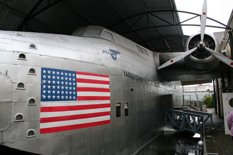
Foynes flying-boat
Up to a point, Lord Copper. You see — and I know this may come as a shock — the flying-boat on display at Foynes is not actually a real flying-boat. It’s not even a portion of a real flying-boat. It’s a reproduction of a portion of a flying-boat and it was built by a film-set designer.
If anyone really needs to be able to see around a small mid-twentieth-century ship, I suspect that the Foynes folk could provide a replica that would cost less to keep than the real thing.
Alternatively, if Dublin needs another example of a locally built vessel, and one different in form from the Cill Áirne, it could take over the Curraghgour II or the Coill an Eo, both also built in Dublin. Maybe the preservationists should start now on their investment planning.
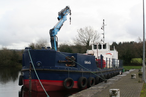
Coill an Eo
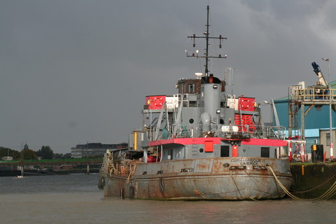
Curraghgour II

 [Sorry, Google: couldn’t get the embedding to work properly. WordPress’s whitelist omits Google, though maps seem to work OK. Here’s the original.]


