That would be the Bishop of the United Church of England and Ireland, as established by the fifth article of the Acts of Union of 1800, of course.
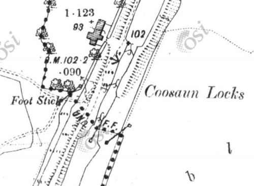
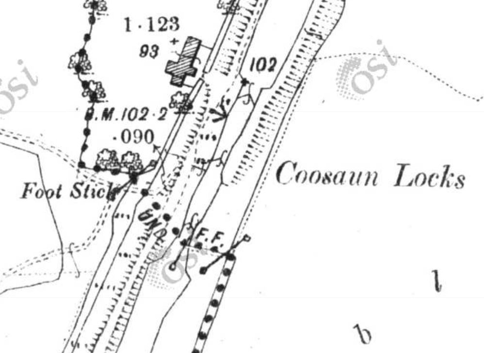
Cussane lock (OSI 25″ ~1900)
Cussane (or Coosaun, as above) Lock was the furthest downstream of the three locks on the Killaloe Canal. It was submerged by the “Flooded Area” created by Parteen Villa Weir as part of the Ardnacrusha hydroelectric scheme.
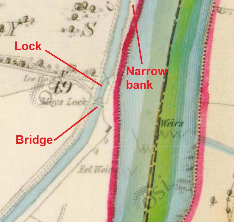
The middle lock on the Killaloe Canal is at Moys and its remains are visible, just above the water, in normal non-flood conditions. It is (or was until recently) still possible to go through it by (small) boat, though of course without needing to use the lock mechanisms.
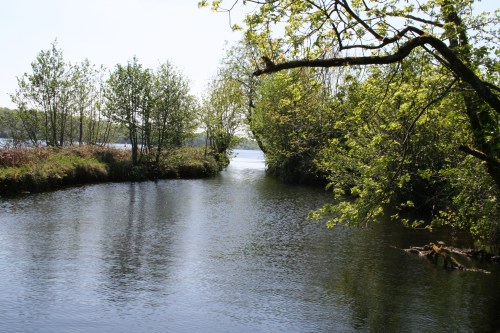
Approaching Moys Lock from upstream
However, although the lock itself survives, the bridge that crossed it is no longer there. It was shown on the 6″ (~1840) and 25″ (~1900) Ordnance Survey maps; I would guess that it was removed as part of the Ardnacrusha works, but I don’t know and would welcome information.

The lock and bridge at Moys (OSI 6″ ~1840)
The other thing I don’t know about the bridge is why it was built in the first place. Hely Dutton [Statistical Survey of the County of Clare, with observations on the means of improvement; drawn up for the consideration, and by direction of the Dublin Society The Dublin Society, Dublin 1808] wrote that
It seems to be the general opinion in Killaloe, that the canal has been cut in the most improper direction; they think it should have been brought in a valley between Killaloe and Dr. Parker’s, and to the north of the Bishop’s house, and not parallel to the Shannon as at present. Bishop Bernard offered several thousand pounds, if this line had been pursued; for, instead of cutting his demesne off from the Shannon, as at present it does, it would have gone at the back of his house; if this was the only objection, I think the engineer acted very impartially, as all public officers should, but very seldom do.
That suggests that the bishop was not best pleased to have a canal in front of his house; if he was willing to pay “several thousand pounds” to have the canal put somewhere else, the Limerick Navigation’s promoters must have been able to deploy considerable firepower (political and financial) to overcome his opposition. I wonder whether promotion to Limerick might have helped: according to a later estimate [Dublin Weekly Register 21 September 1822], promotion from Killaloe to Limerick would have increased a bishop’s income from £7000 to £8000 a year.
Charlotte Murphy [“The Limerick Navigation Company 1697–1836” in North Munster Archaeological Society Journal Vol 22 1980], describing John Brownrigg’s report on the navigation in 1801, said
This latter [Moys] lock had a bridge over the tail to accommodate the Bishop of Killaloe, whose demesne was served by the canal.
But what accommodation did the bishop need? A small strip of land downstream of the lock was insulated by the canal; perhaps the bridge provided access for cattle.
Another possibility is that the bridge provided access to the episcopal eel weirs. According to Mr Blackburne QC, addressing the Shannon Commissioners in 1837 on behalf of the Bishop of Killaloe and Sir Gilbert King Bart of Jamestown [Saunders’s News-Letter 29 December 1837],
The bishop, his tenants, and his predecessors had from time immemorial been in the habit of using twenty-five eel weirs, extending from the tail of Lough Dearg down the whole line of the rapids of Killaloe, which place, from natural impediments, could never be made navigable.
I think I have read somewhere that the eel weirs were worth £75 a year to the bishop, but I can’t remember where I saw that so I haven’t been able to check it.
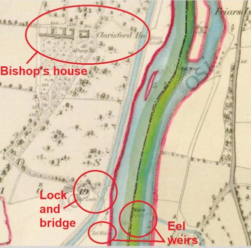
The bishop’s house, the lock and the bridge (OSI 6″ ~1840)
There is one other aspect. The bridge was used by the horses towing boats on the canal and, of course, by the men leading them. We know that because the towing-path changed sides at Moys Lock. It was on the west side of the canal from Cussaun to Moys but on the east from Moys to Killaloe: it is marked on the 6″ OSI map and named on the 25″.
That forced horses and men to walk on a narrow embankment rather than on the shore. But it kept them out of the bishop’s garden and a little further from his house. Might that have been the intention?
I would be glad to hear from anyone who knows more about Moys.