Category Archives: Modern matters

Thon Sheugh and WI’s budget

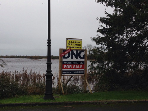
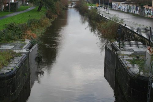
A Sinn Féin MLA, whose party colleague is one of two ministers responsible for Waterways Ireland, has expressed concern about WI’s financial position:

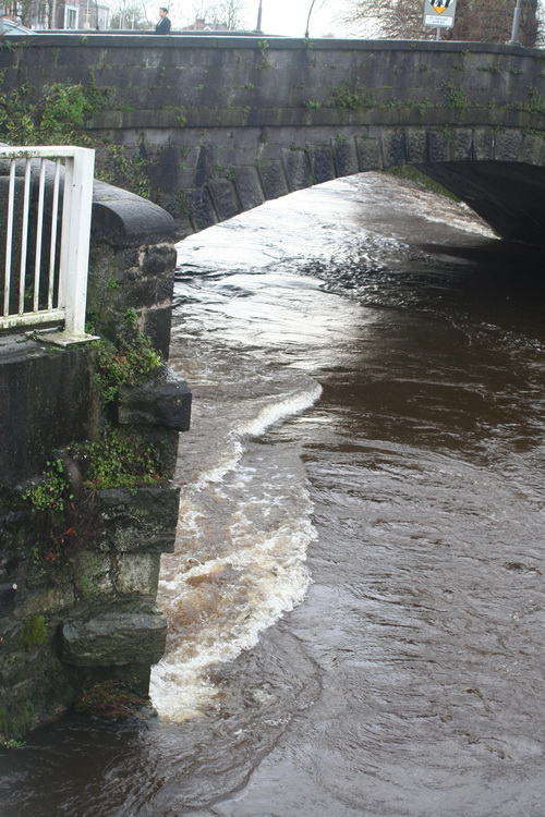
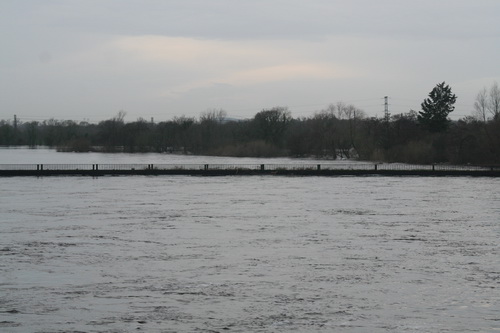
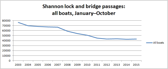
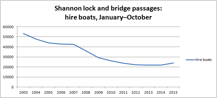
Phil Flanagan: Is the [North South Ministerial] Council aware of the stark financial difficulties facing Waterways Ireland as a result of not only sustained budget cuts but the currency fluctuation because of the weakened euro? Let me point out some of the figures: compared with 2013, the 2014 budget was down by €290,000; and, in 2015, it was down by €875,000, solely because of the weak euro. Was that matter discussed? What potential solutions may ensure that Waterways Ireland is returned to a sustainable financial footing?

I had not realised the extent of the problems caused by the euro.

Replying, Martin McGuinness — also Sinn Féin — said

The fluctuation of the euro was not discussed at the meeting.

Obviously, it does represent a serious challenge, given the fact that the euro has been very weak over recent times. I note that it has strengthened over recent days. Certainly, on foot of the Member highlighting this, we can give it further consideration.

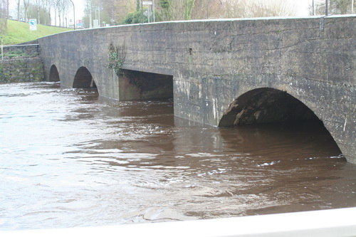
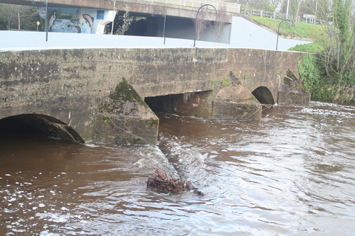
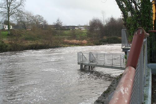
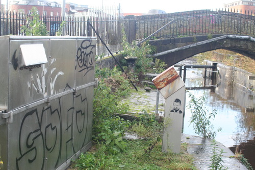
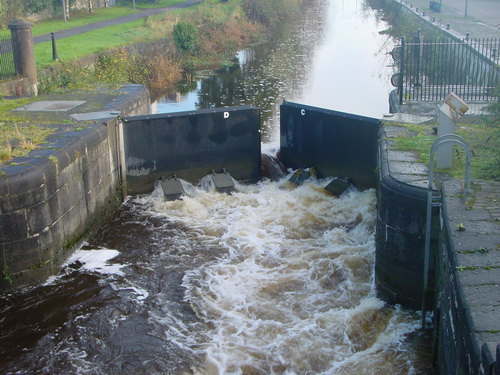
Mr McGuinness went on to provide some information about Saunderson’s Sheugh (which we’re pretending is the Ulster Canal):

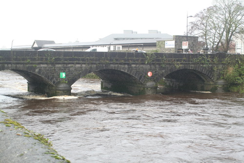
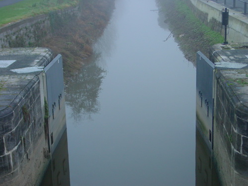
It is important to point out that the work of Waterways Ireland is nearing completion, including the dredging of the River Finn between Upper Lough Erne — that will be of interest to the Member — and Castle Saunderson as part of phase 1 of the restoration of the Ulster canal.

Design plans for the new bridge at Derrykerrib are also at an advanced stage. I understand that there are some contractual issues with the site that, combined with high water levels, have led to delays.

However, Waterways Ireland is working with local councils and other interested parties to secure EU funding under the INTERREG sustainable transport programme. The proposed greenway would run from Smithborough village to the Monaghan town greenway and on to Armagh. The point that the Member raised is important and will be considered by the Council.

Given that that was irrelevant to the question, I presume that Mr McG wanted to get this information on the record.

I would like to know more about the “contractual issues with the site”. I do hope they won’t mean that we miss getting photos of the northern and southern ministers, wearing yellow hard hats and lifejackets, claiming credit for the work. After all, there is an election coming up.


Closing the Grand Canal

The excellent Co Kildare Online Electronic History Journal has a reprint here of a 1959 article about the ending of commercial carrying on the Grand Canal. And putting “canal” in its search engine reveals lots more of interest.

FPP (lapsed)

I mentioned flooded fields, zoned for housing, here. Michael Geraghty has very kindly sent on this photo, taken recently in Athlone.

Athlone Michael Geraghty 01_resize

FPP (lapsed)

How nice to have a waterfront apartment. Though it may be a bit much to have it waterback, waterside, watertop and waterbottom as well.

If there is an award for sales skills amongst auctioneers, I wish to nominate Messrs DNG.

For certain values …

In the Irish Times of 5 January 2016 Fintan O’Toole has an article headed “Genuine local democracy part of the solution to flooding“. He points out that

  • in 2004 the Irish Times property supplement showed a photograph [we are not told whether it was part of an ad or advertorial or of a critique of property development] showing a sign advertising for sale a flooded field that had been zoned for residential use
  • in 1997 a resident of Clonmel detailed how the town’s natural flood defences had been destroyed
  • in 1999 a man in Ennis blamed the flooding of his house on the granting of too many planning permissions
  • in 2000 3500 Clonmel residents objected to building on flood plains
  • nitwitted local councillors didn’t care.

He concludes that

As flooding gets worse, we will have to spend enormous amounts of money on engineering solutions. But in fact one part of the solution doesn’t cost any money at all. It’s called listening. Or, to give it its political title, it’s called genuine local democracy. Top-down, very expensive technocratic measures may have to be part of the response. But they will only work in a political culture that has eyes to look at the land and ears to listen to what people know about it.

Well, up to a point, Lord Copper. The article provides no evidence that a majority of the citizens — in any local authority area, Dáil constituency or other political unit — shares the erudite and enlightened views of those who write letters to, or columns in, the Irish Times. In fact, given that the citizens have, over more than one hundred years, continued to elect large numbers of nitwits to the local authorities and, for almost a century, to the Dáil, it seems unlikely that democracy — genuine, local or otherwise — will ever produce the right answers.

Which may explain why so much power now resides elsewhere, in the hands of experts and courtiers, and why elected representatives are reduced to throwing the occasional tantrum, providing tea and sympathy and making empty promises that then come back to haunt them.


The Ballina pontoon

That’s Ballina, Co Tipperary, on the Shannon, opposite Killaloe.

Killaloe 20160101 14_resize

Looking upstream

Killaloe 20160101 15_resize

The ramp

Killaloe 20160101 20_resize

Looking downstream

Killaloe 20160101 21_resize

From the railway footbridge

Photos taken on 1 January 2016.

The pontoon seems to be more severely affected than it was in the last big floods, on 22 November 2009.

New Ballina pontoon in floods 20091122 1_resize

From across the river

New Ballina pontoon in floods 20091122 2_resize

From the bridge


Managing the Shannon

Sometimes you have to wonder about politicians and their grasp of reality. Take, for instance, young Mr Adams, Sinn Féin TD for Louth. There he was in the Dáil the other day, talking about flooding on the Shannon, and saying (amongst other things):

No single agency is responsible for the management of the River Shannon. Will the Taoiseach give full responsibility to the OPW for management of the Shannon?

Can Mr Adams have forgotten that, under the Good Friday Agreement, a cross-border implementation body called Waterways Ireland, reporting jointly to the Minister for Fairytales in the republic and the Minister for Marching Bands [a Sinn Féin MLA] in Northern Ireland, is responsible for navigation on certain named waterways including the Shannon?

Giving the Office of Public Works full responsibility for the management of the Shannon would require renegotiation of the Good Friday Agreement [and perhaps some later agreements]. I gather that the members of HM Devolved Administration in Northern Ireland delight in doing that sort of thing, but reducing the powers of the largest of the cross-border implementation bodies might not be wise.


Shannon lake levels

According to the Shannon Catchment-based Flood Risk Assessment and Management (CFRAM) Study Technical Assessment: River Shannon Level Operation Review [PDF: Office of Public Works v2_0 July 2012]

ESB collects and maintains records of rainfall, river and lake levels and flow data. Even though ESB has no responsibility to supply flood warnings under their regulations, it issues twice weekly lake level forecasts to all the relevant stakeholders since 2010.

Those stakeholders include Waterways Ireland.

As the levels of the lakes are of great interest to boat-owners and others, it would be really nice if either the ESB or Waterways Ireland were to publish those forecasts. WI wouldn’t need any elaborate new system: they could send them around as marine notices, and the cost would be minimal.

But perhaps the forecasts are already published somewhere? If, Gentle Reader, you know where they are, do please leave a Comment [preferably with a link] below.

Limerick water levels 14 December 2015

The Abbey River

Abbey Bridge 20151214 01_resize

Abbey Bridge

Baal's Bridge 20151214 04_resize

Baal’s Bridge

Mathew Bridge 20151214 01_resize

Mathew Bridge

Mathew Bridge 20151214 05_resize

Current heading for Mathew Bridge

The Shannon in Limerick

Shannon in Limerick 20151214 02_resize

The weir

Plassey

Plassey 20151214 01_resize

Lots of pumps running and equipment trundling about the place

Plassey 20151214 02_resize

Trouble at t’mill

Plassey Millstream 20151214 01_resize

T’millstream

Plassey 20151214 10_resize

Cots on the bank

Plassey Black Bridge 20151214 01_resize

The Black Bridge getting another hammering

Annacotty

I have been told that the Mulkear River rose very rapidly on Saturday night and that, at one time, it was feared that the (older) bridge would be swept away. I gather that folk working in other areas were called to Annacotty to deal with the emergency.

Annacotty 20151214 01_resize

The old bridge at Annacotty (downstream face)

Annacotty 20151214 12_resize

A tree in the water above the bridge

Annacotty 20151214 14_resize

There’s a weir in there somewhere

The Mill Bar in Annacotty was closed today after being flooded.

Annacotty 20151214 15_resize

The Mill Bar

Annacotty 20151214 03_resize

This, from a small garden beside the bridge, suggests that the Mulkear may have carried and deposited a lot of silt

The Park Canal

I gather that the Mulkear’s waters, added to those of the Shannon itself, raised the level of the Park Canal (the bottom section of the Limerick Navigation). A problem with opening the lock gates, to release the water, meant that a few houses in Corbally were flooded. A Sinn Féin councillor, whose party colleague has been responsible [with her southern counterpart] for slashing Waterways Ireland’s budget in recent years, is quoted as saying

I am in no doubt it was primarily caused by the ineptitude of Waterways Ireland.

Alas, the news story does not tell us the source of the councillor’s certainty.

The article also says that

[…] the force of this water meant it was not possible to open the lock gates by hand.

That is, I think, misleading: neither set of gates has gate beams, so they are not opened by hand.

park canal mist 03_resize

The upper gates in 2004, shortly after installation. Note the absence of gate beams. Note also the two sluices or paddles on each gate

Park Canal 20151214 31_resize

Control pedestal and gear

Park Canal 20151214 11_resize

The upper gates open today

I see no sign of the paddles or sluices. Perhaps the level is so high that they’re underwater. I must try to check next time I’m at the canal harbour.

Canal lower lock floods 20091128 1_resize

The upper gates in the floods of 2009

In the floods of 2009 the upper gates were held slightly open and all four sluices were discharging water. That would have lowered the level in the canal; it would also, I think, have made it easier to open the gates fully.

I am guessing, but I imagine that on Saturday night some sort of hydraulic machine was brought in this way …

Park Canal 20151214 21_resize

Two bollards have been moved from the gateway and stacked beside it

… and used to push or pull open the near-side upper gate. There seems to be some slight damage to the stone and iron work.

Park Canal 20151214 10_resize

Slight damage

One other possibility that struck me is that silt from the Mulkear might have built up behind the gates, making them difficult to open, but I have no evidence on the matter.

Park Canal 20151214 12_resize

The lower gates

Park Canal 20151214 22_resize

From the outside looking in


ESB water discharge info

Here is the ESB’s Notifications page, with info on the rate of discharge from its hydroelectric dams and weirs. Today (14 December 2015) Parteen Villa Weir is discharging 440 cumecs (cubic metres per second or, roughly, ton[ne]s per second down the original course of the Shannon. That’s 44 times the 10 cumec usually discharged and more than replaces the 400 cumec diverted through the headrace to the Ardnacrusha power station. The Shannon is therefore running at its pre-Ardnacrusha levels and the Falls of Doonass have regained their power.

Of course if Ardnacrusha didn’t exist, its 400 cumec would be coming down the original course of the Shannon on top of the 440 cumec already there, which would make for interesting levels of flooding.

That ESB page has a link to this infographic, which shows the sort of information I was trying to get across here. I usually start from Leitrim [village]; the ESB starts slightly further upstream at Lough Allen. Note that the Shannon’s few locks are concentrated upstream of Lough Ree: between them and Killaloe are only two locks, at Athlone and Meelick, so the river’s fall is very slight.

Update 2018: the ESB has a new page with lots of interesting information here.

Shannon traffic figures to October 2015

I have not posted charts of Shannon traffic figures for some months now. That was not Waterways Ireland’s fault: it has kindly continued to send the figures to me, but other demands on my time have intervened. However, I have now charted the figures to the end of October 2015, which takes in the bulk of the year’s boating activity. All the usual caveats apply:

  • the underlying figures do not record total waterways usage (even for the Shannon) as, for instance, sailing, fishing or waterskiing on lakes or river stretches, which did not involve a passage through a lock or Portumna Bridge, would not be recorded
  • the passage records would not show, for instance, a change in the balance of types of activities from those in larger cruising boats to those in smaller (sailing, fishing, waterskiing) boats
  • figures like these will not necessarily be representative of those for the year as a whole.

On the other hand, the figures do include the Shannon’s most significant tourism activity, the cruiser hire business. And they are our only consistent long-term indicator of usage of the inland waterways.

There has been a very slight increase in total traffic, although it might be better to regard the figures as confirming that traffic has stabilised at the new, lower level established around 2011.

Shannon JanOct all boats

All boats. The slight increase in total traffic seen up to May has continued to October

I commented on the May figures:

The big news is that there is an increase in the amount of hire-boat traffic and a decrease in the amount of private traffic. [Personal observation suggests very little activity on Lough Derg, apart from the sailing bods.]

Again, that trend has continued. Hire-boat traffic is up …

Shannon JanOct hired

Hire-boat traffic is up

… and private-boat traffic is down.

Shannon JanOct private

Private-boat traffic is down

Perhaps the private boats were afraid to move from the new berths in Killaloe where they wanted to spend the winter at Waterways Ireland’s ridiculously low rates. Is this some delayed effect of the death of the Celtic tiger? Or was it the weather? Neither hire nor private figures changed hugely, but change they nonetheless did.

Shannon JanOct private -v- hired

After a brief period when it seemed that private traffic was overtaking hired, the hire-boats are in the lead again

Of course hire-boat traffic fell much further from its 2003 figure: it dropped to 40% and is still not much higher, whereas private traffic is still more than 80% of its 2003 figure.

Shannon JanOct v2003

Change (private and hired) since 2003

It would be nice to have data on other forms of waterways usage.