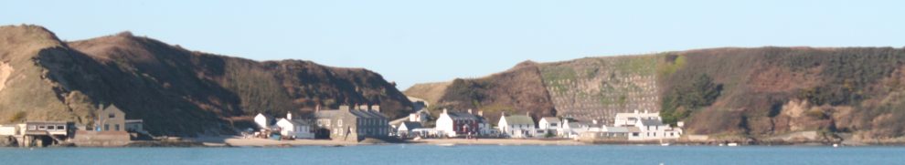
Some observations from a trip to the hyperborean regions.
Navigation
The 2015 edition of Shannon Leisure Development Company’s Navigational Guide to the Shannon and Erne Waterways includes the numbers of some of the markers; I found that helpful, especially on the longer river stretches.
The Guide is wrong about Clonmacnoise: there is no water supply. At Hodson Bay, a suggested course appears to cross a shoal.
Eh?
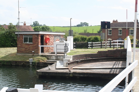
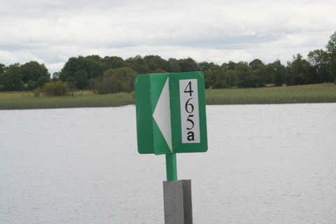
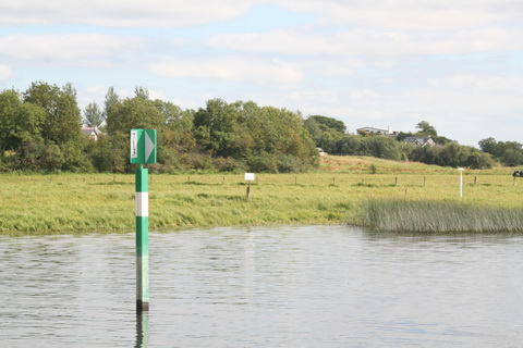
This was the first marker I noticed with a suffix to its number; I presume that means it’s a new marker.
Boxty
As far as I know, boxty is the only contribution made by the north midlands to world cuisine. We bought several varieties in Lanesborough, and jolly good they were too; I regret that I did not record the manufacturers’ names so that I could provide links to their websites.
However, boxty was not the only comestible to be found north of Portumna Bridge. Shannon Crafts and Coffee Dock in Athlone, on The Strand across the river from the lock, provides excellent cakes; boaters can tie up outside and stock up.
TripAdvisor folks liked it too.
Had I been there on a Saturday, I’d have had bratwurst.
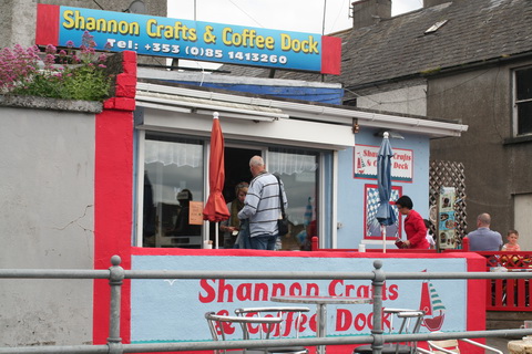
Shannon Crafts and Coffee Dock
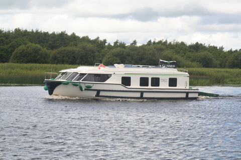
The Em’raldstar Galactica
Les grands bateaux de Monsieur Thibault must have been breeding: we met several of the things.

It’s big …
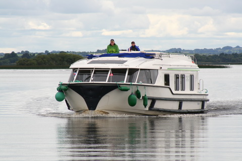
… and, I’m told, luxuriously fitted out …
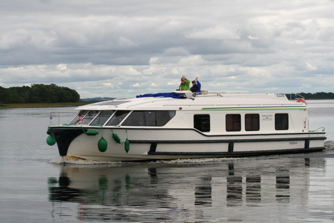
… with good outdoor space on the roof …

… and it accelerates quickly and smoothly from rest, suggesting a good underwater shape …
… but I still think it’s the boating equivalent of the SsangYong Rodius.
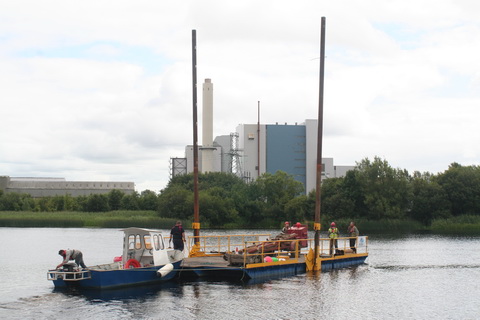
Work in progress
Geotechnical investigation works on the N63 bridge at Lanesborough were being carried out from this pontoon, which was assembled at Hanleys Marina at Ballyleague.

Moving the pontoon into position
And here’s a Waterways Ireland boat, a Pioner I think, returning upstream to its launch site at Meelick Quay. Perhaps it had been investigating the possibility of providing berths near Meelick village.
WI Pioner
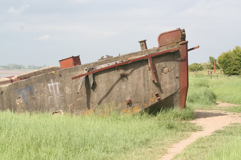
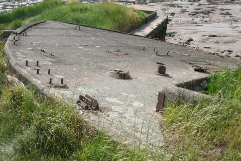
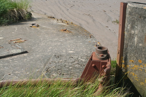
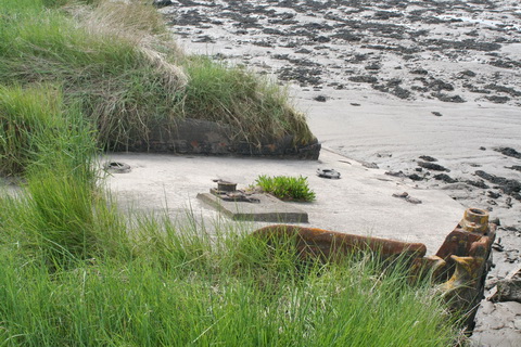
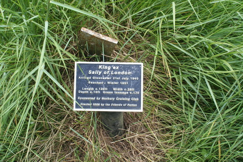
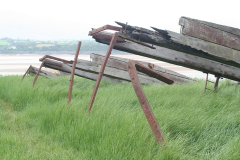
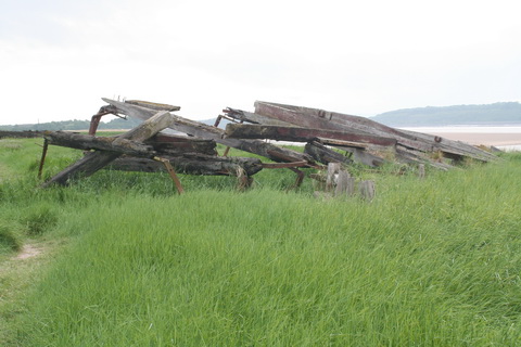
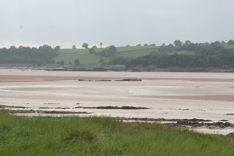
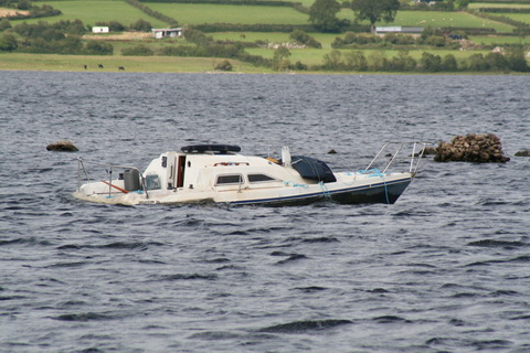
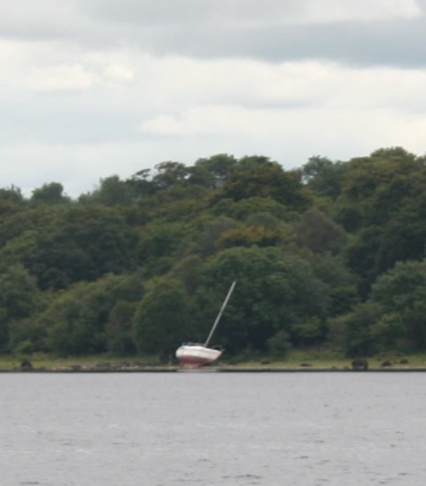
Wrecks?

On the Iskeraulin shoal on Lough Ree

On shore between Blackbrink and Galey bays
I don’t know anything about either of these vessels. The second might, I suppose, have been careened for work on its hull.
Out to lunch
The closing of locks at lunchtime has got to stop.
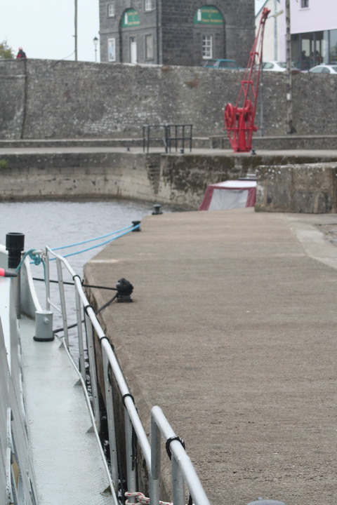
At Meelick, on a windy day, the lower gates were open at lunchtime and two boats were blown forward on to the sill. There, and at Athlone, the waiting pontoons and quays are utterly inadequate to the volume of traffic. Two boats occupied the whole of the Athlone pontoons and only two boats (one a barge) were able to fit on the quay wall. The combined length of boats waiting was about two and a half times the length available for tying to.

Athlone waiting pontoons
Why is it not possible to have staggered lunchtimes? Or to come up with some other arrangement that puts the interests and the safety of the boaters first?
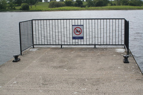
Oddities
Is this a waterside thunderbox or privy?

Outdoor sanitation above Athlone?
In the next photo, the small white sign in the middle says “No shooting”, which is about tweetiebirds rather than citizens. But what is the long-stemmed mushroom on the right? It looks like those gas thingies youo see scattered around the countryside, presumably to provide shelter while you strike a match to light your pipe, and there’s another on the other side of the river. Does that mean that there’s a gas pipe under the river? Or what?
What’s the white thing on the right?
Imperfections
The pale patch of concrete suggests that the corner bollard is missing at the quay below the bridge in Shannonbridge. That makes the short angled section of wall very difficult to use.
Missing bollard?
At Portrunny, some of the timber edging to the pier has rotted; it may be a trip hazard.

Portrunny pier
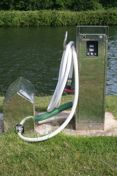
The taps on Portrunny pier defeated us. I would be grateful to anyone who could give me the specification of the adapter required to connect these taps to standard garden/boat hoses.
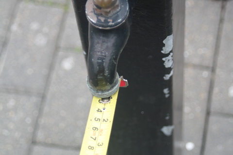
Portrunny’s giant taps
Back on Lough Derg, we found that a barrier had been erected at the end of the pier at Rossmore.
Rossmore
This barrier makes the end of the pier unusable by boats. I have twice seen the end used when strong winds, and waves rolling into the bay, made conditions dangerous.
On one occasion a boat, pinned against the outer (upwind, exposed) side of the pier, worked around to the other side with ropes around the end of the pier; the barrier would have made that manoeuvre impossible.
On another, again with wind and waves coming into the bay, and with the head of the T occupied by other boats, a boat tied to the end of the pier, with its bow into the waves, using strong ropes from bow and stern to bollards along the pier. Again, the barrier would have made that impossible.
The barrier
I do not know whether such considerations affected the decision to erect this barrier. If they did not, I suggest reconsideration.
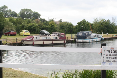
Enterprise
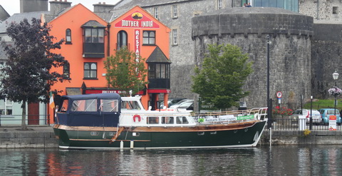
Romaris in Athlone (no, no: I took this one)
Romaris Motor Yacht is offering upmarket cruises in Athlone. And Baysports water park in Hodson Bay seems to attract favourable reviews.
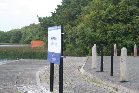
Richmond Harbour
Finally, some thoughts on Richmond Harbour, our terminus ad quem. It is quite a delightful place and Waterways Ireland has done much to improve the amenities and maintain its appearance. Furthermore, Paddy, the patroller who let us up into the harbour, is helpful, friendly and enthusiastic about the Royal Canal.
But what a pity that WI doesn’t do more to promote both Richmond Harbour and the Royal Canal.
First, the Guide might usefully include Paddy’s phone number so that boaters, especially those (like hirers) without lock keys, might be enabled to get into the harbour. The numbers given on p15 don’t include Paddy’s.
Second, the text of the Guide might be updated: it makes it clear (p7) that some hire boats are allowed to use the Grand Canal but makes no equivalent statement about the Royal.
Third, WI might do more to establish an identity for Richmond Harbour itself, with information about its history, layout, buildings and other features. Maybe there was an information display; if so, I missed it.
Fourth, WI might provide information at Richmond Harbour (and perhaps elsewhere) to encourage boaters to venture even a few miles up the Royal. Such information might say what’s where (village X is Y miles/Z hours away), why X is worth a visit, what help is available, where a boat can turn, why it’s worth doing, what boaters should watch out for (mainly, I imagine, weed on prop or in filters). Or perhaps the RCAG or IWAI could do that.
Fifth, folk who use Richmond Harbour for free parking should find their boats below (or even above) the 45th Lock, thus leaving more space for visiting boats.
Boats arrive at the end of the Royal Canal; the canal itself, and the Harbour, should be promoted to them.
Incidentally, the Clondra Canal needs traffic lights: the cheerful and inventive keeper does his best with hand signals, but the systemn is scarcely foolproof. And it would be useful to have something (other than trees) to tie to at either end of the canal.
Weather
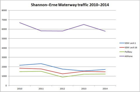
There were days to make Tim O’Brien eat his heart out. But some really bad days that are likely to damage next year’s tourism. I’ll get to the traffic figures anon.