Category Archives: Safety

Weather

I had not realised that the times of the Met Éireann inland lakes weather forecasts, broadcast by the Coast Guard on VHF, had been changed. The times are now

06:15
10:15 repetition
13:15
16:15 repetition

MRCC Dublin, to whom I am grateful for confirming the new times, says

Standby on VHF Channel 16 for your local working channel.

In bygone days the Lough Derg and Lough Ree forecasts were five minutes apart, but now the initial call on Channel 16 is at the same time everywhere.

I found the new 10:15 broadcast to be particularly convenient.

Forecast format

However, one aspect in which I thought the Met Éireann forecasts (also available here) less useful than those from other sources (eg Windguru) is the absence of a forecast for wind gusts. On several occasions this year, the gusts were (a) almost continuous and (b) much stronger than the forecast wind speed. They thus had more influence on our trip planning than did the base wind speed. It would be nice if Met Éireann, and thus the Coast Guard, could include a forecast for gusts.

Hire boats

The hirers’ training materials I mentioned here give good advice about rough weather on lakes but, after seeing several hire boats cross Lough Ree in weather that kept us in harbour, I wondered whether the lakes forecasts are readily available to hirers. If they’re not, perhaps they could be transmitted daily by text message?

I should stress that I did not hear of any accidents caused by stress of weather, but some folk may have had uncomfortable trips.


Boat handling

One of the things that struck me, on our annual tour of inspection of the transpontine regions, was that most hire-boat skippers were very good at handling their boats.

The weather was very windy (more on that anon) and, on several days, we thought it too gusty for safe manoeuvring, but we watched hirers coming in to the various harbours. I don’t recall any of them making a mess of it, despite the wind, and some were remarkably skilful in challenging conditions. A family of Cheshire dairy farmers, experienced on the English narrow canals, were particularly impressive.

I had a look at the CarrickCraft/Waveline/Cruise-Ireland online training materials and I thought they were very good. [I haven’t looked at those of other hire firms: they may have equally good materials.] So was the Captain’s Handbook [PDF to Flipbook], which contains this excellent advice:

Take your time and carry out all manoeuvres slowly and deliberately. If you have the chance, watch a barge captain handling his barge. He is never in a hurry.


Trigonometry and obfuscation

Every so often Waterways Ireland (whom god bless and preserve) sends out a Marine Notice to warn people of sporting activities, so that they can avoid them, and of one or other of the hazards of the navigations. One such, No 68 of 2016, issued on 9 June 2016, says (inter alia):

The attention of all is drawn to the dangers associated with overhead power lines in particular sailing vessels, sailing dinghys and workboats with cranes or large airdrafts.

Vigilance is required especially in the vicinity of slipways and dinghy parks, while voyage planning is a necessity in order to identify the location of overhead lines crossing the navigations.

ESB Networks emergency number is (353)1850 372 999 and Northern Ireland Electricity Networks is (44) 0800 616 817.

Then on 21 July 2016 Waterways Ireland issued Notice No 89 of 2016, which was specific (as far as WI is concerned) to the Northern Ireland navigations. Extracts:

Many sailboats have masts of 9m (30ft) or more and, as most of these masts are made of aluminium, they are an excellent conductor of electricity. If an aluminium mast or rigging come into contact with or too close to power lines, it could result in a fatality.

NIE Networks advises all boat owners to take some simple precautions to stay safe.

  • Plan your route carefully when transporting your boat to or from where it is being launched, making sure you have adequate clearance under overhead power lines. When you are stepping the mast or erecting long aerials, be sure to do so in an area totally clear of overhead power lines.
  • Once out on the water, if you are sailing on inland waterways or near islands or headlands, you should still look for overhead lines as they do cross over waterways. You must ensure that your mast or aerial has proper clearance from any power lines.
  • Always check your charts when underway to ensure you are aware of the location of overhead power lines.

In order to avoid hitting an overhead power line with a mast, it would be useful to know how high off the water, perhaps at Ordinary Summer Level, the power line was. Then you could subtract from that the height of your mast, and some safety factor, and decide whether you could safely sail under the line.

If you don’t know how high the power line is, you have to resort to trigonometry. My recollection of these matters has perhaps faded a little, but as I recall you stand a small boy of known height on your cabin roof and, with your eye level with his feet, you measure (a) the horizontal distance from his feet to your eye and (b) the angle from the horizontal to a line from your eye that touches the top of the boy’s head and the bottom of the power line. Then the small boy falls off the roof, you have to tack, your pencil falls overboard and it all seems much more difficult than finding the height of a tree. And of course you can’t measure the distance to the power line without sailing up to it, which is what you’re trying to avoid until you can decide whether you can safely do so. [Note: this paragraph is not to be used for navigation.]

Life would, therefore, be much easier (and safer) if you knew the minimum clearance under the power lines. Happily, NIE Networks is happy to tell people what it is; I emailed and a speedy response including this:

The clearance on all NIE Networks overhead power lines which cross over navigable waters is 10.5m (lower bank to line or earth). All overhead power lines are marked on navigation charts for the Erne and Lower Bann waters.

However, it should be noted that this is the clearance for NIE Networks overhead power lines and applicable to Northern Ireland only. Clearances for overhead power lines in the Republic of Ireland may be different and would require confirmation from the Electricity Supply Board (ESB).

Big it up for NIE Networks, then. But over several years I tried unsuccessfully to get the ESB to give me the equivalent information for lines crossing navigable waterways in the republic; it would not do so. Without that information, boaters cannot “ensure that [their] mast or aerial has proper clearance from any power lines”, so ESB’s advice is useless blather.

It is some time since I last asked ESB for information, and perhaps it has since been made available, but I see no sign of it on the ESB website. I would be glad to hear from anyone who can supply reliable information.

Limerick floods 1814

Limerick, Dec 1

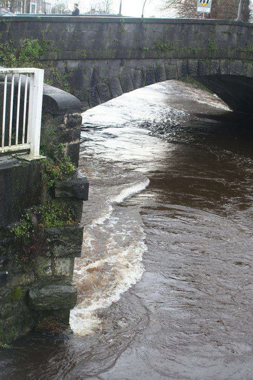
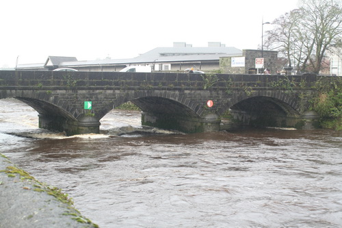
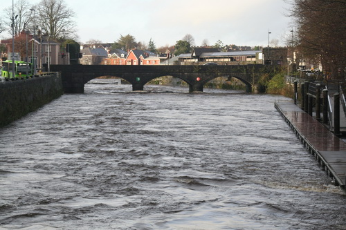
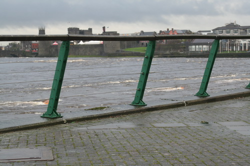
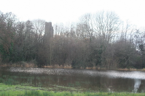
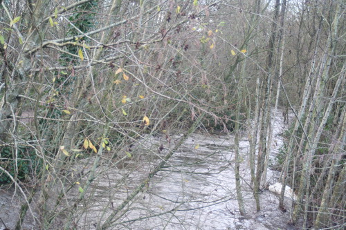
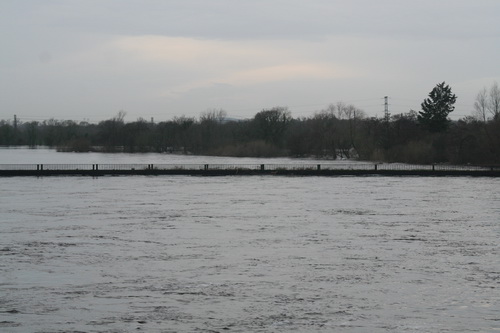
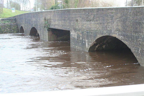
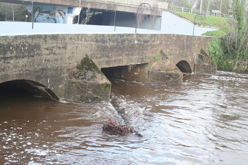
On Thursday night, or at a very early hour on Friday morning, the most awful and terrific tempest from the south and west, that ever was remembered arose, and continued without intermission until between 11 and 12 o’clock yesterday — the river Shannon swelled to an unprecedented height, with a surf which caused it to overflow the country to an extent never before witnessed; there was no trace of the highest banks upon the river, and they are broken and prostrate every where we have as yet heard of — at the quays in this harbour, the several vessels drove from their moorings, and a large Norway ship, the Pax, a brig, the Caroline, and a sloop, the Elizabeth, were forced beyond Curragour Mills, near Thomond bridge, and with much exertion were saved from injury, by Mess Mallock and Graham, ship builders, with their men — the Messery, of Liverpool, at O’Neil’s quay, laden with rock salt, is thrown on her beam ends.

The falling of chimnies has caused several houses to be unroofed; Mr Bodkin’s family, in Bridge Street, were providentially saved, as the next chimney fell on the roof, which was blown in, destroyed the different rooms, and though a child slept in the attic story, and went through the two under floors, it was unhurt. Several trees have been torn up, garden walls blown down, and the whole of the parapet, from the House of Industry to the Revenue Building overturned. A new house in Glentworth Street was completely levelled with the ground. Thomond-bridge miraculously withstood the flood; the whole bridge was covered at one time, and the parapet presented the appearance of a wall built across the river.

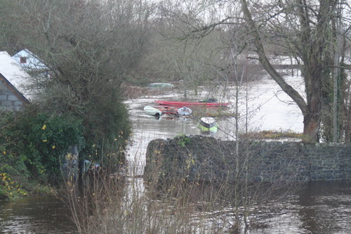
We really fear that the accounts from the coast will be dreadful. Yesterday morning, between eight and nine o’clock, two sail boats were lost between Foynes Island and Ahanish, one was loaded with butter, and had nine passengers, all of whom were drowned; the other a turf-boat, the property of Mr O’Keefe, with three men on board, one of whom (Hurley) perished, and the other two were driven on shore by the violence of the waves, and were saved.

On Tuesday evening a large boat belonging to Denis Malcahy of this town, was driven on the rocks, off the shore of Kilkeran battery, the tide at the same time setting in with such rapidity that the boat filled with water, and one of the crew threw himself overboard and swam ashore, leaving two men and a boy on the wreck; when in this awful moment, one of the workmen belonging to Messrs Mackey and Ryan, plunged into the water and swam to the boat — made a raft of her oars and spars, to which he fastened a rope, and swam off to the length of it — the remaining crew clung round the raft, and in the presence of a number off shore, were towed in, and thus saved from a watery grave. Thomas Gleeson, a mason, was the person who so humanely ventured his life to save that of others, which Providence enabled him to effect.

Caledonian Mercury 24 December 1814. From the British Newspaper Archive run by Findmypast Newspaper Archive Limited, in partnership with the British Library.

Transhipment

At the Grand Canal Company’s half-yearly meeting on 22 February 1890, a Mr Geoghegan

[…] said he had heard from a gentleman interested in the trade between Dublin and Limerick that it often took six days for Guinness’s porter to be carried by canal from the former of these cities to the latter. The cause of this he believed was the necessity for trans-shipment at Shannon Harbour.

The Chairman disagreed:

As to the delays at Shannon Harbour there had been some, but he believed these had been caused by floods and storms in the river.[1]

The company had commissioned Mr E Lloyd, engineer and general manager to the Warwick and Birmingham Canal Company, to inspect the Grand Canal and to advise the board. It was estimated that his survey would cost between £100 and £120. The chairman accepted that there were

[…] many matters […] which demanded immediate steps, and these entailed considerable outlay. It has been evidenced that before the property of the company could be stated to be in a thoroughly satisfactory condition some further exceptional outlay would be advisable from time to time.[2]

At the next half-yearly meeting, held on 23 August 1890, the chairman said that the company was considering investing in a more rapid transhipment system “from our barges to the Shannon steamers” at Shannon Harbour, in accordance with Mr Lloyd’s suggestion.[3]

Shannon Harbour June 2008 02_resize

The transhipment shed at Shannon Harbour in June 2008, before its canopy was removed

I do not know whether the transhipment shed at Shannon harbour, and the gantry mechanism on which goods could be loaded and unloaded under cover, was built on Mr Lloyd’s suggestion. It would be interesting to know more of the building’s history.

Sources


[1] The Freeman’s Journal 24 February 1890

[2] ibid

[3] The Freeman’s Journal 25 August 1890

From the British Newspaper Archive run by Findmypast Newspaper Archive Limited, in partnership with the British Library.

For certain values …

In the Irish Times of 5 January 2016 Fintan O’Toole has an article headed “Genuine local democracy part of the solution to flooding“. He points out that

  • in 2004 the Irish Times property supplement showed a photograph [we are not told whether it was part of an ad or advertorial or of a critique of property development] showing a sign advertising for sale a flooded field that had been zoned for residential use
  • in 1997 a resident of Clonmel detailed how the town’s natural flood defences had been destroyed
  • in 1999 a man in Ennis blamed the flooding of his house on the granting of too many planning permissions
  • in 2000 3500 Clonmel residents objected to building on flood plains
  • nitwitted local councillors didn’t care.

He concludes that

As flooding gets worse, we will have to spend enormous amounts of money on engineering solutions. But in fact one part of the solution doesn’t cost any money at all. It’s called listening. Or, to give it its political title, it’s called genuine local democracy. Top-down, very expensive technocratic measures may have to be part of the response. But they will only work in a political culture that has eyes to look at the land and ears to listen to what people know about it.

Well, up to a point, Lord Copper. The article provides no evidence that a majority of the citizens — in any local authority area, Dáil constituency or other political unit — shares the erudite and enlightened views of those who write letters to, or columns in, the Irish Times. In fact, given that the citizens have, over more than one hundred years, continued to elect large numbers of nitwits to the local authorities and, for almost a century, to the Dáil, it seems unlikely that democracy — genuine, local or otherwise — will ever produce the right answers.

Which may explain why so much power now resides elsewhere, in the hands of experts and courtiers, and why elected representatives are reduced to throwing the occasional tantrum, providing tea and sympathy and making empty promises that then come back to haunt them.


The Ballina pontoon

That’s Ballina, Co Tipperary, on the Shannon, opposite Killaloe.

Killaloe 20160101 14_resize

Looking upstream

Killaloe 20160101 15_resize

The ramp

Killaloe 20160101 20_resize

Looking downstream

Killaloe 20160101 21_resize

From the railway footbridge

Photos taken on 1 January 2016.

The pontoon seems to be more severely affected than it was in the last big floods, on 22 November 2009.

New Ballina pontoon in floods 20091122 1_resize

From across the river

New Ballina pontoon in floods 20091122 2_resize

From the bridge


Shannon lake levels

According to the Shannon Catchment-based Flood Risk Assessment and Management (CFRAM) Study Technical Assessment: River Shannon Level Operation Review [PDF: Office of Public Works v2_0 July 2012]

ESB collects and maintains records of rainfall, river and lake levels and flow data. Even though ESB has no responsibility to supply flood warnings under their regulations, it issues twice weekly lake level forecasts to all the relevant stakeholders since 2010.

Those stakeholders include Waterways Ireland.

As the levels of the lakes are of great interest to boat-owners and others, it would be really nice if either the ESB or Waterways Ireland were to publish those forecasts. WI wouldn’t need any elaborate new system: they could send them around as marine notices, and the cost would be minimal.

But perhaps the forecasts are already published somewhere? If, Gentle Reader, you know where they are, do please leave a Comment [preferably with a link] below.

Limerick water levels 14 December 2015

The Abbey River

Abbey Bridge 20151214 01_resize

Abbey Bridge

Baal's Bridge 20151214 04_resize

Baal’s Bridge

Mathew Bridge 20151214 01_resize

Mathew Bridge

Mathew Bridge 20151214 05_resize

Current heading for Mathew Bridge

The Shannon in Limerick

Shannon in Limerick 20151214 02_resize

The weir

Plassey

Plassey 20151214 01_resize

Lots of pumps running and equipment trundling about the place

Plassey 20151214 02_resize

Trouble at t’mill

Plassey Millstream 20151214 01_resize

T’millstream

Plassey 20151214 10_resize

Cots on the bank

Plassey Black Bridge 20151214 01_resize

The Black Bridge getting another hammering

Annacotty

I have been told that the Mulkear River rose very rapidly on Saturday night and that, at one time, it was feared that the (older) bridge would be swept away. I gather that folk working in other areas were called to Annacotty to deal with the emergency.

Annacotty 20151214 01_resize

The old bridge at Annacotty (downstream face)

Annacotty 20151214 12_resize

A tree in the water above the bridge

Annacotty 20151214 14_resize

There’s a weir in there somewhere

The Mill Bar in Annacotty was closed today after being flooded.

Annacotty 20151214 15_resize

The Mill Bar

Annacotty 20151214 03_resize

This, from a small garden beside the bridge, suggests that the Mulkear may have carried and deposited a lot of silt

The Park Canal

I gather that the Mulkear’s waters, added to those of the Shannon itself, raised the level of the Park Canal (the bottom section of the Limerick Navigation). A problem with opening the lock gates, to release the water, meant that a few houses in Corbally were flooded. A Sinn Féin councillor, whose party colleague has been responsible [with her southern counterpart] for slashing Waterways Ireland’s budget in recent years, is quoted as saying

I am in no doubt it was primarily caused by the ineptitude of Waterways Ireland.

Alas, the news story does not tell us the source of the councillor’s certainty.

The article also says that

[…] the force of this water meant it was not possible to open the lock gates by hand.

That is, I think, misleading: neither set of gates has gate beams, so they are not opened by hand.

park canal mist 03_resize

The upper gates in 2004, shortly after installation. Note the absence of gate beams. Note also the two sluices or paddles on each gate

Park Canal 20151214 31_resize

Control pedestal and gear

Park Canal 20151214 11_resize

The upper gates open today

I see no sign of the paddles or sluices. Perhaps the level is so high that they’re underwater. I must try to check next time I’m at the canal harbour.

Canal lower lock floods 20091128 1_resize

The upper gates in the floods of 2009

In the floods of 2009 the upper gates were held slightly open and all four sluices were discharging water. That would have lowered the level in the canal; it would also, I think, have made it easier to open the gates fully.

I am guessing, but I imagine that on Saturday night some sort of hydraulic machine was brought in this way …

Park Canal 20151214 21_resize

Two bollards have been moved from the gateway and stacked beside it

… and used to push or pull open the near-side upper gate. There seems to be some slight damage to the stone and iron work.

Park Canal 20151214 10_resize

Slight damage

One other possibility that struck me is that silt from the Mulkear might have built up behind the gates, making them difficult to open, but I have no evidence on the matter.

Park Canal 20151214 12_resize

The lower gates

Park Canal 20151214 22_resize

From the outside looking in


ESB water discharge info

Here is the ESB’s Notifications page, with info on the rate of discharge from its hydroelectric dams and weirs. Today (14 December 2015) Parteen Villa Weir is discharging 440 cumecs (cubic metres per second or, roughly, ton[ne]s per second down the original course of the Shannon. That’s 44 times the 10 cumec usually discharged and more than replaces the 400 cumec diverted through the headrace to the Ardnacrusha power station. The Shannon is therefore running at its pre-Ardnacrusha levels and the Falls of Doonass have regained their power.

Of course if Ardnacrusha didn’t exist, its 400 cumec would be coming down the original course of the Shannon on top of the 440 cumec already there, which would make for interesting levels of flooding.

That ESB page has a link to this infographic, which shows the sort of information I was trying to get across here. I usually start from Leitrim [village]; the ESB starts slightly further upstream at Lough Allen. Note that the Shannon’s few locks are concentrated upstream of Lough Ree: between them and Killaloe are only two locks, at Athlone and Meelick, so the river’s fall is very slight.

Update 2018: the ESB has a new page with lots of interesting information here.